


This is the ULTIMATE SINGLE-TRAIL TOUR with STUNNING VIEW!
If you cannot get enough from single-trails this is the tour for you!
ATTENTION!!! Please do not follow the track on day 3 from Lago Concarno down to Bormio!! It is not rideable, has very steep drop-offs and is DANGEROUS EVEN TO WALK!! See description below for an alternative.
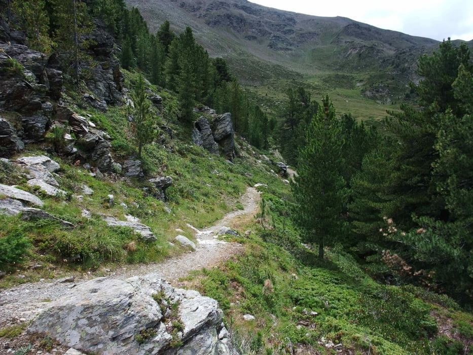
Specifically put together to ride as much trails as possible, this tour has almost no paved roads and few gravel roads (usually during downhills). In this area a LOT OF WORK ON THE TRAILS HAS BEEN DONE! So many of them can be ridden with a nice flow and not much getting off the bike.
It touches some of the greatest landscapes of the Alps with excellent infrastructure and great food. The best bike hotel I have been in so far is also included (Santa Caterina, see below).
The tour can be modified in a flexible manner since it often touches the same village twice, making it also good in not so constant weather conditions. Some detail:
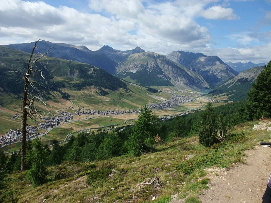
Day 1: Scoul - Rifugio Val Fraele. An easy start with some stunning views, a very nice trail down to St. Maria and a very nice Rifugio with friendly people at the end to stay overnight. Don't miss second breakfast at S-Charls! Great food! Better skip breakfast in the morning and have it there!
Day 2: Rifugio Val Fraele - Livigno. Easy but beautiful ride over Passo Alpisella with a steep downhill on a small gravel road. Don't go too close to the edge since the dropoff in this steep valley would hurt significantly... You can drop by the hotel in Livigno and drop off most of your luggage and continue on what you will remember as one of your best trail-day ever (I promise!): First up to the Vale de Federia. Partly very steep uphill, so if you can't handle it take the gondola which will take your bike. Down a great trial which leads to a great little mountain hut with perfect food for cheap (skip the food before the trail on top of the gondola, the guy is very unfriendly!). Then down to Livigno, and on trails above the village to the end of the valley. Back on the other side, up to the Valle della Mine and again on trails with stunning views, then down to the valley. Stop at the bakery / pizza place just when you hit the road to put an end to a perfect day!
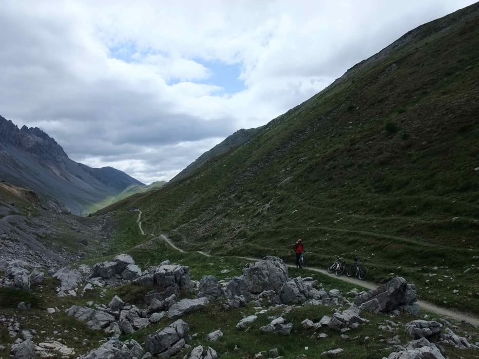
Day 3: Livigno - Santa Caterina: This day starts with steep but not too long uphill to Passo d'Eira. Here the whole fun starts: Perfect trails all the way to Passo Trela and down to Lago Concarno. ATTENTION: From the Lago. DO NOT FOLLOW THE TRACK DOWN TO BORMIO HERE!! UNRIDEABLE, STEEP AND DANGEROUS EVEN TO WALK!! Instead, ride over the dam of the lake, up to the little church and then on this side of the valley down to Bormio.
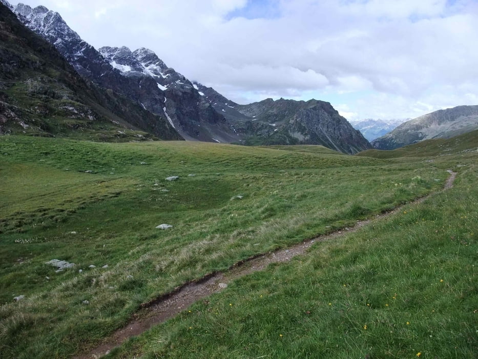
From Bormio a gravel road takes you up to Santa Caterina where you leave your luggage at the BEST BIKE HOTEL THAT I HAVE EVER BEEN TO (HOTEL SPORT, www.sporthotelpedranzini.it). If you still feel strong, the "Pizzini-Trails" are waiting still for you. Up another 1000 meters on gravel, enjoy the view on the magnificant glaciers of the Ortler-mountains and a cappuccino with cake on top (Pizzini hut). Then flow down the Pizzini trails!!! Hotel sport will have plenty of good food for you to recover :-)
Day 4: Passo del Alpe - Val Sobretto. What should I say, another perfect trail day! The Hotel owner himself drove us up with his bike shuttle so we only had about 200 meters uphill to Passo del Alpe. Most are riding it the other way, but this way round it is much better. Very nice trail downhill. Stop at "Allesandro" (Rifugio La Baita) for cappuccino even if it is still eraly ...(look for the little flag on the right, behind the church - there is a sign only for the other direction since everybody goes this way...). Down gravel and finally paved road. Our Hotel chief pickes us up at the bottom and gave us a shuttle to Bormio (you can ride the road, but not so nice). We then biked up to Bormio 2000 (you can take Gondola also). Now we wanted to take the Gondola (no way to bike) to Bormio 3000 and go down "Kelo Trails". Gondola was not working, so we rode our bikes along the mountain into Val Sabretto - a great trail with mangificant views again. Then down to Santa Caterina on a difficult trail that will require that you get off the bike sometimes...
Day 5: Santa Caterina - Poschavio. Down to Bormio and then up to Passo di Val Viola. Newly build trail lets you enjoy the flow without pushing your bike for a single meter! Once we hit the road to passo Bernina we biked on that road up to the top. Then you get yet another perfect downhill trail all the way from Bernina pass to Poschiavo! Don't miss it! If to tired, take the train up.
Day 6: Poschiavo - St. Moritz - Passo Suvretta. We took the train up to Passo Bernina (the road is dangerous and it was our last day). From top a nice trail now down to St. Moritz. Our GPS track ends here since strong rain with very cold temperatures made it unpleasant to continue. We wanted to finish this trip with "Passo Suvretta". Apparently a very nice trail there. You can also go up with the Gondola if tired...
Back to Scoul: Since we did not have time to bike we took the train. Very easy, about 2 hours from St. Moritz. Alternatively you will find GPS tracks that take you on gravel roads back to Scoul. Don't bike on this road, it is narrow and very curvy, thus very dangerous!
This is the end of a trail-adventure that you will never forget! I promise!
Tour gallery
Tour map and elevation profile
Minimum height 967 m
Maximum height 2796 m
More about the tour author

|
jhurlebaus |
Comments

More about the tour author
|
|
jhurlebaus |
Add to my favorites
Remove from my favorites
Edit tags
Open track
My score
Rate