


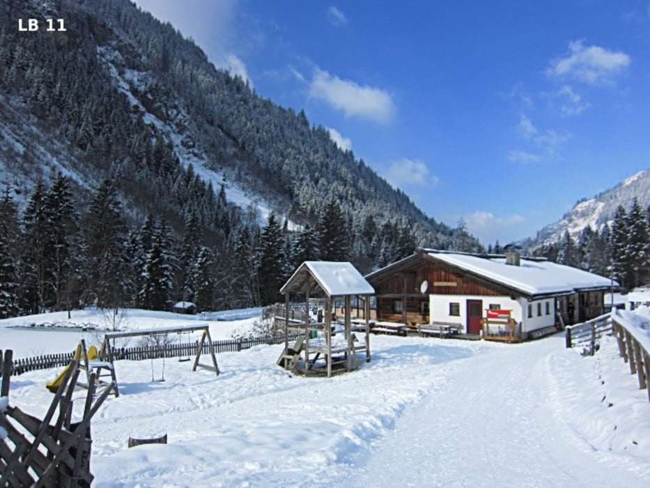
The Kristall-trail in Rohrmoos-Untertal is a cross-country skiing tour in the classical style, has a length of 13.6 km and 223 altimeters. Immediately after the start of Hinkerbrücke the first pitch starts up to the inn - Tetter. Here are on 800m about 50 altimeters to overcome. Just after the inn Tetter follows a small descent to the small plateau - Tettermoor. From there are until to the pasture - Angereralm no significant climbs. In Tettermoor the skating track and the classic crystal-separated trail briefly for a few hundred meters. After a short forest passage can be reached the second refreshment Waldhäuslalm.
More infos, photos and video you'll see on biketours4you.at
Die Kristall-Loipe in Rohrmoos-Untertal ist eine Loipe im klassischen Stil, hat eine Länge von 13,6 km und insgesamt 223 Höhenmeter. Gleich nach dem Start bei der Hinkerbrücke beginnt die erste Steigung hinauf zum Gasthof Tetter. Dabei sind auf 800m ca. 50 Höhenmeter zu überwinden. Gleich nach dem Gasthof Tetter folgt eine kleine Abfahrt zum Tettermoor hinunter. Von dort weg hat man taleinwärts bis zur Angereralm keine nennenswerten Steigungen. Im Tettermoor trennen sich die Skating-Loipe und die klassische Kristall-Loipe kurz für einige hundert Meter. Nach einer kurzen Waldpassage erreicht man mit der Waldhäuslalm die zweite Einkehrmöglichkeit.
Mehr Infos, Fotos und Video findest du auf biketours4you.at
Tour gallery
Tour map and elevation profile
Minimum height 980 m
Maximum height 1100 m
More about the tour author
|
|
Trek1400d |
Comments

More about the tour author
|
|
Trek1400d |
Add to my favorites
Remove from my favorites
Edit tags
Open track
My score
Rate