Login

Forgot your login?

Cookies have to be accepted!
Your browser's cookie functionality is disabled. Please enable this functionality.

Not a member yet?

Register now
Login

Available for registred users only

Log in to use this feature.

Forgot your login?

Cookies have to be accepted!
Your browser's cookie functionality is disabled. Please enable this functionality.

Not a member yet?

Register now
Filter
Categories
Advanced filters
  • Distance (km)
  • Height
Save filters Reset filter

TrackRank

QRCode

Technical data

Distance6,7 km Height532 m Way down346 m Duration02:53 h:m Date24.03.2011
Scores Author Landscape Fun factor Fitness Technique

Statistics

847 Views Scores 38 Downloads Average
Rate
  • Track data sheet
  • Directions
  • Downloads
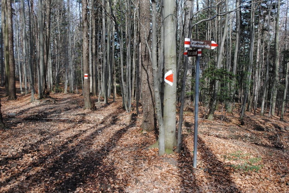
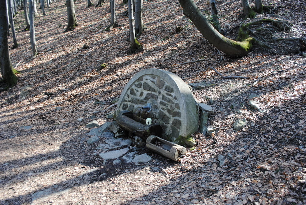
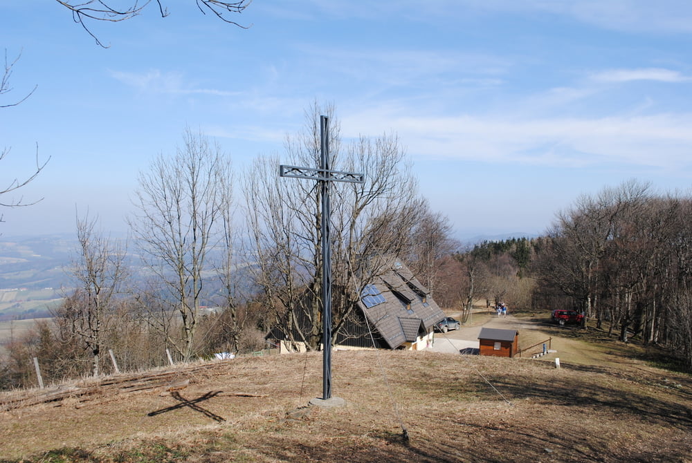
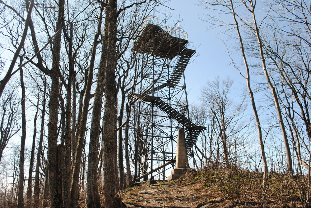
Ausgangspunkt Forsthof (Parkplatz).Entlang der Strasse  bis zur Abzweigung rechts (rot markiert).Über den Pensionistensteig  bis zur Schöpflquelle (Schluck aus alten Blechhäferl nehmen).Dann weiter bis zum Schöpfl-Schutzhaus(gute Hausmannskost).Nach Stärkung bis zum Gipfelkreuz und auf die Matraswarte.Wunderschöner Rundblick bei schönen Wetter.Dann wieder zurück zur Schöpflquelle und dann bei der Wegkreuzung links (auch rot markiert ) über den Githsteig nach Forsthof zum Parkplatz.

Further information at

http://www.oetk.at/index.htm?/huetten/37.htm

Tour gallery

Tour map and elevation profile

  • Open Street Map
  • Google
Minimum height 400 m Maximum height 928 m Detailed view

More about the tour author

LeoCheops
Member since 2008

Send private message

Comments

GPS tracks

Trackpoints
  • GPX / Garmin Map Source (gpx) download
  • TCX / Garmin Training Center® (tcx) download
  • CRS / Garmin Training Center® (crs) download
  • Google Earth (kml) download
  • G7ToWin (g7t) download
  • TTQV (trk) download
  • Overlay (ovl) download
  • Fugawi (txt) download
  • Kompass (DAV) Track (tk) download
  • Track data sheet (pdf) download
  • Original file of the author (gpx) download

More about the tour author

LeoCheops
Member since 2008

Send private message
Share track
Add to my favorites
Remove from my favorites
Edit tags
My score
Rate
Track: Schöpfl im Frühling (24.03.2011)
Type: Mountain hiking
Distance: 6,7 km
Evaluated on:
Duration:
Day(s)
Hour(s)
Minute(s)
Score: Landscape Fun factor Fitness Technique