Login

Forgot your login?

Cookies have to be accepted!
Your browser's cookie functionality is disabled. Please enable this functionality.

Not a member yet?

Register now
Login

Available for registred users only

Log in to use this feature.

Forgot your login?

Cookies have to be accepted!
Your browser's cookie functionality is disabled. Please enable this functionality.

Not a member yet?

Register now
Filter
Categories
Advanced filters
  • Distance (km)
  • Height
Save filters Reset filter

TrackRank

QRCode

Technical data

Distance10,8 km Height657 m Way down598 m Duration05:12 h:m Date19.04.2011
Scores Author Landscape Fun factor Fitness Technique

Statistics

317 Views Scores 18 Downloads Average
Rate
  • Track data sheet
  • Directions
  • Downloads
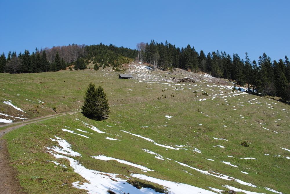
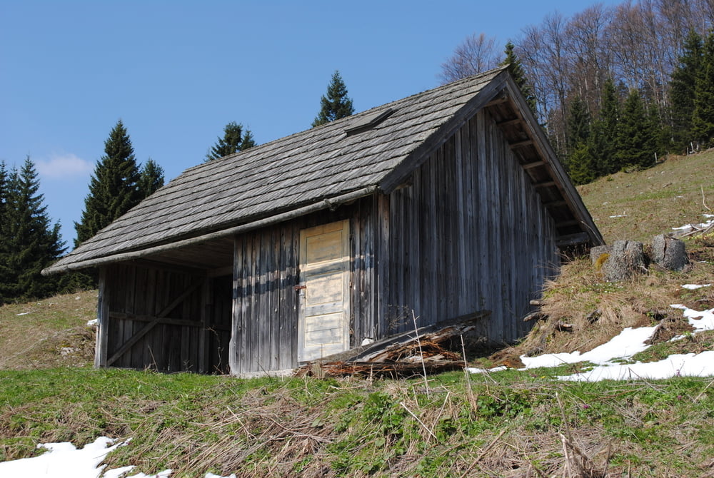
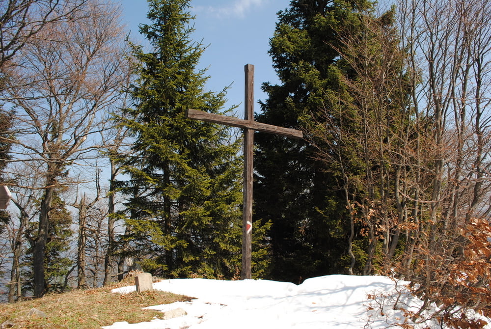
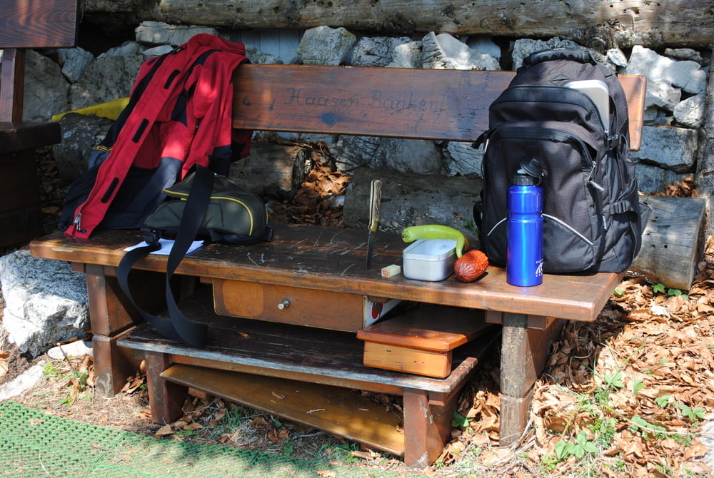
Parken in Rohr im Gebirge .Vorerst durch den Klausgraben(Straße)bis zu einen links ,einzeln stehenden Haus.Dort führt ein Seitengraben in die Öd.Bei der Abzweigung zum Hammerleck links bleiben und auf gewundener Forststrasse bis zu einer Sennhütte.Dort treffen wir auf die blaue Markierung die über das letzte Drittel der Südflanke auf den Gipfel führt.Bei mir war der Weg noch ziemlich rutschig (bei der Querung von kleinen Schneefeldern).Gipfelkreuz ist teilweise durch Jungholz verdeckt.Dann die beiden Haasenbankerln besuchen-Schnaps kosten-Spende einlegen und eine Eintragung in das Gipfelbuch.Zurück über die gesamte Südflanke(blau markiert),vorbei beim Schacherkreuz(ist übrigens nunmehr als kleine Kapelle ausgebaut) zurück nach Rohr im Gebirge.

Tour gallery

Tour map and elevation profile

  • Open Street Map
  • Google
Minimum height 625 m Maximum height 1278 m Detailed view

More about the tour author

LeoCheops
Member since 2008

Send private message

Comments

GPS tracks

Trackpoints
  • GPX / Garmin Map Source (gpx) download
  • TCX / Garmin Training Center® (tcx) download
  • CRS / Garmin Training Center® (crs) download
  • Google Earth (kml) download
  • G7ToWin (g7t) download
  • TTQV (trk) download
  • Overlay (ovl) download
  • Fugawi (txt) download
  • Kompass (DAV) Track (tk) download
  • Track data sheet (pdf) download
  • Original file of the author (gpx) download

More about the tour author

LeoCheops
Member since 2008

Send private message
Share track
Add to my favorites
Remove from my favorites
Edit tags
My score
Rate
Track: Von Süden auf den Jochart (19.04.2011)
Type: Mountain hiking
Distance: 10,8 km
Evaluated on:
Duration:
Day(s)
Hour(s)
Minute(s)
Score: Landscape Fun factor Fitness Technique