Login

Forgotten password?

Cookies have to be accepted!
Your browser's cookie functionality is disabled. Please enable this functionality.

Not a member yet?

Register now
Login

Available for registred users only

Log in to use this feature.

Forgotten password?

Cookies have to be accepted!
Your browser's cookie functionality is disabled. Please enable this functionality.

Not a member yet?

Register now
Filter
Categories
Advanced filters
  • Distance (km)
  • Height
Save filters Reset filter

TrackRank

QRCode

Technical data

Distance15,5 km Height474 m Way down473 m Duration04:00 h:m Date24.04.2011
Scores Author Landscape Fun factor Fitness Technique

Statistics

811 Views Scores 65 Downloads Average
Rate
  • Track data sheet
  • Directions
  • Downloads

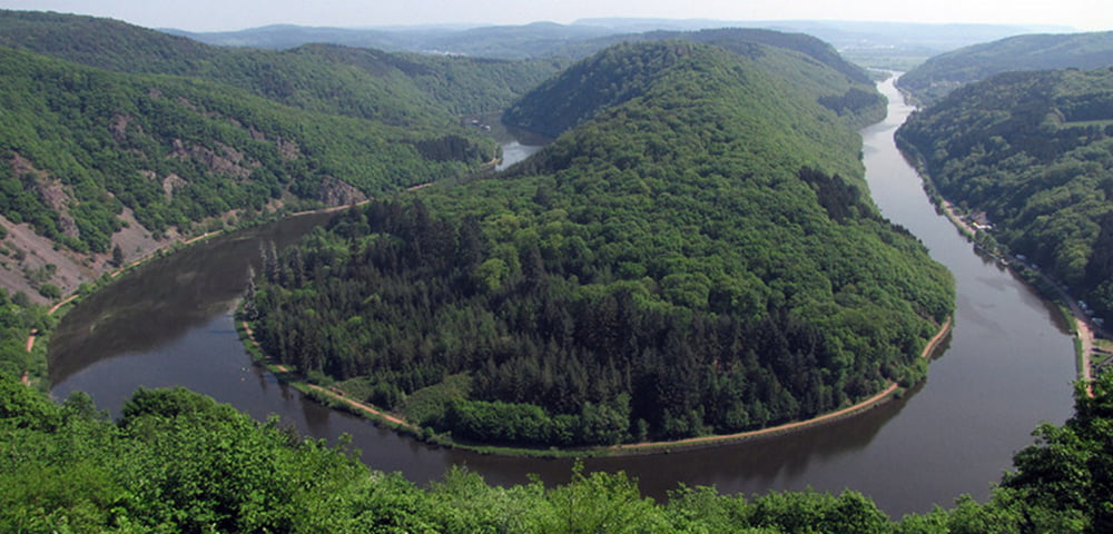
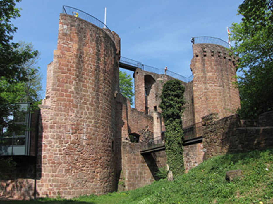
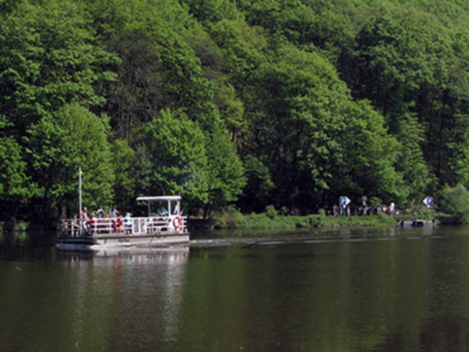
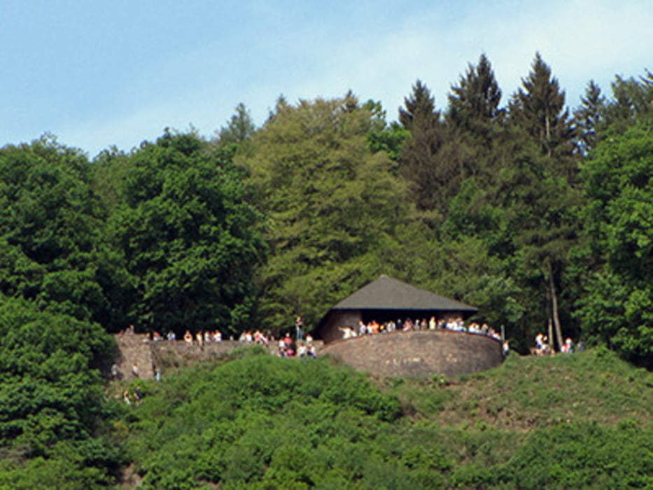
In Mettlach an der Kirche vorbei Richtung Burg Montclair aufsteigen. Immer der Wegmarkierung mit der Kochmütze folgen. Von der Burg zur Saarfähre absteigen. Dann auf die andere Seite übersetzen und auf Wanderweg 3 zum Aussichtspunkt Cloef aufsteigen. Am Aussichtspunkt vorbei wieder der Kochmützenmarkierung folgen bis zum erneuten Abzweig des Wanderweg 3. Hier bis zum Saarufer absteigen und dann links halten zurück nach Mettlach. 

Landschaftlich sehr reizvolle Tour mit schönen Aussichtspunkten. Einkehr im Fährhaus.

Tour gallery

Tour map and elevation profile

  • Open Street Map
  • Google
Minimum height 165 m Maximum height 392 m Detailed view

More about the tour author

biauwe
Member since 2008

Send private message

Comments

Mettlach im Saarland

GPS tracks

Trackpoints
  • GPX / Garmin Map Source (gpx) download
  • TCX / Garmin Training Center® (tcx) download
  • CRS / Garmin Training Center® (crs) download
  • Google Earth (kml) download
  • G7ToWin (g7t) download
  • TTQV (trk) download
  • Overlay (ovl) download
  • Fugawi (txt) download
  • Kompass (DAV) Track (tk) download
  • Track data sheet (pdf) download
  • Original file of the author (gpx) download

More about the tour author

biauwe
Member since 2008

Send private message
Share track
Add to my favorites
Remove from my favorites
Edit tags
My score
Rate
Track: Saarschleife
Type: Hiking
Distance: 15,5 km
Evaluated on:
Duration:
Day(s)
Hour(s)
Minute(s)
Score: Landscape Fun factor Fitness Technique