Login

Forgot your login?

Cookies have to be accepted!
Your browser's cookie functionality is disabled. Please enable this functionality.

Not a member yet?

Register now
Login

Available for registred users only

Log in to use this feature.

Forgot your login?

Cookies have to be accepted!
Your browser's cookie functionality is disabled. Please enable this functionality.

Not a member yet?

Register now
Filter
Categories
Advanced filters
  • Distance (km)
  • Height
Save filters Reset filter

TrackRank

QRCode

Technical data

Distance14,0 km Height81 m Way down70 m Duration03:00 h:m Date27.04.2011
Scores Author Landscape Fun factor Fitness Technique

Statistics

805 Views Scores 20 Downloads Average
Rate
  • Track data sheet
  • Directions
  • Downloads
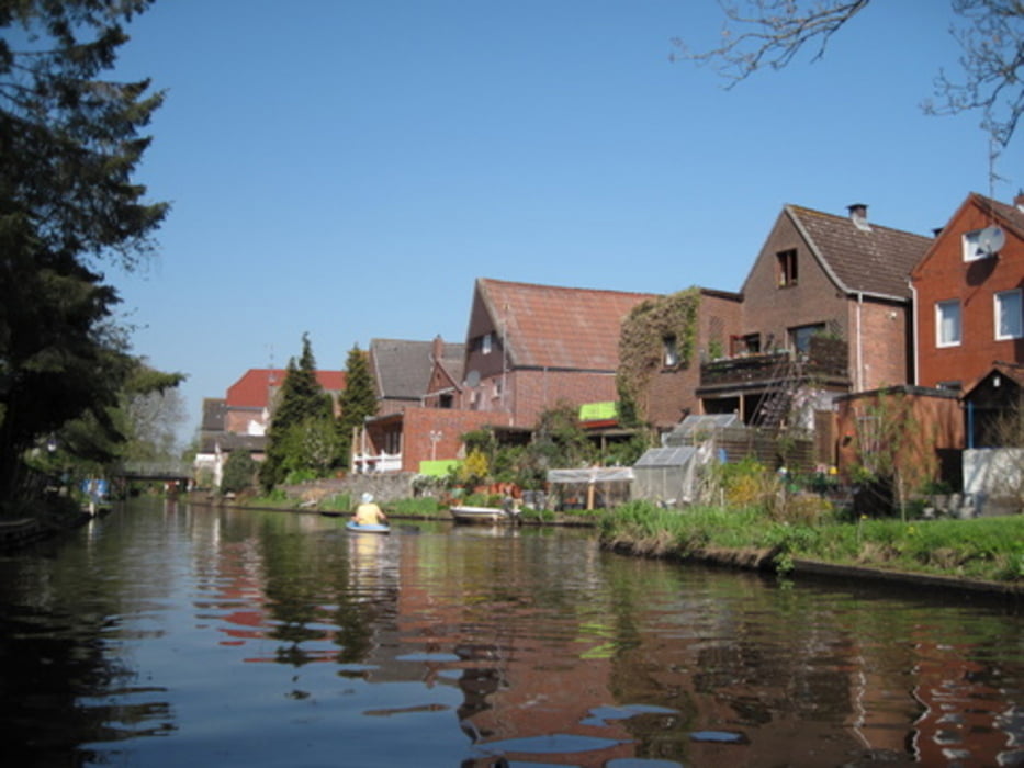
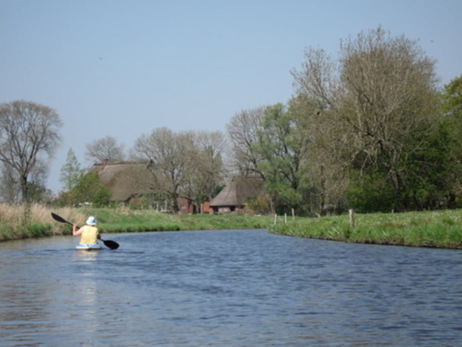
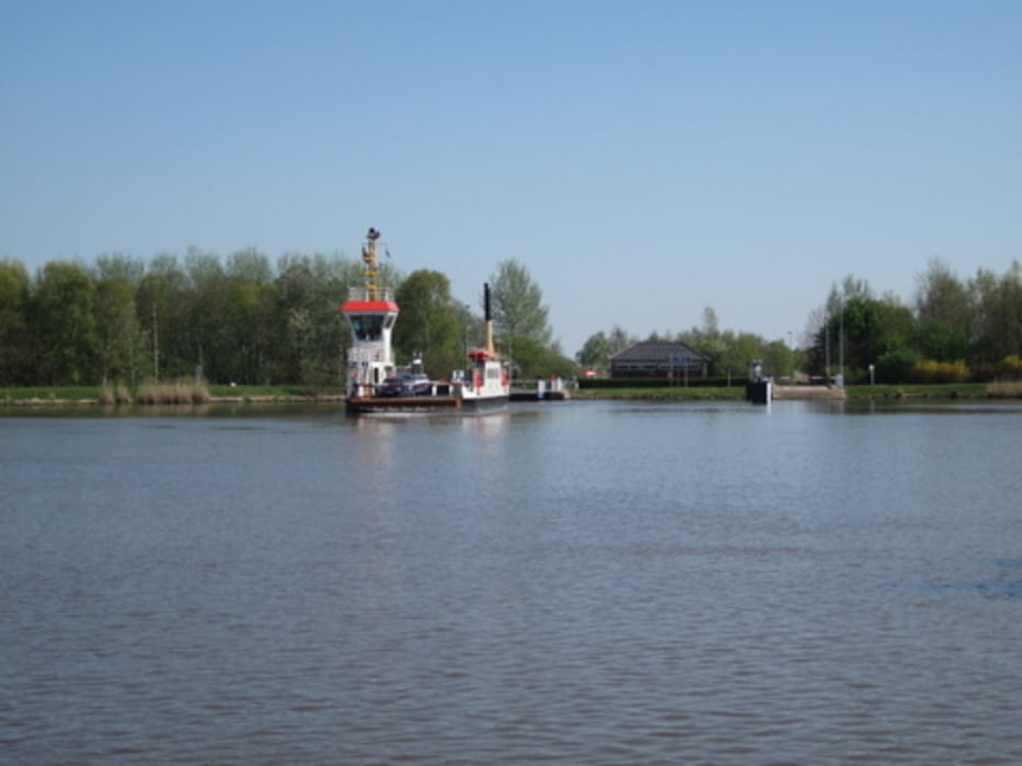
Die Wilsterau ist etwas besonderes. Zum Einen in der historischen Bedeutung für die Entwässerung des Landes, zum Anderen als wichtiger Wirtschaftsweg. Der Fluss liegt heute unter dem Meeresniveau. Der tiefste Punkt Deutschland mit 3,5 m unter NN liegt ganz in der Nähe. Zum Ende der Tour tauchen Ozeanriesen hinter hohen Bäumen auf: Wir erreichen den NOK, eine der meistbefahrenen Schiffahrtsstassen der Welt.

Tour gallery

Tour map and elevation profile

  • Open Street Map
  • Google
Minimum height -94 m Maximum height 23 m Detailed view

More about the tour author

sugesei
Member since 2010

Send private message

Comments

GPS tracks

Trackpoints
  • GPX / Garmin Map Source (gpx) download
  • TCX / Garmin Training Center® (tcx) download
  • CRS / Garmin Training Center® (crs) download
  • Google Earth (kml) download
  • G7ToWin (g7t) download
  • TTQV (trk) download
  • Overlay (ovl) download
  • Fugawi (txt) download
  • Kompass (DAV) Track (tk) download
  • Track data sheet (pdf) download
  • Original file of the author (gpx) download

More about the tour author

sugesei
Member since 2010

Send private message
Share track
Add to my favorites
Remove from my favorites
Edit tags
My score
Rate
Track: Paddeln unter NN auf der Wilsterau
Type: Boat and canoe
Distance: 14,0 km
Evaluated on:
Duration:
Day(s)
Hour(s)
Minute(s)
Score: Landscape Fun factor Fitness Technique