


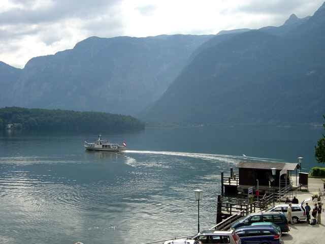
Ausgangspunkt für diese durchaus lehrreiche Wanderung entlang des Soleleitungsweges bildet das Landhotel Agathawirt in St. Agatha. Zuerst führt der Weg über Wiesen und die Ortschaft St. Agatha in die Richtung des Bahnhofes Steeg-Gosau. Nachdem man den Bahnübergang überquert hat, passiert man nach ca. 200 m den Traunfluss und nach weiteren 200 m zweigt rechts ein Weg ab zum Soleleitungsweg Richtung Hallstatt (UNESCO Weltkulturerbe). Am wunderschönen Soleleitungsweg (beschildert mit Infotafeln), vorbei an Wasserfällen und mit herrlichen Ausblicken auf den darunterliegenden Hallstätter See, gelangt man nach Hallstatt (ca. 6 km), wo man sich den Ort, die Kirchen, das Beinhaus und vieles mehr ansehen kann. Weiter geht´s mit dem Boot ans andere Seeufer und von dort auf einem idyllischen Weg (Pflanzenlehrpfad) entlang des Hallstätter Sees zurück nach St. Agatha (8 km).
Tour gallery
Tour map and elevation profile
Minimum height 504 m
Maximum height 643 m
More about the tour author

|
Landhotel Agathawirt |
Comments

über Bad Goisern nach St. Agatha, Ausgangspunkt: Landhotel Agathawirt
GPS tracks
Trackpoints-
GPX / Garmin Map Source (gpx) download
-
TCX / Garmin Training Center® (tcx) download
-
CRS / Garmin Training Center® (crs) download
-
Google Earth (kml) download
-
G7ToWin (g7t) download
-
TTQV (trk) download
-
Overlay (ovl) download
-
Fugawi (txt) download
-
Kompass (DAV) Track (tk) download
-
Track data sheet (pdf) download
-
Original file of the author (g7t) download
More about the tour author
|
|
Landhotel Agathawirt |
Add to my favorites
Remove from my favorites
Edit tags
Open track
My score
Rate