Login

Forgot your login?

Cookies have to be accepted!
Your browser's cookie functionality is disabled. Please enable this functionality.

Not a member yet?

Register now
Login

Available for registred users only

Log in to use this feature.

Forgot your login?

Cookies have to be accepted!
Your browser's cookie functionality is disabled. Please enable this functionality.

Not a member yet?

Register now
Filter
Categories
Advanced filters
  • Distance (km)
  • Height
Save filters Reset filter

TrackRank

QRCode

Technical data

Distance7,7 km Height404 m Way down327 m Duration04:04 h:m Date04.08.2011
Scores Author Landscape Fun factor Fitness Technique

Statistics

425 Views Scores 28 Downloads Average
Rate
  • Track data sheet
  • Directions
  • Downloads

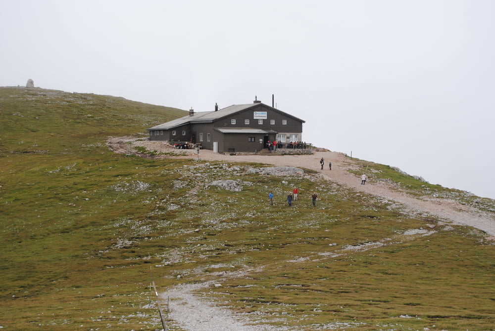
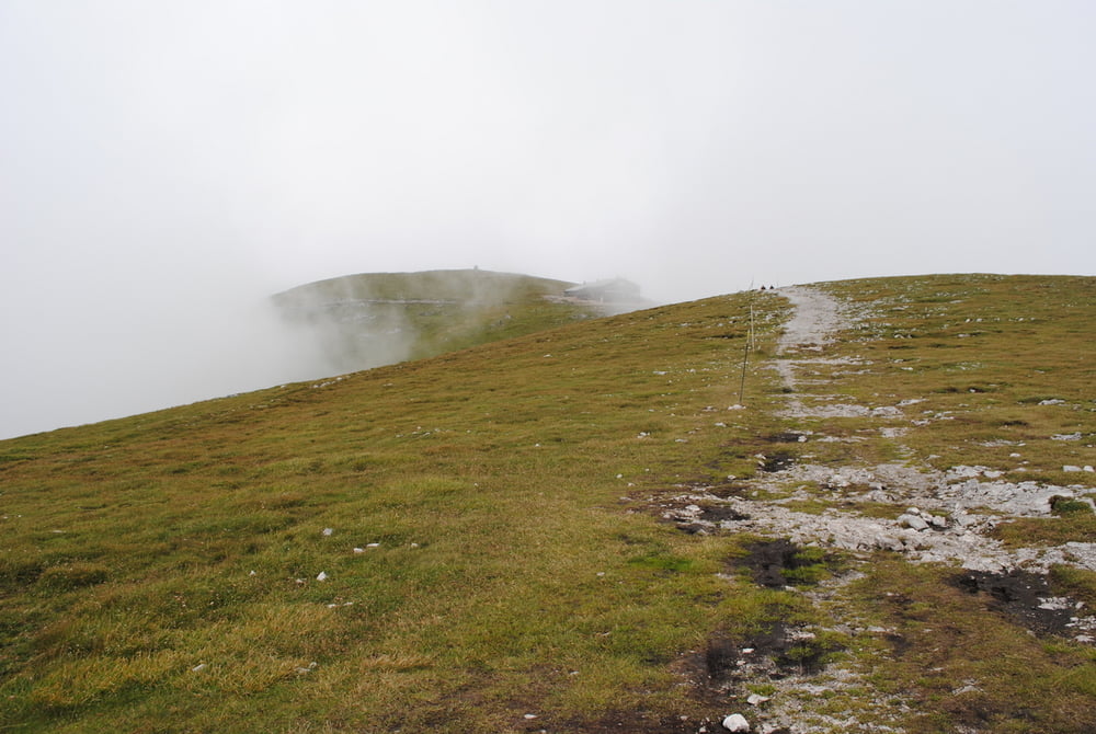
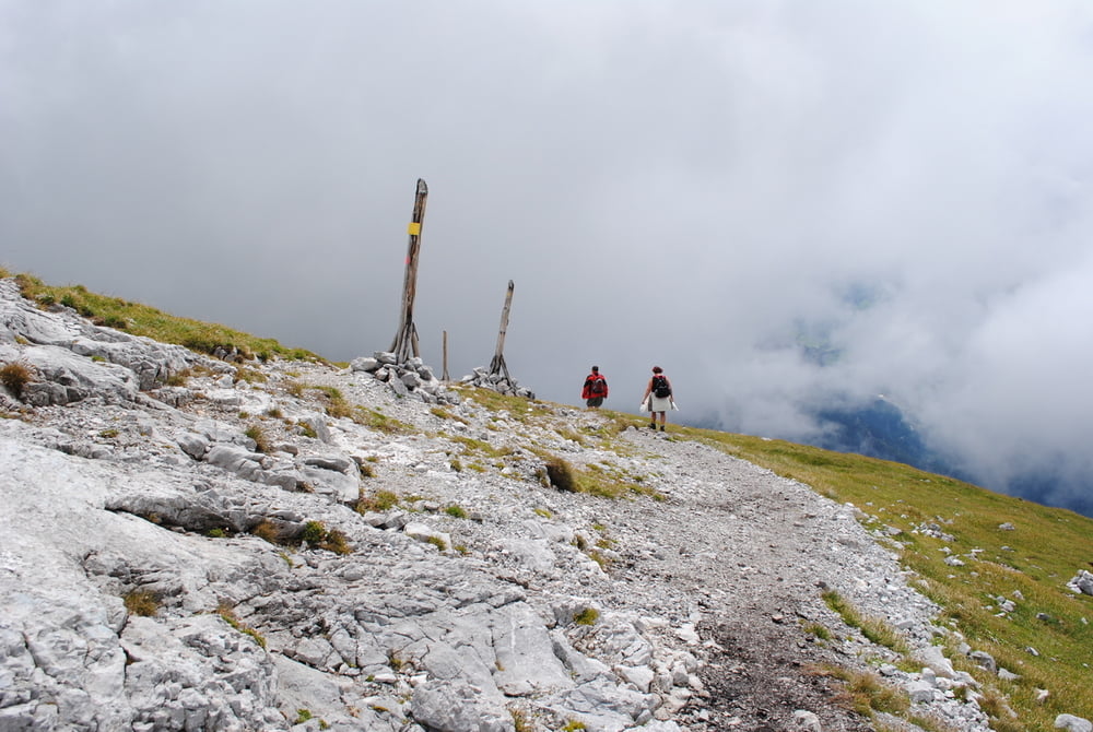
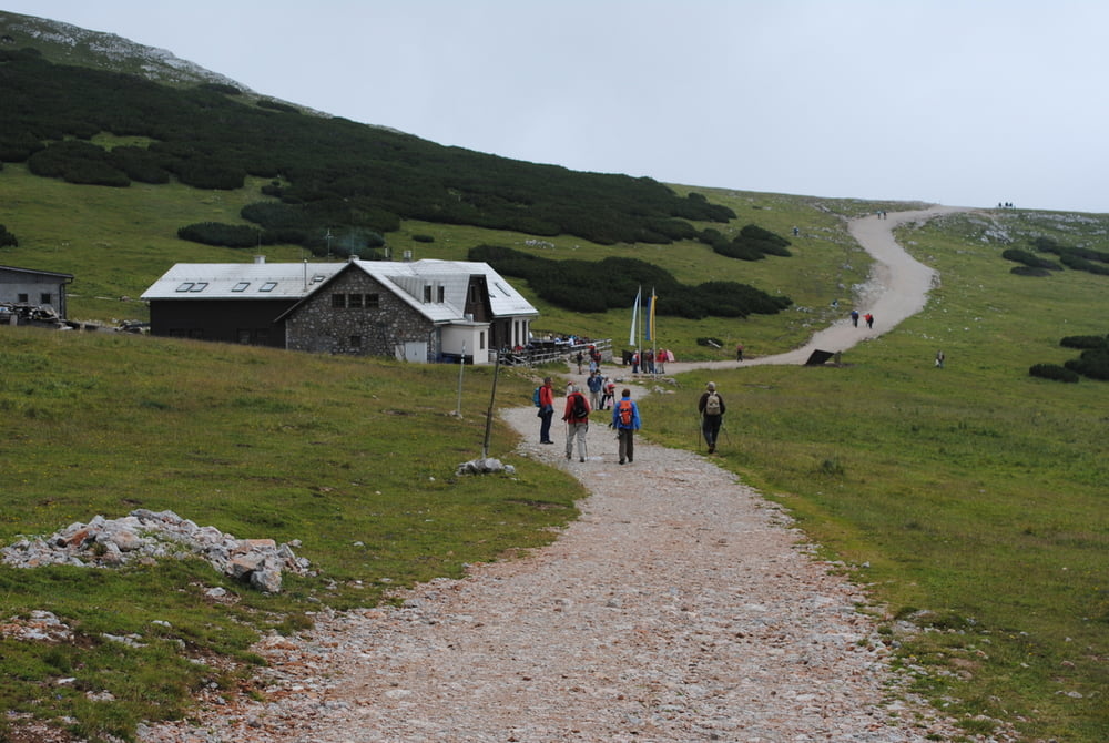
Start  Zahnradbahnendstelle Hochschneeberg.Leider Nebel ,der die ganze Wanderung nur teilweise aufriß.Vorbei am Damböckhaus und dann etwas steiler auf die Fischerhütte.Leider nur wenig Fernsicht daher weiter auf den Kaiserstein und dann auf das Klosterwappen.(Wettergott hatte Einsicht und reduzierte kurz den Nebel).Steil hinunter neben gewaltigen Schneemarkierungen und wieder zurück zum Damböckhaus.(Geräucherte Wurst mit Kraut und Kartoffeln,ein Bier und einen doppelten Marillenbrand_fein wars).Dann zurück zum Bahnhof Hochschneeberg.

Tip:Berg- und Talfahrt bereite im Internet buchen .

Further information at

http://www.oetk.at/index.htm?/huetten/13.htm

Tour gallery

Tour map and elevation profile

  • Open Street Map
  • Google
Minimum height 1716 m Maximum height 2070 m Detailed view

More about the tour author

LeoCheops
Member since 2008

Send private message

Comments

GPS tracks

Trackpoints
  • GPX / Garmin Map Source (gpx) download
  • TCX / Garmin Training Center® (tcx) download
  • CRS / Garmin Training Center® (crs) download
  • Google Earth (kml) download
  • G7ToWin (g7t) download
  • TTQV (trk) download
  • Overlay (ovl) download
  • Fugawi (txt) download
  • Kompass (DAV) Track (tk) download
  • Track data sheet (pdf) download
  • Original file of the author (gpx) download

More about the tour author

LeoCheops
Member since 2008

Send private message
Share track
Add to my favorites
Remove from my favorites
Edit tags
My score
Rate
Track: Schneeberg_Kaiserstein und Klosterwappen (02.08.2011)
Type: Mountain hiking
Distance: 7,7 km
Evaluated on:
Duration:
Day(s)
Hour(s)
Minute(s)
Score: Landscape Fun factor Fitness Technique