


Date: July 30, 2011
Start: 1640 m (Gradental parking area)
Finish: 2488 m (Adolf Nossberger Hütte)
Highest point: 2488 m (Adolf Nossberger Hütte)
Lowest point: 1640 m
Total ascent: 902 m
Total descent: 48 m
http://www.tauernalpin-touren.at/bergwandern-und-gipfelwandern/top-10-wandertipps/gradental.html
Our similar but shorter tour from 2009 (Gradental - Vordersee): /en/tracks/detail.48218.html
Our similar tour from 2010 (Gradental - A.Nossberger Hütte - Gradental): /en/tracks/detail.66080.html
**************************
Do not take anything, do not leave anything!
**************************
Please, do NOT leave trash behind. Paper tissues are also trash! Chocolate wrap as well. Bring a small trash bag with you and take your trash with yourself to the next trash can. It is not that heavy.
**************************
Further information at
https://picasaweb.google.com/beatahardi/2010073008013NaposHutteTura?authuser=0&feat=directlinkTour gallery

Tour map and elevation profile
Minimum height 1624 m
Maximum height 2490 m
More about the tour author
|
|
beepee |
Comments

Places where you can eat and drink:
Adolf Nossberger Hütte
Route:
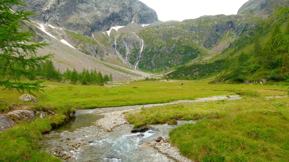
1. Gradental parking area
2. follow the dirt road next to the creek
3. as you reach Naturlehrweg Gradental sign, walk under it - into the forest
4. follow the marked trail in the forest, leading up
5. cross the creek, go through the gate, and soon you will reach Gradenmoos
6. in Gradenmoos, keep right, walk around the 'Moos' on its right side
7. after crossing the creek, soon you will find a trail marking, that shows the way towards Adolf Nossberger Hütte
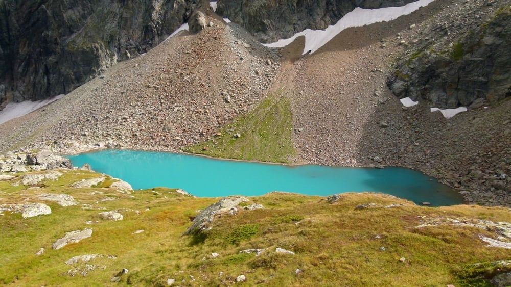
8. on the way up, the longer trail via Vordersee is recommended (no.816)
9. after a quite steep walk (560 m ascent in 2 km) you will reach Vordersee
10. walk past Vordersee, then past Mittersee, and you will see the Hütte already
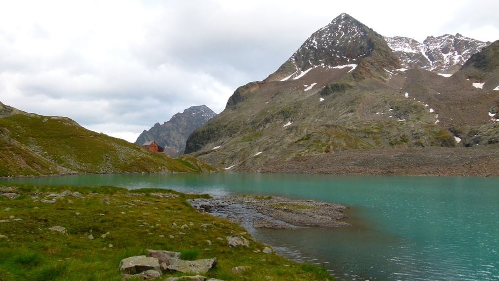
11. reach Adolf Nossberger Hütte that is built next to Gradensee
After a nice meal and some rest in the Hütte, walk around Gradensee! It will take about an hour if you walk slowly.
Make sure to bring plenty of water!!!
**************************
Do not take anything, do not leave anything!
**************************
Please, do NOT leave trash behind. Paper tissues are also trash! Chocolate wrap as well. Bring a small trash bag with you and take your trash with yourself to the next trash can. It is not that heavy.
**************************
GPS tracks
Trackpoints-
GPX / Garmin Map Source (gpx) download
-
TCX / Garmin Training Center® (tcx) download
-
CRS / Garmin Training Center® (crs) download
-
Google Earth (kml) download
-
G7ToWin (g7t) download
-
TTQV (trk) download
-
Overlay (ovl) download
-
Fugawi (txt) download
-
Kompass (DAV) Track (tk) download
-
Track data sheet (pdf) download
-
Original file of the author (gpx) download
More about the tour author
|
|
beepee |
Add to my favorites
Remove from my favorites
Edit tags
Open track
My score
Rate