


This hike takes in the 14 km length of the Semnoz ridge from the Crêt de Chatillon at 1699 mtr, to the town of Annecy in the Haute Savoire region of France.
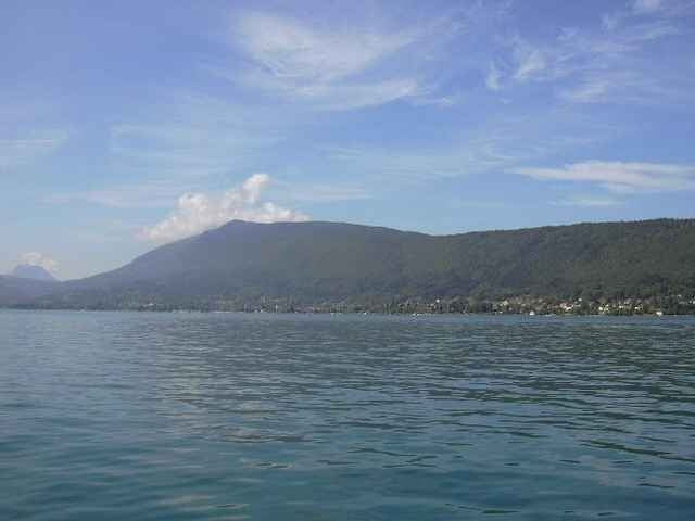
There are wonderful panoramic views at the start, with clear views to Mont Blanc.
I walked the path in July 2004, but it is known locally as a mountain bike trail. Most of the route is on the Grande Randonee that completely circles the Lac de Annecy.
The path is well marked for the most part, although it is worth paying attention at the third Waypoint (Chalet de Benévent) and continue on in the general direction of the hike. I made an error here and added about 2km onto the journey.
The route is clearly shown on the French IGN map number 3431 OT (GPS compatible).
Further information at
http://www.sibra.frGalería de rutas
Mapa de la ruta y perfil de altitud
Minimum height 438 m
Maximum height 1593 m
More about the tour author

|
SILVAED |
Comentarios

The start of the trail is at the highest point of the Semnoz ( Crêt de Chatillon), it is easily reached by taking a “Sibra” bus from opposite Annecy train station.
The bus will take Mountain Bikes so the trail can also be ridden down.
Behind the restaurant “Semnoz – Alpes”, there is a stony track that goes down, crosses the road and then carries on into the forest. The GPS TRACK starts here and leads all the way back to Annecy.
The bus will take Mountain Bikes so the trail can also be ridden down.
Behind the restaurant “Semnoz – Alpes”, there is a stony track that goes down, crosses the road and then carries on into the forest. The GPS TRACK starts here and leads all the way back to Annecy.
Tracks GPS
Puntos del track-
GPX / Garmin Map Source (gpx) download
-
TCX / Garmin Training Center® (tcx) download
-
CRS / Garmin Training Center® (crs) download
-
Google Earth (kml) download
-
G7ToWin (g7t) download
-
TTQV (trk) download
-
Overlay (ovl) download
-
Fugawi (txt) download
-
Kompass (DAV) Track (tk) download
-
Hoja de ruta (pdf) download
-
Original file of the author (g7t) download
More about the tour author
|
|
SILVAED |
Add to my favorites
Remove from my favorites
Edit tags
Open track
Mi valoración
Rate