


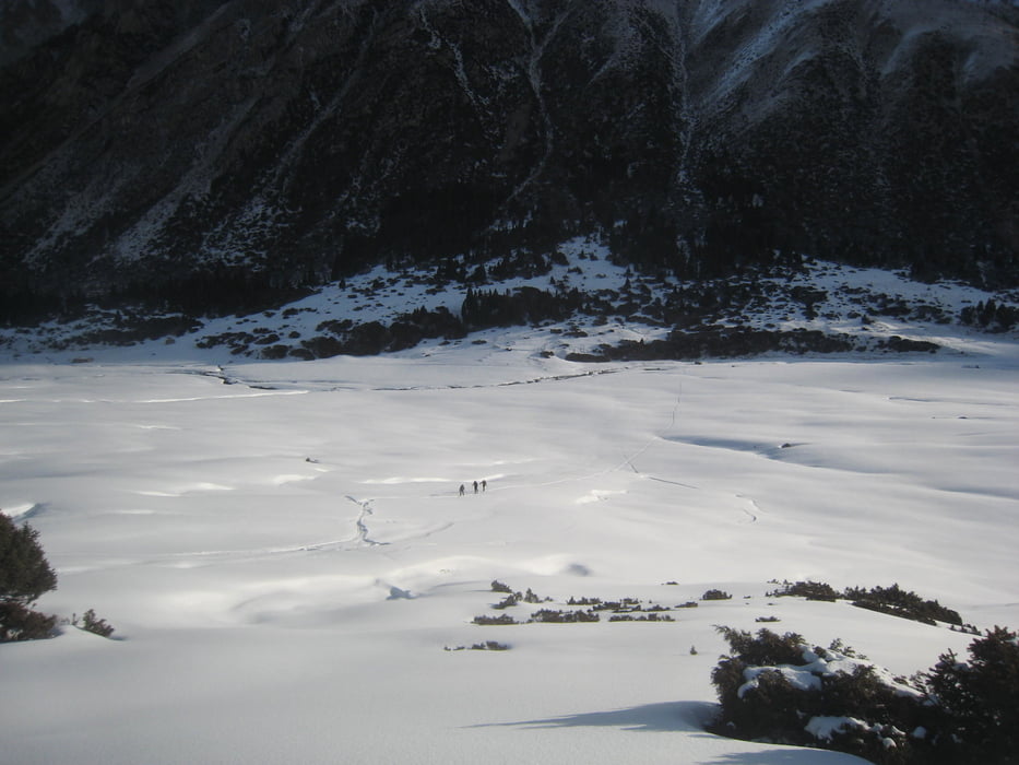
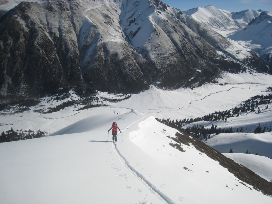
Vom Jurtenlager mit dem Skidoo bis ca. 2750m empor. Dann nach SW immer am Kamm entlang. Dabei lösten wir per Fernauslösung ein Schneebrett im ansonsten einladenden Hang zur Rechten aus!
Aufstieg bis zu Vorgipfel und auf der Südseit Abfahrt, teilweise mit Firn. Vor der letzten bewaldeten Talstufe wieder auf die Aufstiegsroute wechseln.
Warnung: wir hatten im Internet von der Schwimmschneeproblematik in Kirgistan gelesen, aber gehofft dass dies Einzelfälle waren. Wir können nun bestätigen dass die Schneebrettgefahr wirklich extrem hoch ist!
Galería de rutas


Mapa de la ruta y perfil de altitud
Minimum height 2638 m
Maximum height 3355 m
More about the tour author

|
Gi |
Comentarios

Von Karakol nach Aksuu ans Ortsende dem Bach entlang. Vonhier entweder mit skidoo, Pferden oder auf Ski zu Fuß ins Jurtenlager auf 2650m Höhe
Tracks GPS
Puntos del track-
GPX / Garmin Map Source (gpx) download
-
TCX / Garmin Training Center® (tcx) download
-
CRS / Garmin Training Center® (crs) download
-
Google Earth (kml) download
-
G7ToWin (g7t) download
-
TTQV (trk) download
-
Overlay (ovl) download
-
Fugawi (txt) download
-
Kompass (DAV) Track (tk) download
-
Hoja de ruta (pdf) download
-
Original file of the author (gpx) download
More about the tour author
|
|
Gi |
Add to my favorites
Remove from my favorites
Edit tags
Open track
Mi valoración
Rate