


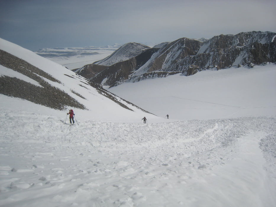
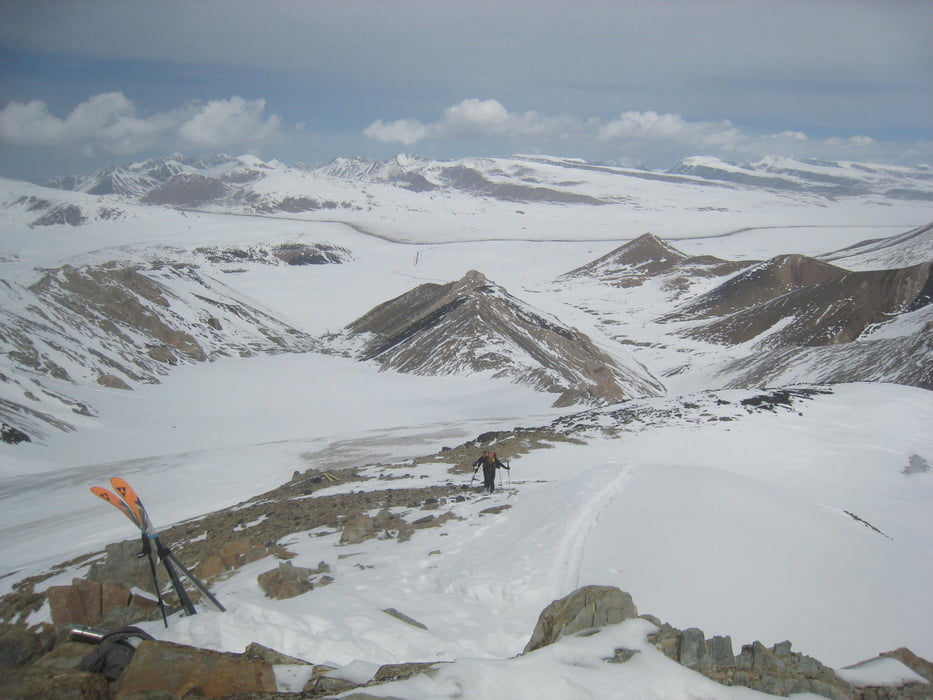
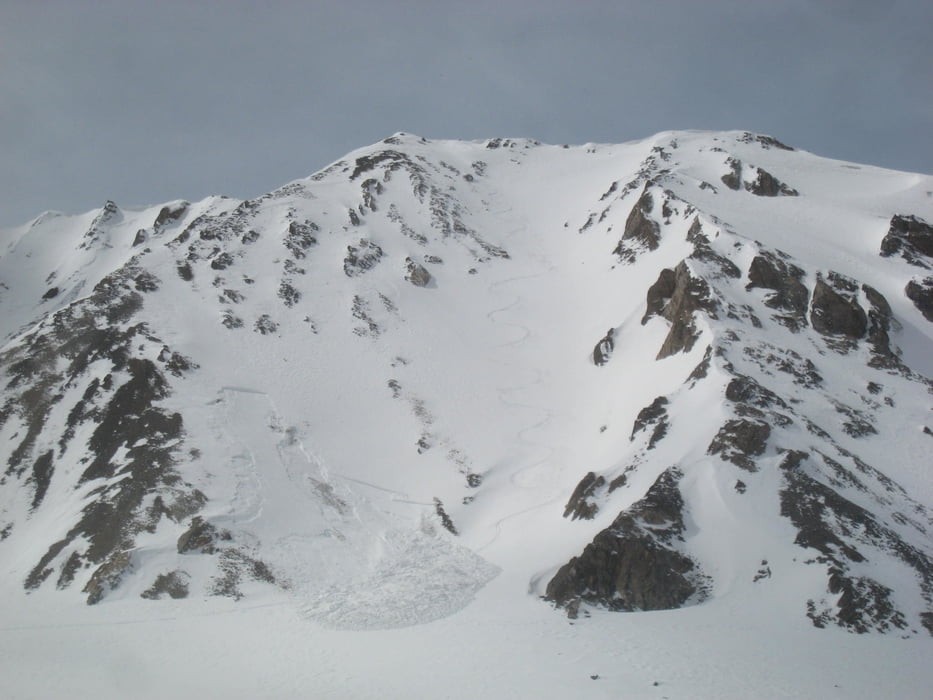
Von der Straße flach nach SO bis zum Taleingang, dann in der Talmitte empor zum Sattel am Ende des Tales und links, bei uns eisig, bis zum Gipfel. Bei der Abfahrt kann nochmals zum Nebengipfel aufgestiegen werden. In der Rinne neben dem Track lösten wir dabei ein Schneebrett aus.
Dann Abfahrt wie Aufstieg
Warnung: wir hatten im Internet von der Schwimmschneeproblematik in Kirgistan gelesen, aber gehofft dass dies Einzelfälle wären. Wir können nun bestätigen dass die Schneebrettgefahr wirklich extrem hoch ist!
Galería de rutas
Mapa de la ruta y perfil de altitud
Minimum height 3827 m
Maximum height 4465 m
More about the tour author

|
Gi |
Comentarios

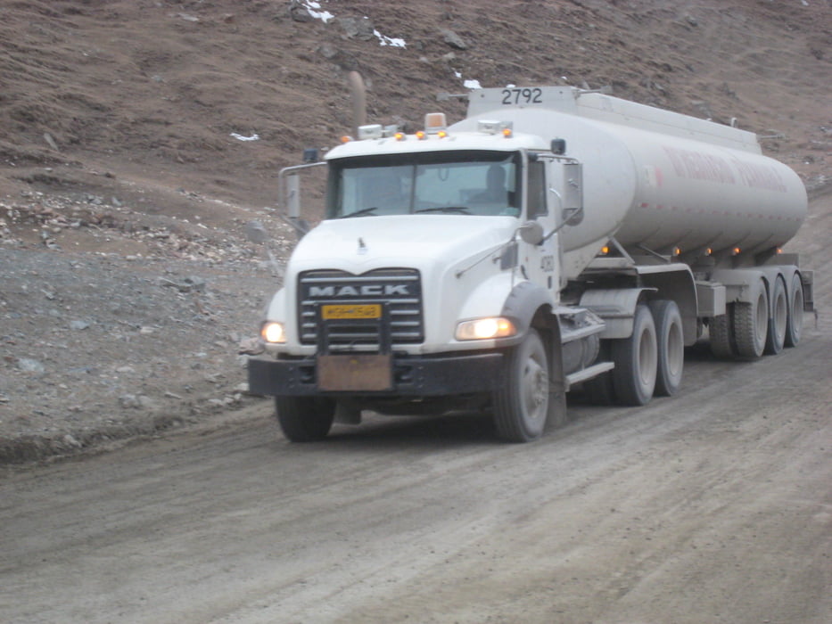
Von Tamga / Barskoon am Isyk-Kul See die Straße zur Goldmine nehmen. Hier Kontrolle an einer Schranke. Womit unser einheimischer Begleiter das Personal in der Kontrollstation überzeugte uns passieren zu lassen wissen wir nicht. Über einen Pass in die Hochebene an deren Ende die Kumtor-Mine liegt. Wo die A364 nach Osten abknickt geradeaus weiter auf eine kleine schlecht bis gar nicht geräumte Straße, dort nach ca. 5km parken.
Tracks GPS
Puntos del track-
GPX / Garmin Map Source (gpx) download
-
TCX / Garmin Training Center® (tcx) download
-
CRS / Garmin Training Center® (crs) download
-
Google Earth (kml) download
-
G7ToWin (g7t) download
-
TTQV (trk) download
-
Overlay (ovl) download
-
Fugawi (txt) download
-
Kompass (DAV) Track (tk) download
-
Hoja de ruta (pdf) download
-
Original file of the author (gpx) download
More about the tour author
|
|
Gi |
Add to my favorites
Remove from my favorites
Edit tags
Open track
Mi valoración
Rate