


Von Rothenburg o.d. Tauber nach Steinbach
--> Eine Tour für Romantiker durchs Taubertal aus dem Wanderburch "Fränkisches Weinland mit Taubertal die Nr. 44
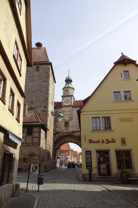
* Drei Mal Riemenschneider --> Jakobs- und Franziskanerkirche und in Detwang wo ein weiterer Riemenschneider Altar steht!
* Die Weinberge um Rothenburg wurden nach dem 1.Weltkrieg aufgegeben --> 1999 wurde ein geologischer Lehrpfad und Rebsortenpfad von Karl Thürauf vom Restaurant Glocke wieder im alten Weinberg unterhalb der Stadtmauer angelegt.
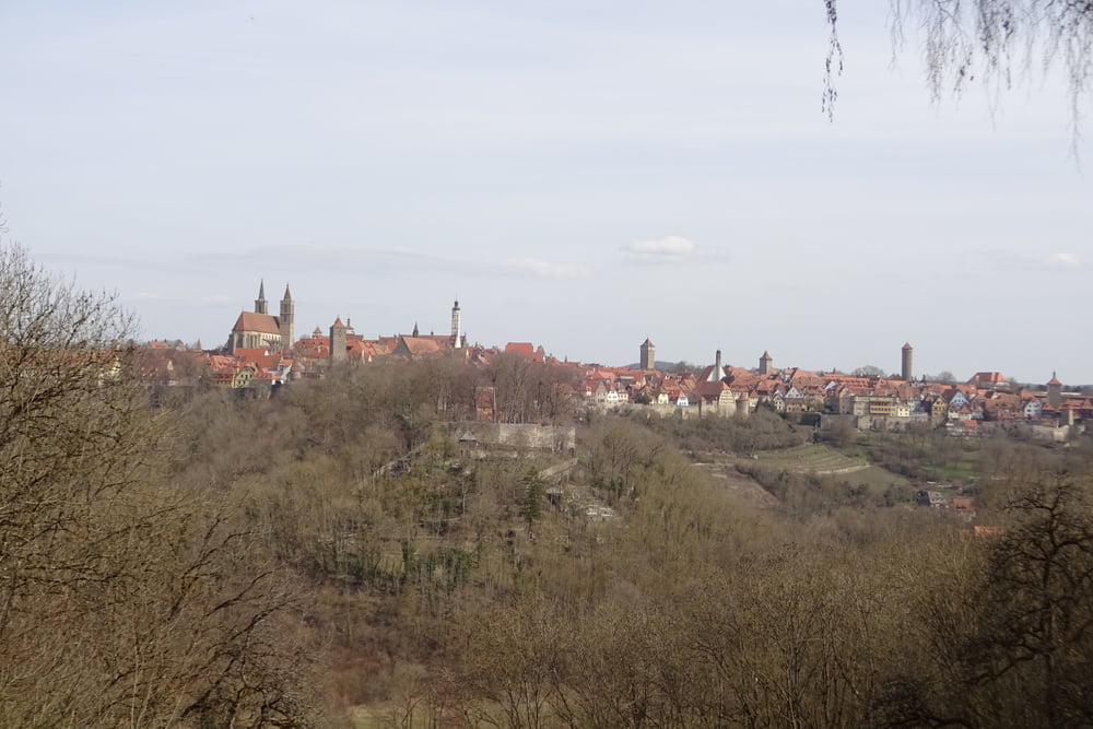
* traumhafter Blick von der Engelsburghöhe auf Rothenburg......
Schöne abwechslungsreiche Wanderung um Rothenburg o.d. Tauber.
Viel Spaß!
Galería de rutas
Mapa de la ruta y perfil de altitud
Minimum height 284 m
Maximum height 433 m
More about the tour author
|
|
FLU |
Comentarios

Tracks GPS
Puntos del track-
GPX / Garmin Map Source (gpx) download
-
TCX / Garmin Training Center® (tcx) download
-
CRS / Garmin Training Center® (crs) download
-
Google Earth (kml) download
-
G7ToWin (g7t) download
-
TTQV (trk) download
-
Overlay (ovl) download
-
Fugawi (txt) download
-
Kompass (DAV) Track (tk) download
-
Hoja de ruta (pdf) download
-
Original file of the author (gpx) download
More about the tour author
|
|
FLU |
Add to my favorites
Remove from my favorites
Edit tags
Open track
Mi valoración
Rate