


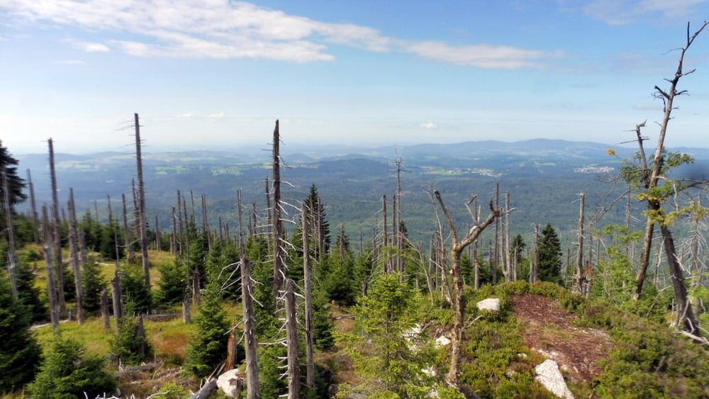
Rundwanderung auf dem einsamen, unmarkierten Grenzsteig zwischen Lusen und Großer Rachel im Nationalpark Bayerischer Wald.
Vom Parkplatz Fredenbrücke über die Gläserne Arche zu den „Blauen Säulen“, vorbei am Kleinen Spitzberg (1233 m) und Großen Spitzberg (1352 m) zum Plattenhausenriegel (1376 m). Über den Bärenlochriegel (1304 m) und der Racheldiensthütte wieder zurück.
Hinweise: Schwere Wanderung, gute Kondition erforderlich. Wanderausrüstung erforderlich. Nicht markierte Wegabschnitte (Kerngebiet des NP Bayerischer Wald).
Start/Ziel: Parkplatz Fredenbrücke
Markierung: „Ranne“, „Buntspecht“
Route: Parkplatz Fredenbrücke (Markierung „Ranne“) – Martinsklause – Teufelsloch – Gläserne Arche – Beginn nichtmarkierter Wegabschnitt – „Blaue Säulen“ – Kleiner Spitzberg – Großer Spitzberg – Abstecher zum Plattenhausriegel – Pilotenmarterl – Bärenlochriegel – Zirkelfilz – Steinschachtenhänge – Horizontalsteig (Markierung „Buntspecht“) – Racheldiensthütte – Parkplatz Fredenbrücke
POI: Martinsklause, Teufelsloch, Gläserne Arche, „Blaue Säulen“, Plattenhausriegel, Pilotenmarterl, Bärenlochriegel
Galería de rutas


Mapa de la ruta y perfil de altitud
Minimum height 838 m
Maximum height 1373 m
More about the tour author

|
ejee |
Comentarios

Tracks GPS
Puntos del track-
GPX / Garmin Map Source (gpx) download
-
TCX / Garmin Training Center® (tcx) download
-
CRS / Garmin Training Center® (crs) download
-
Google Earth (kml) download
-
G7ToWin (g7t) download
-
TTQV (trk) download
-
Overlay (ovl) download
-
Fugawi (txt) download
-
Kompass (DAV) Track (tk) download
-
Hoja de ruta (pdf) download
-
Original file of the author (gpx) download
More about the tour author
|
|
ejee |
Add to my favorites
Remove from my favorites
Edit tags
Open track
Mi valoración
Rate