


Heute begann der Tag mit dem w.o. von W. Wir waren natürlich alle enttäuscht.
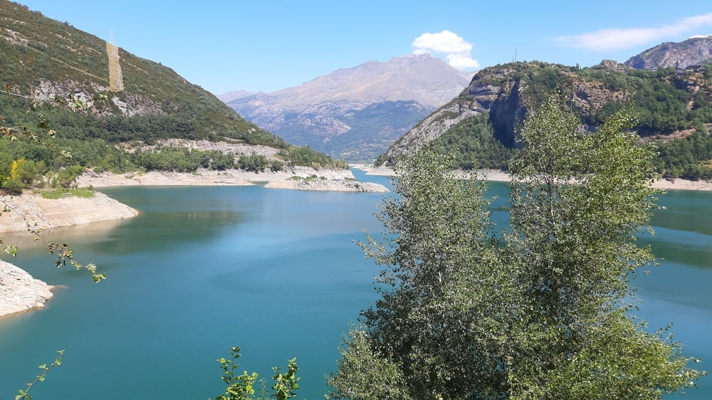
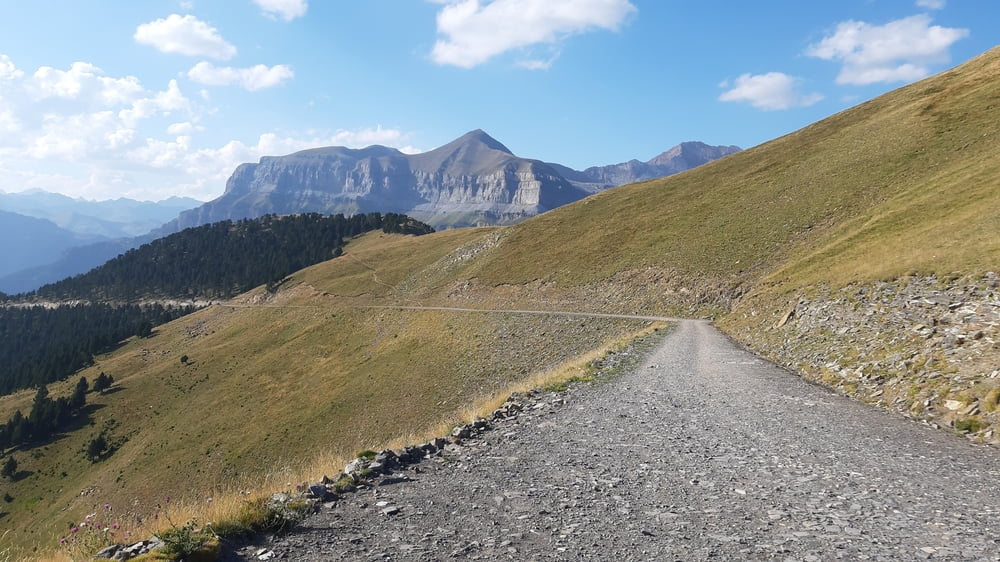
Zu zweit setzten wir unseren cross fort in eine ganz besondere Gegend der Pyrenäen: den Ordenos Nationalpark..
Durch eine beeindruckende Schlucht und später dann wieder richtig in die Höhe, ca 2000m. Untergrund und Steigung waren heute sehr gut. Teer und ab Nerin guter Schotter.
Allerdings hat am Nachmittag die Hitze wieder voll zugeschlagen. Ca ab 1800m wehte dann eine leichte Brise, der die Auffahrt gleich deutlich leichter machte. Abfahrt ca 15 km wieder guter Schotter, erst weiter unten wird es ruppiger.
Quartier: La Borda de Chelis, Luxus. Ein tolles Häuschen für uns zwei (Es wäre Platz für 5). N 147€! Auch in dieser Gegend war es wieder schwierig, irgendein Quartier zu finden.
Galería de rutas


Mapa de la ruta y perfil de altitud
Minimum height 653 m
Maximum height 2191 m
More about the tour author
|
|
mitter |
Comentarios

Start in Gistaìn.
Tracks GPS
Puntos del track-
GPX / Garmin Map Source (gpx) download
-
TCX / Garmin Training Center® (tcx) download
-
CRS / Garmin Training Center® (crs) download
-
Google Earth (kml) download
-
G7ToWin (g7t) download
-
TTQV (trk) download
-
Overlay (ovl) download
-
Fugawi (txt) download
-
Kompass (DAV) Track (tk) download
-
Hoja de ruta (pdf) download
-
Original file of the author (gpx) download
More about the tour author
|
|
mitter |
Add to my favorites
Remove from my favorites
Edit tags
Open track
Mi valoración
Rate