


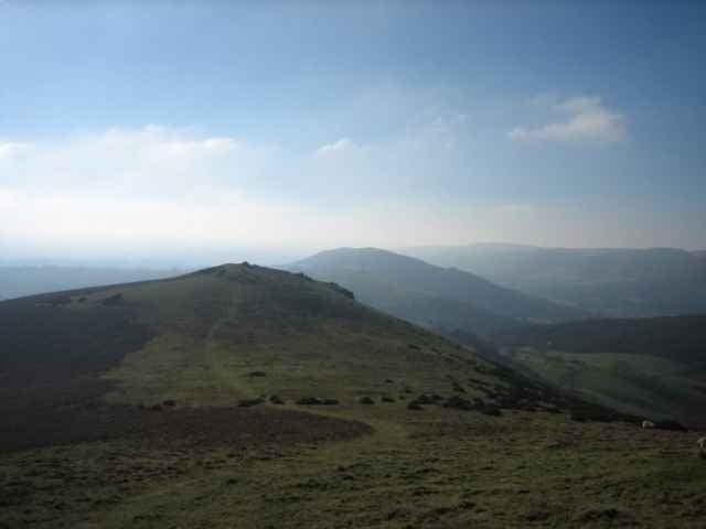
Caer Caradoc is a rounded hill sitting to the east of Church Stretton. It offers great views of the Long Mynd and the surrounding countryside all the way to Birmingham (on a clear day).
There are few trees and the wind can be strong so it's wise to bring something warm to wear.
This walk started in Church Stretton where there are shops and includes Caer Caradoc and Hope Bowder Hill, as well as Ragleth Hill. The last can be omitted easily to save time.
There are few trees and the wind can be strong so it's wise to bring something warm to wear.
This walk started in Church Stretton where there are shops and includes Caer Caradoc and Hope Bowder Hill, as well as Ragleth Hill. The last can be omitted easily to save time.
Further information at
http://www.walkingbritain.co.uk/walks/walks7/w321.shtmlGalería de rutas
Mapa de la ruta y perfil de altitud
Minimum height 178 m
Maximum height 469 m
More about the tour author

|
zangezur |
Comentarios

Start in the centre of Church Stretton, and head along Essex Road until you find a path leading off to the right, crossing the train track. Cross over the A49 and then straight ahead across a field, small road, and then another field towards Caer Caradoc. See the detailed instructions in the link.
Tracks GPS
Puntos del track-
GPX / Garmin Map Source (gpx) download
-
TCX / Garmin Training Center® (tcx) download
-
CRS / Garmin Training Center® (crs) download
-
Google Earth (kml) download
-
G7ToWin (g7t) download
-
TTQV (trk) download
-
Overlay (ovl) download
-
Fugawi (txt) download
-
Kompass (DAV) Track (tk) download
-
Hoja de ruta (pdf) download
-
Original file of the author (gpx) download
More about the tour author
|
|
zangezur |
Add to my favorites
Remove from my favorites
Edit tags
Open track
Mi valoración
Rate