

This walk was based on two walks I found in a book of walks in the Bergen region (see Trailhead information).
Arna is a small town, situated at the end of an arm of Sørfjorden, and is the first stop on the Bergen - Oslo railway line. The station is sandwiched between two tunnels, as the railway line passes through the hillside.
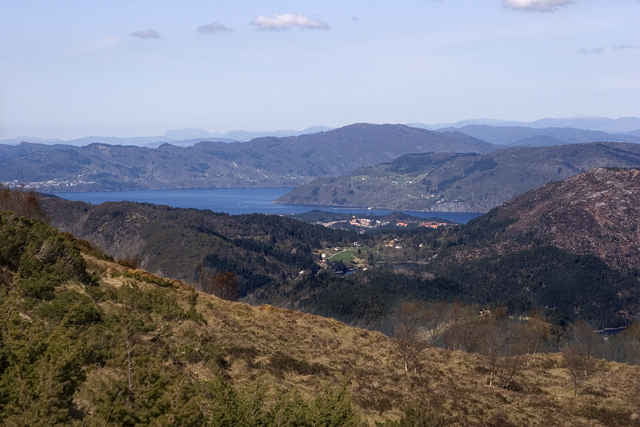
The walk takes you over the hills with views to Arna, Bergen and Jordal along the way. The walk ends at Mount Fløyen from where you can either walk down into the town, or take the funicular railway.
The walk begins along the roadside - follow the road up the hillside through Mjeldheim. The road wriggles a bit, and eventually opens out into fields. Take a right turn onto Kvamsdalen (WP1), marked for Gaupås and follow the road until you reach the information board and the pathway marked for Vikingshytten and Norhytta (WP2). Follow the path up the hillside. Once you reach WP3, there is no further path and you need to watch out for signs and cairns marking the way. It is easy at this point to get confused. The route climbs through a small wood, and once I emerged at the top I didn't find any route markers for some way. Keep climbing until you reach the summit (bear left out of the woods) and you should eventually find some route markers. This area onwards became very wet and sometime slipperly on the slopes.
Once you climb up onto the ridge, you should have a view of Norhytta down below you, and Vikinghytten on the neighbouring ridge. Cross the valley to the opposite ridge (again, I lost the route markers here, and took a bit of a longer route across) and then continue along the ridge to Vikinghytten. At Vikinghytten there is are toilet facilities and also refreshments (between 10.30 and 14.30 Sundays, if I correctly translated the Norwegian). There is no running water.
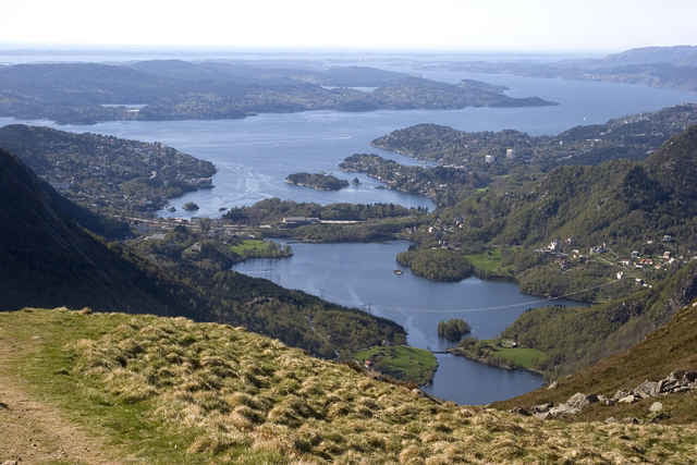
From Vikinghytten, follow the route markers that lead SW from from the hut. Follow the cairns marking the way. At a certain point you will see a lake below you and some marked trails. From this point on, I saw many other hikers (most, I think, following the Ulriken-Fløyen route). Once you reach the trail, follow the signs for Fløyen.
Arna is a small town, situated at the end of an arm of Sørfjorden, and is the first stop on the Bergen - Oslo railway line. The station is sandwiched between two tunnels, as the railway line passes through the hillside.
The walk takes you over the hills with views to Arna, Bergen and Jordal along the way. The walk ends at Mount Fløyen from where you can either walk down into the town, or take the funicular railway.
The walk begins along the roadside - follow the road up the hillside through Mjeldheim. The road wriggles a bit, and eventually opens out into fields. Take a right turn onto Kvamsdalen (WP1), marked for Gaupås and follow the road until you reach the information board and the pathway marked for Vikingshytten and Norhytta (WP2). Follow the path up the hillside. Once you reach WP3, there is no further path and you need to watch out for signs and cairns marking the way. It is easy at this point to get confused. The route climbs through a small wood, and once I emerged at the top I didn't find any route markers for some way. Keep climbing until you reach the summit (bear left out of the woods) and you should eventually find some route markers. This area onwards became very wet and sometime slipperly on the slopes.
Once you climb up onto the ridge, you should have a view of Norhytta down below you, and Vikinghytten on the neighbouring ridge. Cross the valley to the opposite ridge (again, I lost the route markers here, and took a bit of a longer route across) and then continue along the ridge to Vikinghytten. At Vikinghytten there is are toilet facilities and also refreshments (between 10.30 and 14.30 Sundays, if I correctly translated the Norwegian). There is no running water.
From Vikinghytten, follow the route markers that lead SW from from the hut. Follow the cairns marking the way. At a certain point you will see a lake below you and some marked trails. From this point on, I saw many other hikers (most, I think, following the Ulriken-Fløyen route). Once you reach the trail, follow the signs for Fløyen.
Galería de rutas
Mapa de la ruta y perfil de altitud
Minimum height -50 m
Maximum height 625 m
More about the tour author

|
Comentarios

More about the tour author
|
|
Añadir a mis favoritos
Eliminar de mis favoritos
Edit tags
Open track
Mi valoración
Rate