


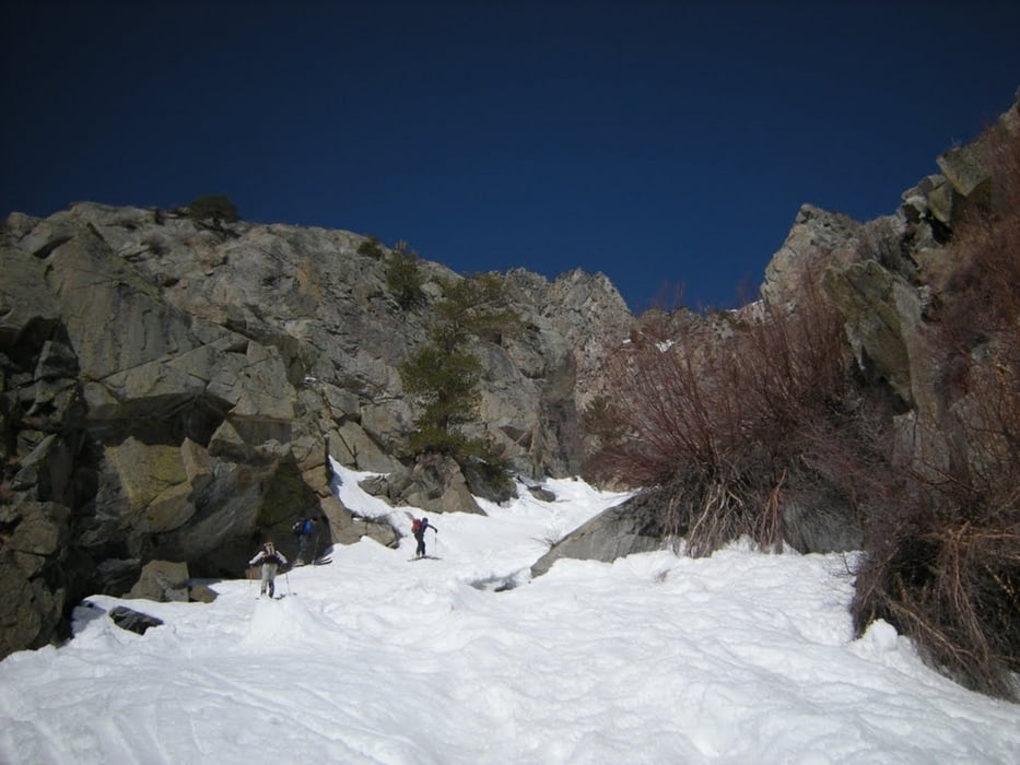
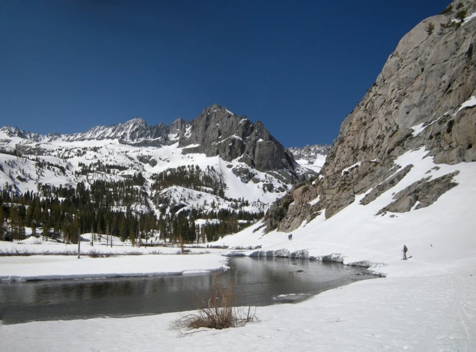
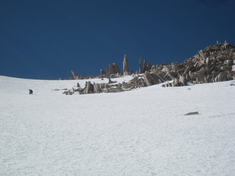
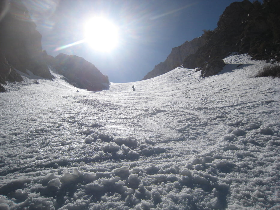
Von der glacier lodge dem Tal folgen und durch eine steile Engstelle am Bach entlang zum Willow lake. Nach der Engstelle schlechter Satellitenempfang, daher falsche Höhenangabe im Track. Die Tour steigt kontinuierlich an. Über weite Böden weiter Richtung contact Pass. Am Anstieg zum Sattel die Flanke rechts hinauf bis zum letzten Schneezipfel. wir trugen die Skier nun zuerst über den Blockgrat, später etwas rechts davon bis zum Gipfel. Vermutlich wäre es einfacher gewesen am Ende der Schneerinne rechts hinauszuqueren (wie auch angetestet, siehe track) und dann durch eine etas rechts gelegene Rinne über Schnee bis zum Zusammentreffen mit unserem Aufstieg zu gehen. Über den Grat weiter und dann die offenen Flanke rechts hinunter Richtung Willow lake. Auf dem Sattel oberhalb des Willow lakes nicht die Rinne zum Willow lake (Aufstieg) hinunter, sondern links halten (nicht zu weit rechts hinunterfahren, das Gelände bricht dort ab) zu einer Rinne die direkt in den offenen Talboden unterhalb der Engstelle des Aufstiegs hinunterzieht.
Galería de rutas
Mapa de la ruta y perfil de altitud
Minimum height 2379 m
Maximum height 3927 m
More about the tour author

|
Gi |
Comentarios

Von der US395 in Big Bine auf die W Crocker Road abbiegen. Diese wird zur Glacier Lodge Road der man entlang dem S. Fork Big Pine Creek bis zur Glacier Lodge folgt.
Tracks GPS
Puntos del track-
GPX / Garmin Map Source (gpx) download
-
TCX / Garmin Training Center® (tcx) download
-
CRS / Garmin Training Center® (crs) download
-
Google Earth (kml) download
-
G7ToWin (g7t) download
-
TTQV (trk) download
-
Overlay (ovl) download
-
Fugawi (txt) download
-
Kompass (DAV) Track (tk) download
-
Hoja de ruta (pdf) download
-
Original file of the author (gpx) download
More about the tour author
|
|
Gi |
Add to my favorites
Remove from my favorites
Edit tags
Open track
Mi valoración
Rate