Login

Olvidaste tu contraseña?

Las cookies tienen que estar habilitadas!
Las cookies no están habilitadas en tu navegador. Por favor, modifica la configuración antes de continuar.

Not a member yet?

Register now
Login

Available for registred users only

Log in to use this feature.

Olvidaste tu contraseña?

Las cookies tienen que estar habilitadas!
Las cookies no están habilitadas en tu navegador. Por favor, modifica la configuración antes de continuar.

Not a member yet?

Register now
Filtro
Categorías
Advanced filters
  • Distancia (km)
  • Altitud en metros
Guardar filtro Reset filter

TrackRank

QRCode

Technical data

Distancia1.304,1 km Altitud en metros3490 m Descenso4105 m Duración5 días 0 h Fecha22.01.2012
Valoraciones Autor Paisaje Diversión Condición Técnica

Estadística

507 Visitas Valoraciones 27 Descargas Promedio
Rate
  • Hoja de ruta
  • Punto de partida
  • Descargas

Die gesamte Beschreibung schildert eine 4-wöchige Rundreise durch NAMIBIA, BOTSWANA und den Victoriafällen in ZIMBABWE wobei folgende Hauptatraktionen besucht wurden:

Windhoek, Erongo, Etosha, Caprivi, Chobe, Victoria Falls, Kalahari, Okavango Delta, Naukluftgebirge, Sossusvlei, Walvis Bay und Swakopmund

Insgesamt besteht die Beschreibung aus 4 Teilen.

Fahrzeug: Toyota Hilux

Alle in den Beschreibungen angeführten Unterkünfte sind für abenteuerlustige Individualtouristen zu empfehlen (in Botswana sind Lodges nicht eingezäunt).


Teil 1:
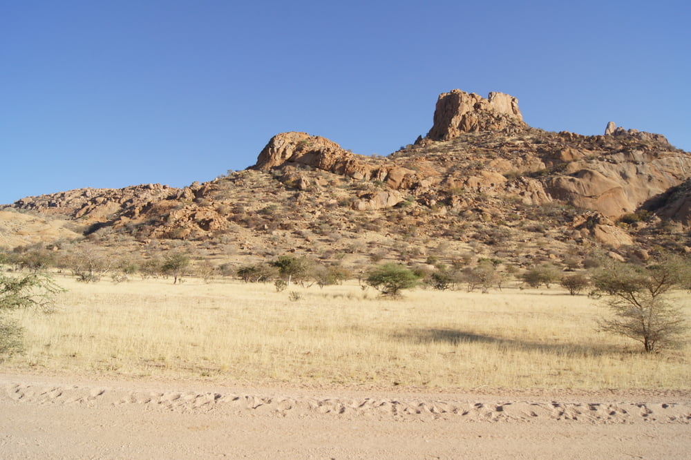
Tag 1: Von Windhoek führt die Reise auf der asphaltierten B1 bis Okahandja und dann weiter auf der B2 bis Usakos. Dort zweigt die Schotterstraße zum ersten Ziel, der Omandumba Farm im Erongogebirge, ab.


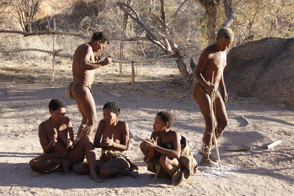
Tag 2: Ausflüge auf der Farm zu Felsmalereien und einem San-Dorf


Tag 3: Weiterfahrt vorwiegend auf Schotterstraßen durchs Erongogebirge zur Otjitotongwe - Cheetah Guest Farm


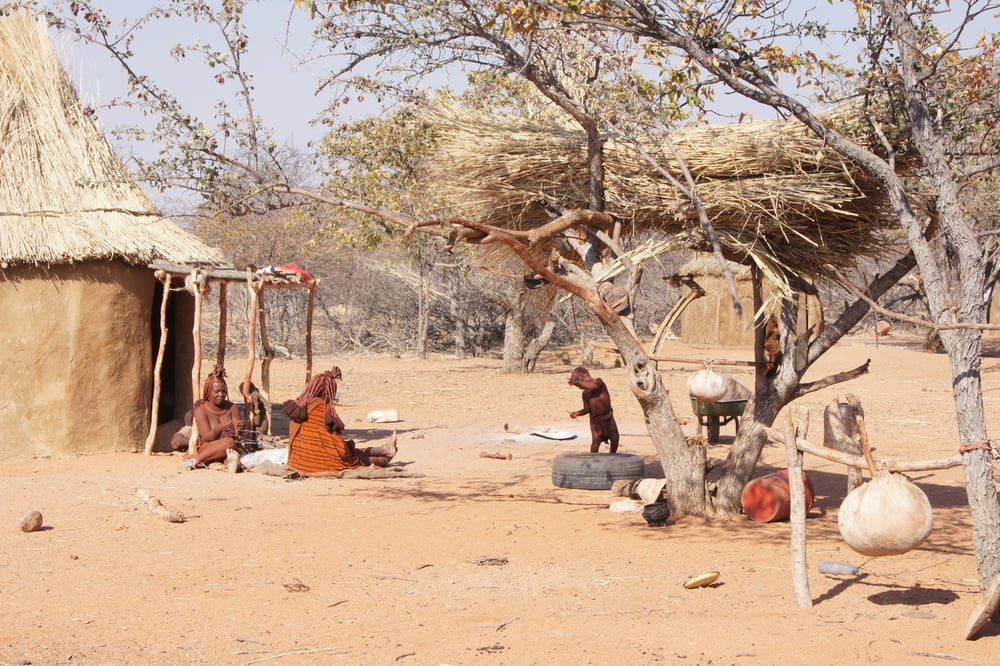
Tag 4: Nach einem morgendlichen Besuch in einem Himbadorf geht es zur Okaukuejo Lodge im Etosha Nationalpark, wo noch Zeit für eine Pirschfahrt bleibt.


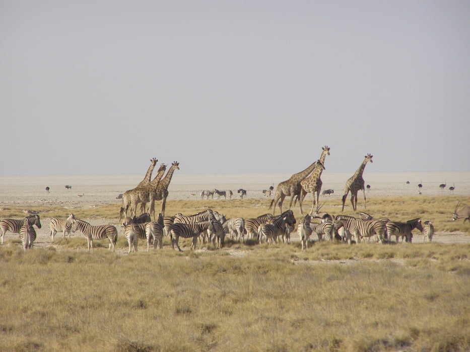
Tag 5: Pirschfahrt im Etosha Nationalpark
 

Galería de rutas

Mapa de la ruta y perfil de altitud

  • Open Street Map
  • Google
Minimum height 619 m Maximum height 1717 m Vista detallada

More about the tour author

erwin417
Member since 2009

Send private message

Comentarios

Ausgangspunkt der Reise ist Windhoek.

Tracks GPS

Puntos del track
  • GPX / Garmin Map Source (gpx) download
  • TCX / Garmin Training Center® (tcx) download
  • CRS / Garmin Training Center® (crs) download
  • Google Earth (kml) download
  • G7ToWin (g7t) download
  • TTQV (trk) download
  • Overlay (ovl) download
  • Fugawi (txt) download
  • Kompass (DAV) Track (tk) download
  • Hoja de ruta (pdf) download
  • Original file of the author (gpx) download

More about the tour author

erwin417
Member since 2009

Send private message
Share track
Add to my favorites
Remove from my favorites
Edit tags
Mi valoración
Rate
Ruta: Namibia-Botswana-Zimbabwe (August 2010)-Teil 1
Tipo: Rutas de esquí
Distancia: 1.304,1 km
valorizado al:
Duración:
Day(s)
Hour(s)
Minute(s)
Valoración: Paisaje Diversión Condición Técnica