



We did this walk at the end of October when the leaves were on the turn. We chose this hike for the views over the high Taunus but there is also a good mix of woodland walking too. Plenty of good panaramas but not so many that you get overload.
Just before Niedergladbach the path follows a stream where we saw loads of evidence of wild boar mudbaths. Sadly didn't see one of these very shy (but fierce!) creatures.
As with all my routes, the Garmin plot is eratic because the etrex does not like the combination of hills and trees too much, so I have provided routes I have corrected by overlaying the track on Magicmaps Hessen 3D.
Applicable map: WM Rheingau Rad- und Wanderkarte 1:40000
Just before Niedergladbach the path follows a stream where we saw loads of evidence of wild boar mudbaths. Sadly didn't see one of these very shy (but fierce!) creatures.
As with all my routes, the Garmin plot is eratic because the etrex does not like the combination of hills and trees too much, so I have provided routes I have corrected by overlaying the track on Magicmaps Hessen 3D.
Applicable map: WM Rheingau Rad- und Wanderkarte 1:40000
Galerie du tour
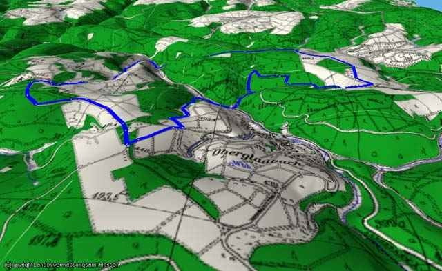
Carte du tour et altitude
Minimum height 219 m
Maximum height 470 m
More about the tour author

|
gpfx |
Commentaires

Rainer Jung
on 05.02.2008
Schöne Rundtour, ca. 12 km lang.
More about the tour author
|
|
gpfx |
Add to my favorites
Remove from my favorites
Edit tags
Open track


My score
Rate