Login

Login oublié ?

Cookies have to be accepted!
Your browser's cookie functionality is disabled. Please enable this functionality.

Not a member yet?

Register now
Login

Available for registred users only

Log in to use this feature.

Login oublié ?

Cookies have to be accepted!
Your browser's cookie functionality is disabled. Please enable this functionality.

Not a member yet?

Register now
Filter
Catégories
Advanced filters
  • Longueur (km)
  • Altimètre
Enregistrer le filtre Reset filter

TrackRank

QRCode

Technical data

Longueur16,3 km Altimètre163 m Way down163 m Durée00:00 h:m Date10.12.2018
Evaluations Author Paysage Aspect amusement Condition Technique

Statistiques

407 Vues Evaluations 44 Téléchargements Moyenne
Rate
  • Feuille de tours
  • Arrivée
  • Téléchargements
Durchqueren Sie mehrere Venngebiete 16,00 Km

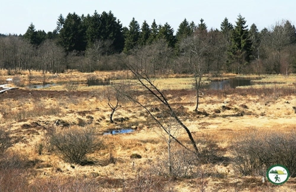
Westlich von Mützenich liegt links und rechts der N67 (Mützenich – Eupen) ein ausgedehntes Venn-Gebiet: Brackvenn, Nahtsief, Königliches Torfmoor, Im Platten Venn, Imgenbroicher Venn und einige mehr bilden eine landschaftliche Einheit.

Unsere Tour (16 km, 130 hm) verbindet mehrere von ihnen: Im Platten Venn, Brackvenn, Imgenbroicher Venn, Steinley und Nahtsief. Durch die einzelnen Gebiete führen schmale Stege und Pfade (7 km), verbunden sind sie durch Wald- und Wiesenwege (6 km) sowie durch Schotterwege und einen Abschnitt mit Asphalt; das lässt sich auf ausgedehnten Wanderungen im Venn kaum vermeiden!

Wegeverlauf: Parkplatz Nahtsief – Im Platten Venn – Grenzweg – Brackvenn – Kaiser-Karls-Bettstatt – Steling – Schennskul – Imgenbroicher Venn – Steinley – Hahnestreck – Rotenbüchel – Verbrannte Brücke - Nahtsief*)

Further information at

http://der-eifelyeti.de/2018/12/09/das-venn-bei-muetzenich/

Carte du tour et altitude

  • Open Street Map
  • Google
Minimum height 531 m Maximum height 662 m Vue de détail

More about the tour author

Eifelyeti
Member since 2008

Send private message

Commentaires

Tracks GPS

Trackpoints
  • GPX / Garmin Map Source (gpx) download
  • TCX / Garmin Training Center® (tcx) download
  • CRS / Garmin Training Center® (crs) download
  • Google Earth (kml) download
  • G7ToWin (g7t) download
  • TTQV (trk) download
  • Overlay (ovl) download
  • Fugawi (txt) download
  • Kompass (DAV) Track (tk) download
  • Feuille de tours (pdf) download
  • Original file of the author (gpx) download

More about the tour author

Eifelyeti
Member since 2008

Send private message
Share track
Add to my favorites
Remove from my favorites
Edit tags
My score
Rate
Tour: Das Venn bei Mützenich
Cat.: Randonnées
Longueur: 16,3 km
Evaluated on:
Durée:
Day(s)
Hour(s)
Minute(s)
Evaluation: Paysage Aspect amusement Condition Technique