Login

Login oublié ?

Cookies have to be accepted!
Your browser's cookie functionality is disabled. Please enable this functionality.

Not a member yet?

Register now
Login

Available for registred users only

Log in to use this feature.

Login oublié ?

Cookies have to be accepted!
Your browser's cookie functionality is disabled. Please enable this functionality.

Not a member yet?

Register now
Filter
Catégories
Advanced filters
  • Longueur (km)
  • Altimètre
Enregistrer le filtre Reset filter

TrackRank

QRCode

Technical data

Longueur12,0 km Altimètre0 m Way down0 m Durée04:00 h:m Date13.05.2019
Evaluations Author Paysage Aspect amusement Condition Technique

Statistiques

527 Vues Evaluations 29 Téléchargements Moyenne
Rate
  • Feuille de tours
  • Arrivée
  • Téléchargements
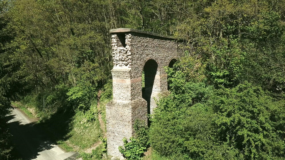
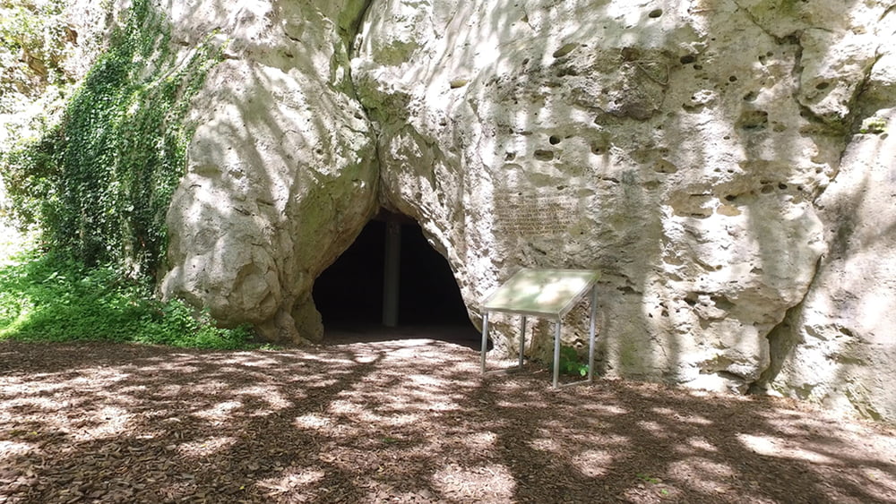
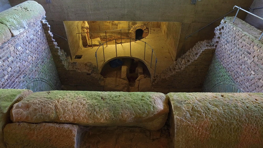
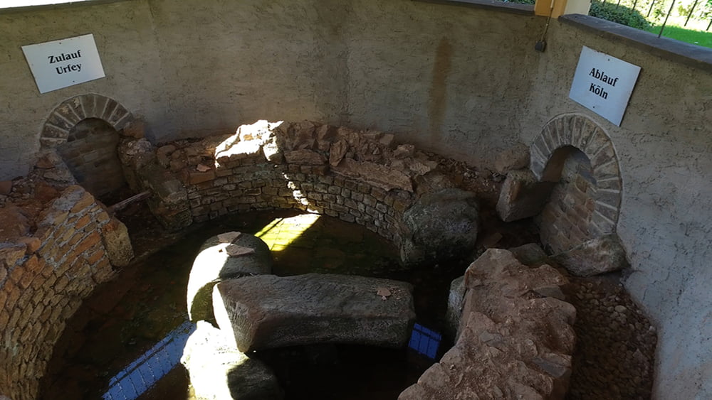
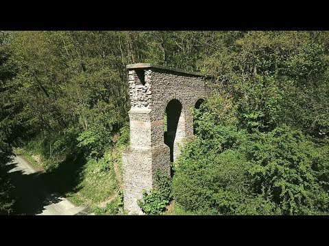
Von der römischen Aquädukt-Brücke wandert man anfangs über die aussichtsreichen Höhen der Nordeifel. Es folgt eine Zeitreise am Kartstein mit der Kakushöhle vom Neandertaler bis heute und läuft dann an Kreuzen und der Pfarrkirche St. Cyrianus in Weyer vorbei hinab ins Tal. Zum Schluss folgt man dem Römerkanal-Wanderweg mit seinen Baudenkmälern zurück zum Ausgangspunkt.

Galerie du tour

Carte du tour et altitude

  • Open Street Map
  • Google
Minimum height 99999 m Maximum height -99999 m Vue de détail

More about the tour author

schleidy
Member since 2013

Send private message

Commentaires

Tracks GPS

Trackpoints
  • GPX / Garmin Map Source (gpx) download
  • TCX / Garmin Training Center® (tcx) download
  • CRS / Garmin Training Center® (crs) download
  • Google Earth (kml) download
  • G7ToWin (g7t) download
  • TTQV (trk) download
  • Overlay (ovl) download
  • Fugawi (txt) download
  • Kompass (DAV) Track (tk) download
  • Feuille de tours (pdf) download
  • Original file of the author (gpx) download

More about the tour author

schleidy
Member since 2013

Send private message
Share track
Add to my favorites
Remove from my favorites
Edit tags
My score
Rate
Tour: Über die Höhen von Mechernich -Wasser für Köln
Cat.: Randonnées
Longueur: 12,0 km
Evaluated on:
Durée:
Day(s)
Hour(s)
Minute(s)
Evaluation: Paysage Aspect amusement Condition Technique