Login

Login oublié ?

Cookies have to be accepted!
Your browser's cookie functionality is disabled. Please enable this functionality.

Not a member yet?

Register now
Login

Available for registred users only

Log in to use this feature.

Login oublié ?

Cookies have to be accepted!
Your browser's cookie functionality is disabled. Please enable this functionality.

Not a member yet?

Register now
Filter
Catégories
Advanced filters
  • Longueur (km)
  • Altimètre
Enregistrer le filtre Reset filter

TrackRank

QRCode

Technical data

Longueur2,5 km Altimètre55 m Way down56 m Durée00:00 h:m Date13.12.2020
Evaluations Author Paysage Aspect amusement Condition Technique

Statistiques

83 Vues Evaluations 2 Téléchargements Moyenne
Rate
  • Feuille de tours
  • Arrivée
  • Téléchargements
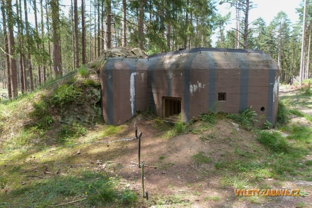
Pěší okruh po naučné stezce československého opevnění u Slavonic, v oblasti jižní Čechy - Česká Kanada.

Further information at

https://www.vylety-zabava.cz/tipy-na-vylet/jizni-cechy/13115-naucna-stezka-ceskoslovenskeho-opevneni

Carte du tour et altitude

  • Open Street Map
  • Google
Minimum height 566 m Maximum height 600 m Vue de détail

More about the tour author

vasatkoj
Member since 2014

Send private message

Commentaires

Tracks GPS

Trackpoints
  • GPX / Garmin Map Source (gpx) download
  • TCX / Garmin Training Center® (tcx) download
  • CRS / Garmin Training Center® (crs) download
  • Google Earth (kml) download
  • G7ToWin (g7t) download
  • TTQV (trk) download
  • Overlay (ovl) download
  • Fugawi (txt) download
  • Kompass (DAV) Track (tk) download
  • Feuille de tours (pdf) download
  • Original file of the author (gpx) download

More about the tour author

vasatkoj
Member since 2014

Send private message
Share track
Add to my favorites
Remove from my favorites
Edit tags
My score
Rate
Tour: Naučná stezka československého opevnění u Slavonic
Cat.: Randonnées
Longueur: 2,5 km
Evaluated on:
Durée:
Day(s)
Hour(s)
Minute(s)
Evaluation: Paysage Aspect amusement Condition Technique