Login

Login oublié ?

Cookies have to be accepted!
Your browser's cookie functionality is disabled. Please enable this functionality.

Not a member yet?

Register now
Login

Available for registred users only

Log in to use this feature.

Login oublié ?

Cookies have to be accepted!
Your browser's cookie functionality is disabled. Please enable this functionality.

Not a member yet?

Register now
Filter
Catégories
Advanced filters
  • Longueur (km)
  • Altimètre
Enregistrer le filtre Reset filter

TrackRank

QRCode

Technical data

Longueur8,6 km Altimètre554 m Way down68 m Durée02:40 h:m Date19.08.2023
Evaluations Author Paysage Aspect amusement Condition Technique

Statistiques

213 Vues Evaluations 0 Téléchargements Moyenne
Rate
  • Feuille de tours
  • Arrivée
  • Téléchargements
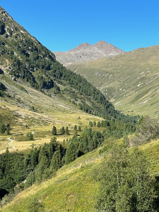
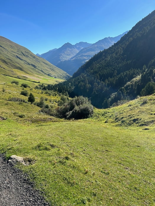
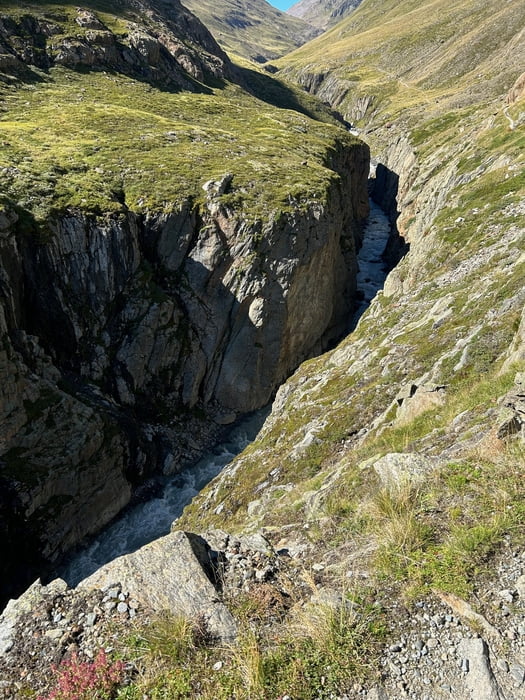
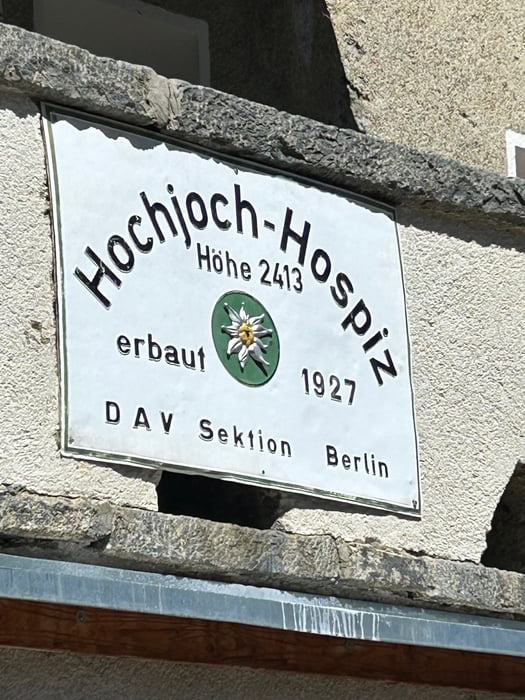
Einfache Wanderung die ich dieses Mal über die Asphaltsdstrecke Richtung Roten begonnen habe (Parallelstrecke links vom Bach ist deutlich schöner, da man auch die Hängebrücke mitnimmt). Wollte halt dieses mal die andere Route nehmen. Nach etwa 2km treffen die Strecken wieder aufeinander und dann geht es langsam und stetig zur Hütte Hochjoch Hospiz. Dort sieht man auch bereits die Abzweigung zum saykogel die ich am folg. Tag vorgenommen habe. Die Tour zum Hochjoch Hospiz hat keinerlei besondere Schwierigkeiten/Anforderungen, ist allerdings landschaftlich sehr schön.

Galerie du tour

Carte du tour et altitude

  • Open Street Map
  • Google
Minimum height 1920 m Maximum height 2406 m Vue de détail

More about the tour author

revvot
Member since 2017

Send private message

Commentaires

Tracks GPS

Trackpoints
  • GPX / Garmin Map Source (gpx) download
  • TCX / Garmin Training Center® (tcx) download
  • CRS / Garmin Training Center® (crs) download
  • Google Earth (kml) download
  • G7ToWin (g7t) download
  • TTQV (trk) download
  • Overlay (ovl) download
  • Fugawi (txt) download
  • Kompass (DAV) Track (tk) download
  • Feuille de tours (pdf) download
  • Original file of the author (gpx) download

More about the tour author

revvot
Member since 2017

Send private message
Share track
Add to my favorites
Remove from my favorites
Edit tags
My score
Rate
Tour: Vent - Hochjoch Hospiz
Cat.: Randonnées
Longueur: 8,6 km
Evaluated on:
Durée:
Day(s)
Hour(s)
Minute(s)
Evaluation: Paysage Aspect amusement Condition Technique