Login

Login oublié ?

Cookies have to be accepted!
Your browser's cookie functionality is disabled. Please enable this functionality.

Not a member yet?

Register now
Login

Available for registred users only

Log in to use this feature.

Login oublié ?

Cookies have to be accepted!
Your browser's cookie functionality is disabled. Please enable this functionality.

Not a member yet?

Register now
Filter
Catégories
Advanced filters
  • Longueur (km)
  • Altimètre
Enregistrer le filtre Reset filter

TrackRank

QRCode

Technical data

Longueur36,2 km Altimètre579 m Way down579 m Durée02:30 h:m Date24.07.2003
Evaluations Author Paysage Aspect amusement Condition Technique

Statistiques

4887 Vues Evaluations 725 Téléchargements Moyenne
Rate
  • Feuille de tours
  • Arrivée
  • Téléchargements
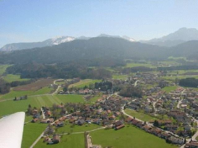
Eine kleine Runde durch das Samerberg Hochtal hinunter zum Inn und über einen Uphill zurück ins Hochtal. In den Wiesen des Hochtals gibt es ein paar schöne Singletrails, von denen einige in die Tour eingebaut sind.

Galerie du tour

Carte du tour et altitude

  • Open Street Map
  • Google
Minimum height 445 m Maximum height 807 m Vue de détail

More about the tour author

AndreasPahl

Commentaires

Autobahn A8 München-Salzburg, Ausfahrt 104 Achenmühle, weiter nach Achenmühle, dort rechts abbiegen Richtung Törwang, nach wenigen Kilometern links Richtung Grainbach. In Grainbach nicht der Rechtskehre folgen, sondern geradeaus Richtung Schöffau. Der Strasse immer geradeaus folgen und am Spatenauparkplatz parken.

Alternativer Startort : Am Inn : Neubeuern oder Nussdorf (Ich hab im Hochtal gewohnt, deshalb bin ich von dort gestartet)

Tracks GPS

Trackpoints
  • GPX / Garmin Map Source (gpx) download
  • TCX / Garmin Training Center® (tcx) download
  • CRS / Garmin Training Center® (crs) download
  • Google Earth (kml) download
  • G7ToWin (g7t) download
  • TTQV (trk) download
  • Overlay (ovl) download
  • Fugawi (txt) download
  • Kompass (DAV) Track (tk) download
  • Feuille de tours (pdf) download
  • Original file of the author (g7t) download

More about the tour author

AndreasPahl

Share track
Add to my favorites
Remove from my favorites
Edit tags
My score
Rate
Tour: Rund um den Samerberg
Cat.: Mountainbike
Longueur: 36,2 km
Evaluated on:
Durée:
Day(s)
Hour(s)
Minute(s)
Evaluation: Paysage Aspect amusement Condition Technique