

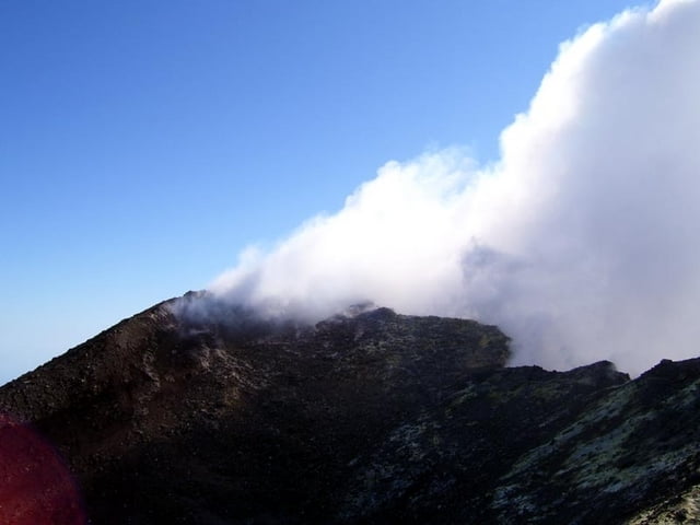

Ascent from the Rif.Sapienza(1900m) (actual a hotel - 50€/night&person - 10% discount für members of Alpine Clubs) to one of the summit-craters(3250m). Because of the at that time existing south wind, we chose the accordant crater. In case of north wind just climb the first crater. Spectacluar view into the crater, but also to Sicilia. You are 3000m above the surrounding landscape!
On the way back we climbed to other craters. The gps-track ends where the ascent and decent tracks merge.
To see the sunrise it is better to go from Etna-Nord.(see my gps-track there)
The Etna is dangerous! Thunderstorm! Storm! Fog! Please pay attention to the safety-warnings f.e. www.vulkan-etna-update.de(in German). Take warm and windproof clothing, cap, glasses(against the sandy wind), water.
Attention CHEAT: The ascent by cable-car and bus to the Torre del Filosofo on about 2800m for 50€ (!) isn't worth while. You don't see more as at Rif.Sapienza. You just save almost 900 altidude-meters to the summit.
----------------------------------------------------------------------------------------------------------------------------------
DEUTSCH: Aufstieg vom Rifugio Sapienza (eigentlich ein Hotel - 50€/Nacht/Nase - 10% Rabatt für AV-Mitglieder/ ) zu einem der Gipfelkrater. Wegen des damals herrschenden Südwindes haben wir den entsprechenden Krater ausgewählt. Bei Nordwind kann man gleich dem ersten Krater besteigen. Großartige Sicht in die Krater, aber auch über Sizilien. Man ist 3000m über der umgebenden Landschaft!
Am Rückweg haben wir noch 2 weitere Krater bestiegen. Der Gps-Track endet dort, wo sich Abstieg und Aufstieg vereinen.
Den Sonnenaufgang beobachtet man besser von Etna-Nord! (->mein gps-track)
Der Weg ist leicht , aber der Etna ist gefährlich! Gewitter! Sturm! Nebel! Bitte die Sicherheitshinweise unter www.vulkan-etna-update.de beachten. Warme, winddichte Kleidung, Mütze, Brille (gegen den sandigen Wind) und Wasser mitnehmen.
Achtung BESCHISS: Die Auffahrt mit Seilbahn und Bus zum Torre Filosofo auf ca. 2800m lohnt nicht! Kostet 50€ und man sieht dort oben auch nicht mehr als am Rif.Sapienza. Spart Euch das Geld! Man spart natürlich fast 900 Höhenmeter im Aufstieg!
Further information at
http://www.vulkan-etna-update.deGalerie du tour



Carte du tour et altitude
Minimum height 1908 m
Maximum height 3246 m
More about the tour author
|
|
hans-lauber |
Commentaires

More about the tour author
|
|
hans-lauber |
Add to my favorites
Remove from my favorites
Edit tags
Open track


My score
Rate