Login

Login oublié ?

Cookies have to be accepted!
Your browser's cookie functionality is disabled. Please enable this functionality.

Not a member yet?

Register now
Login

Available for registred users only

Log in to use this feature.

Login oublié ?

Cookies have to be accepted!
Your browser's cookie functionality is disabled. Please enable this functionality.

Not a member yet?

Register now
Filter
Catégories
Advanced filters
  • Longueur (km)
  • Altimètre
Enregistrer le filtre Reset filter

TrackRank

QRCode

Technical data

Longueur8,9 km Altimètre344 m Way down346 m Durée00:00 h:m Date23.04.2010
Evaluations Author Paysage Aspect amusement Condition Technique

Statistiques

1379 Vues 3 Evaluations 166 Téléchargements 3.67 Moyenne
Rate
  • Feuille de tours
  • Arrivée
  • Téléchargements

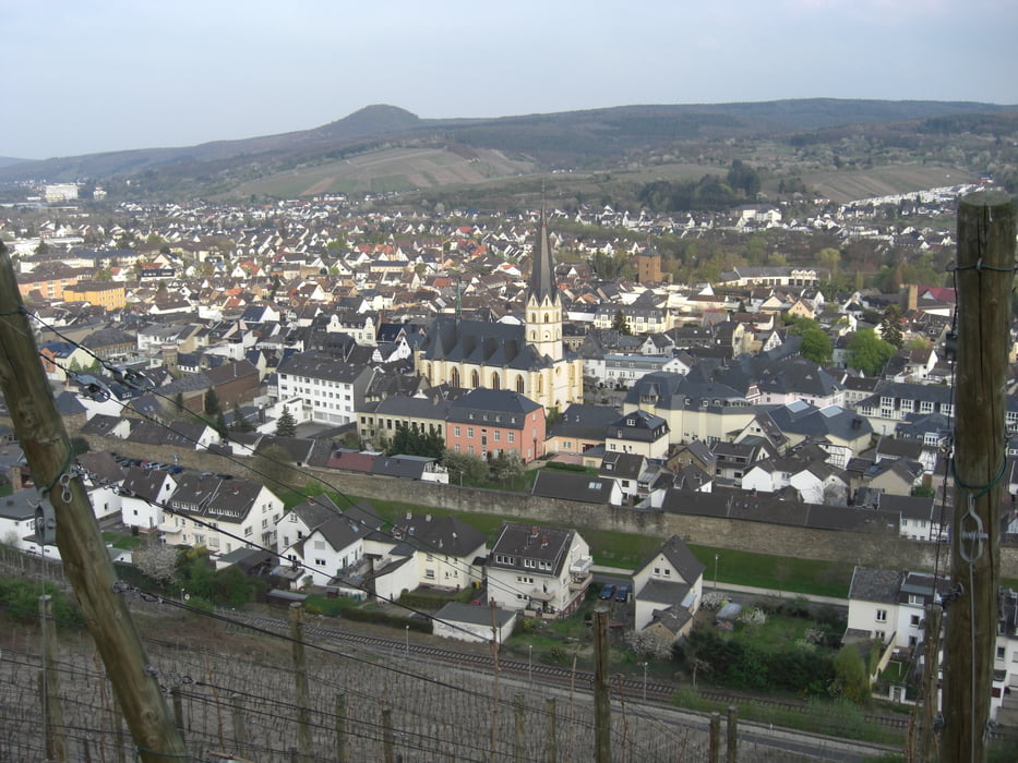
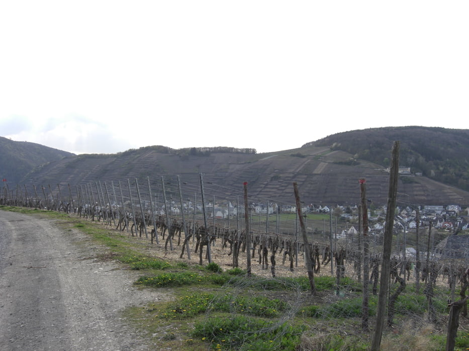
Netter Rundweg von Ahrweiler aus über den EVA-Turm rüber zum Nachbarort Marienthal. Auf dem Rückweg wird das Dokumentationszentrum zum ehemaligen Bundenbunker gekreuzt.

Der Weg führt über Waldwege und dem Rotwenwanderweg. Herrliche Ausblicke ins Ahrtal garantiert.


Galerie du tour

Carte du tour et altitude

  • Open Street Map
  • Google
Minimum height 98 m Maximum height 319 m Vue de détail

More about the tour author

Schlumpf01
Member since 2009

Send private message

Commentaires

BertAusten on 10.03.2014

tolle wanderung

Sontag die tour gelaufen, tolle wanderung

mein dank

Gruss
Bert

Start ist in Ahrweiler - Bahnhof Ahrweiler-Markt - an den Weinbergen. Der Kletterseilgarten ist in unmittelbarer Nähe.

Tracks GPS

Trackpoints
  • GPX / Garmin Map Source (gpx) download
  • TCX / Garmin Training Center® (tcx) download
  • CRS / Garmin Training Center® (crs) download
  • Google Earth (kml) download
  • G7ToWin (g7t) download
  • TTQV (trk) download
  • Overlay (ovl) download
  • Fugawi (txt) download
  • Kompass (DAV) Track (tk) download
  • Feuille de tours (pdf) download
  • Original file of the author (gpx) download

More about the tour author

Schlumpf01
Member since 2009

Send private message
Share track
Add to my favorites
Remove from my favorites
Edit tags
My score
Rate
Tour: Auf zum EVA-Turm
Cat.: Randonnées
Longueur: 8,9 km
Evaluated on:
Durée:
Day(s)
Hour(s)
Minute(s)
Evaluation: Paysage Aspect amusement Condition Technique