Login

Login oublié ?

Cookies have to be accepted!
Your browser's cookie functionality is disabled. Please enable this functionality.

Not a member yet?

Register now
Login

Available for registred users only

Log in to use this feature.

Login oublié ?

Cookies have to be accepted!
Your browser's cookie functionality is disabled. Please enable this functionality.

Not a member yet?

Register now
Filter
Catégories
Advanced filters
  • Longueur (km)
  • Altimètre
Enregistrer le filtre Reset filter

TrackRank

QRCode

Technical data

Longueur8,8 km Altimètre432 m Way down442 m Durée03:30 h:m Date18.10.2010
Evaluations Author User Paysage Aspect amusement Condition Technique

Statistiques

1181 Vues 1 Evaluation 20 Téléchargements 4.00 Moyenne
Rate
  • Feuille de tours
  • Arrivée
  • Téléchargements

Körtúra Szádelő községből.

Galerie du tour

Carte du tour et altitude

  • Open Street Map
  • Google
Minimum height 250 m Maximum height 636 m Vue de détail

More about the tour author

andrew85
Member since 2008

Send private message

Commentaires

Rum2014 on 28.07.2020

Leichte Tour, schönes Tal

Das Tal ist tief eingeschnitten, die Tour leicht, aber zu Recht sehr beliebt.
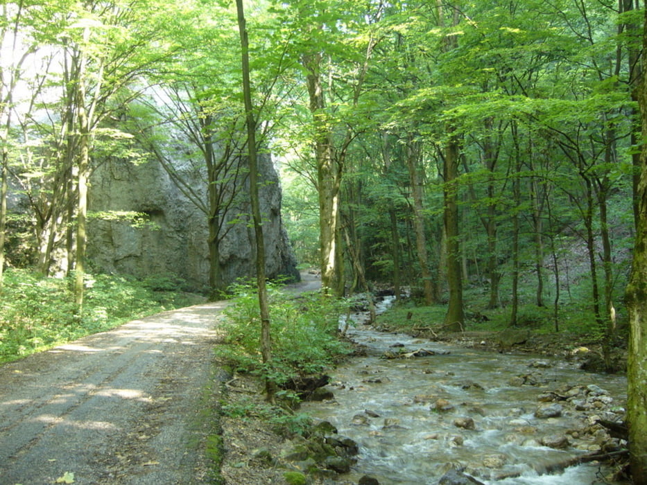
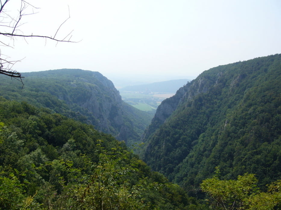
Die Strecke bis zum "Endpunkt" des Tals ist sehr leicht und sogar mit Kinderwagen möglich. Man könnte einfach den selben Weg zum Parkplatz zurück gehen, dann ist das eher ein Spaziergang als eine Wanderung. Oder man geht wie hier gezeigt auf die Höhe, wo man ein paar Ausblicke und mehr schöne Natur hat. Wer mag könnte auch noch weiter nach Norden gehen oder die Tour durch andere Wege, die ausgeschildert sind, verlängern.
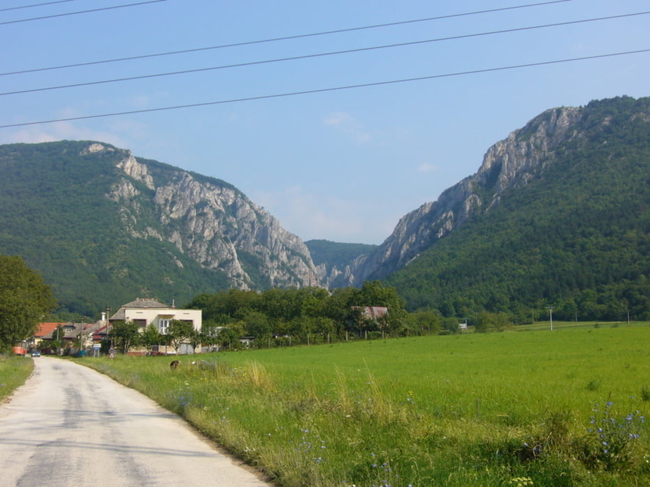
A település autóval vagy busszal érhető el.

Tracks GPS

Trackpoints
  • GPX / Garmin Map Source (gpx) download
  • TCX / Garmin Training Center® (tcx) download
  • CRS / Garmin Training Center® (crs) download
  • Google Earth (kml) download
  • G7ToWin (g7t) download
  • TTQV (trk) download
  • Overlay (ovl) download
  • Fugawi (txt) download
  • Kompass (DAV) Track (tk) download
  • Feuille de tours (pdf) download
  • Original file of the author (gpx) download

More about the tour author

andrew85
Member since 2008

Send private message
Share track
Add to my favorites
Remove from my favorites
Edit tags
My score
Rate
Tour: Szádelői-szurdok / Zadielska dolina
Cat.: Luge
Longueur: 8,8 km
Evaluated on:
Durée:
Day(s)
Hour(s)
Minute(s)
Evaluation: Paysage Aspect amusement Condition Technique