Login

Login oublié ?

Cookies have to be accepted!
Your browser's cookie functionality is disabled. Please enable this functionality.

Not a member yet?

Register now
Login

Available for registred users only

Log in to use this feature.

Login oublié ?

Cookies have to be accepted!
Your browser's cookie functionality is disabled. Please enable this functionality.

Not a member yet?

Register now
Filter
Catégories
Advanced filters
  • Longueur (km)
  • Altimètre
Enregistrer le filtre Reset filter

TrackRank

QRCode

Technical data

Longueur34,5 km Altimètre478 m Way down489 m Durée02:30 h:m Date13.02.2012
Evaluations Author Paysage Aspect amusement Condition Technique

Statistiques

301 Vues Evaluations 3 Téléchargements Moyenne
Rate
  • Feuille de tours
  • Arrivée
  • Téléchargements
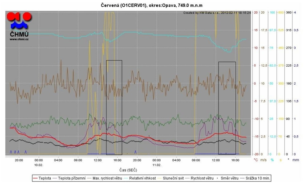
10.2.2012 pátek po práci, azuro + halovy jev, -12°C, wind SV na pohodu, ke konci přidal a stabil, takže jsem se cítil zatím nejjistěji na pokusy o skoky - pár se jich povedlo a všechny s bezpečným přistáním

Galerie du tour

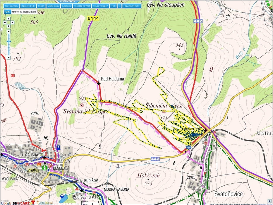
Carte du tour et altitude

  • Open Street Map
  • Google
Minimum height 533 m Maximum height 617 m Vue de détail

More about the tour author

mtbBen
Member since 2011

Send private message

Commentaires

Tracks GPS

Trackpoints
  • GPX / Garmin Map Source (gpx) download
  • TCX / Garmin Training Center® (tcx) download
  • CRS / Garmin Training Center® (crs) download
  • Google Earth (kml) download
  • G7ToWin (g7t) download
  • TTQV (trk) download
  • Overlay (ovl) download
  • Fugawi (txt) download
  • Kompass (DAV) Track (tk) download
  • Feuille de tours (pdf) download
  • Original file of the author (gpx) download

More about the tour author

mtbBen
Member since 2011

Send private message
Share track
Add to my favorites
Remove from my favorites
Edit tags
My score
Rate
Tour: kite freeride Svatoňovice
Cat.: Parapente et deltaplane
Longueur: 34,5 km
Evaluated on:
Durée:
Day(s)
Hour(s)
Minute(s)
Evaluation: Paysage Aspect amusement Condition Technique