


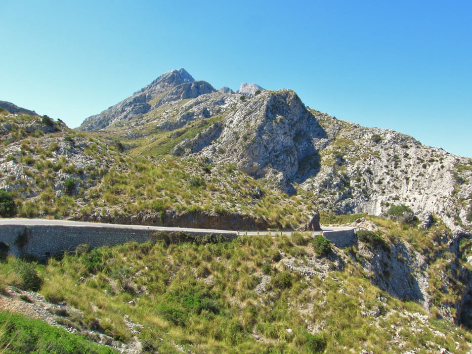
The start of this bike tour is in Alcúdia. First you’ll drive out of the city and along the coast to the junction with the road Ma-2202 at 3.6 km. Six kilometers later we reach the town Pollenca. Then we bike 6 kilometers to the west with an average slope of 1%. After that the ascent towards Sanctuary Lluc and the Tramuntana mountains begins with a 6% slope. At the Aqueduct after 40 kilometers we turn right towards the pass - Coll de Cals Reis 723m and Sa Calobra. On the hilly section to the pass there are already some very good viewpoints.
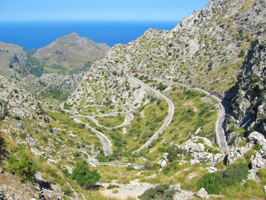
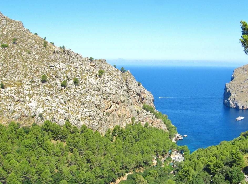
The 10 km descent to the bay of Sa Calobra is the scenic highlight of this tour. Many cyclists say this tour is one of the most beautiful they have ever ridden. The serpentine route offers a gentle slope up to the striking point, the "tie knot". At the level of Sa Moleta the Italian engineer Paretti just saw the opportunity to have the road circling with a 270 ° turn around itself. On the descent, with 14 hairpin curves you’ll see from almost any point four street tapes. At the end of the road down to the bay of Cala de Sa Calobra has adapted to the flow of tourists. There are many restaurants, bars and some hotels arisen. The small beach is not the primary aim of the visitors, only the Torrent de Pareis draws people magically. 500m next to the beach - Cala de Sa Calobra flow the not always constantly water-bearing torrent de Pareis in the Mediterranean Sea. The Landscape is with the up to 200m high canyon very attractive.
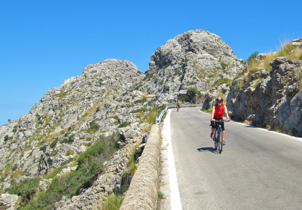
Afterwards we drive about 700 vertical meters back up to the pass Coll de Cals Reis. The average slopes are between 5.6% and 9.8%. The not wide road is on weekends and in summer highly frequented by some buses. Then back towards Lluc Sanctuary. At Km 73.6 straight and continue downhill to Caimari. The last part of this highly recommended tour is about Selva and Campanet somewhat hilly. The last 25 km we drive without significant gradients back to Alcúdia.
Tour Galerie
Tour Karte und Höhenprofil
Minimale Höhe -2 m
Maximale Höhe 724 m
Mehr zum Tourautor
|
|
Trek1400d |
Kommentare

Mehr zum Tourautor
|
|
Trek1400d |
Zu meinen Favoriten hinzufügen
Von meinen Favoriten entfernen
Tags bearbeiten
Tour öffnen
Meine Bewertung
Bewerten