Login

Login vergessen?

Cookies müssen akzeptiert werden!
Die Cookie-Funktion Ihres Browsers ist deaktiviert. Bitte aktivieren Sie die Funktion.

Noch kein Mitglied?

Jetzt Registrieren
Login

Nur für eingeloggte Benutzer möglich

Melde dich an, um diese Funktion nutzen zu können.

Login vergessen?

Cookies müssen akzeptiert werden!
Die Cookie-Funktion Ihres Browsers ist deaktiviert. Bitte aktivieren Sie die Funktion.

Noch kein Mitglied?

Jetzt Registrieren
Filter
Kategorien
Erweiterte Filter
  • Länge (km)
  • Höhenmeter
Filter speichern Filter zurücksetzen

TrackRank

QRCode

Technische Daten

Länge71,4 km Höhenmeter0 m Abstieg0 m Dauer5 Tage 0 h Datum23.07.2015
Bewertungen Autor Landschaft Spaßfaktor Kondition Technik

Statistik

473 Views Bewertungen 57 Downloads Durchschnitt
Bewerten
  • Tourenblatt
  • Anfahrt
  • Downloads

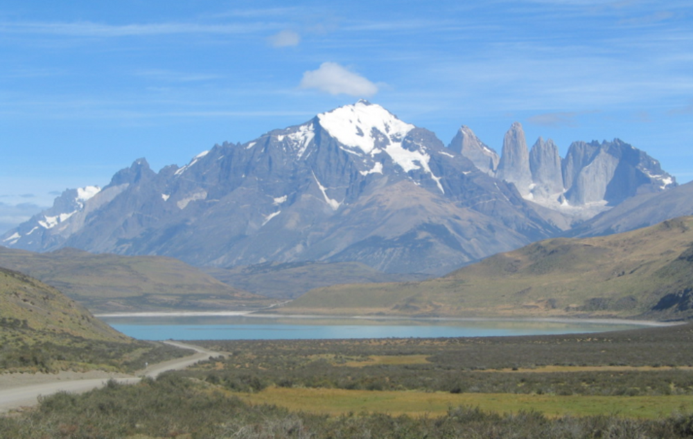
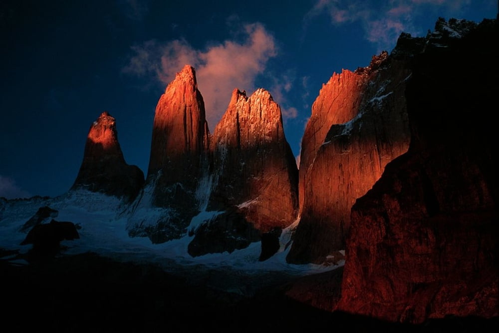
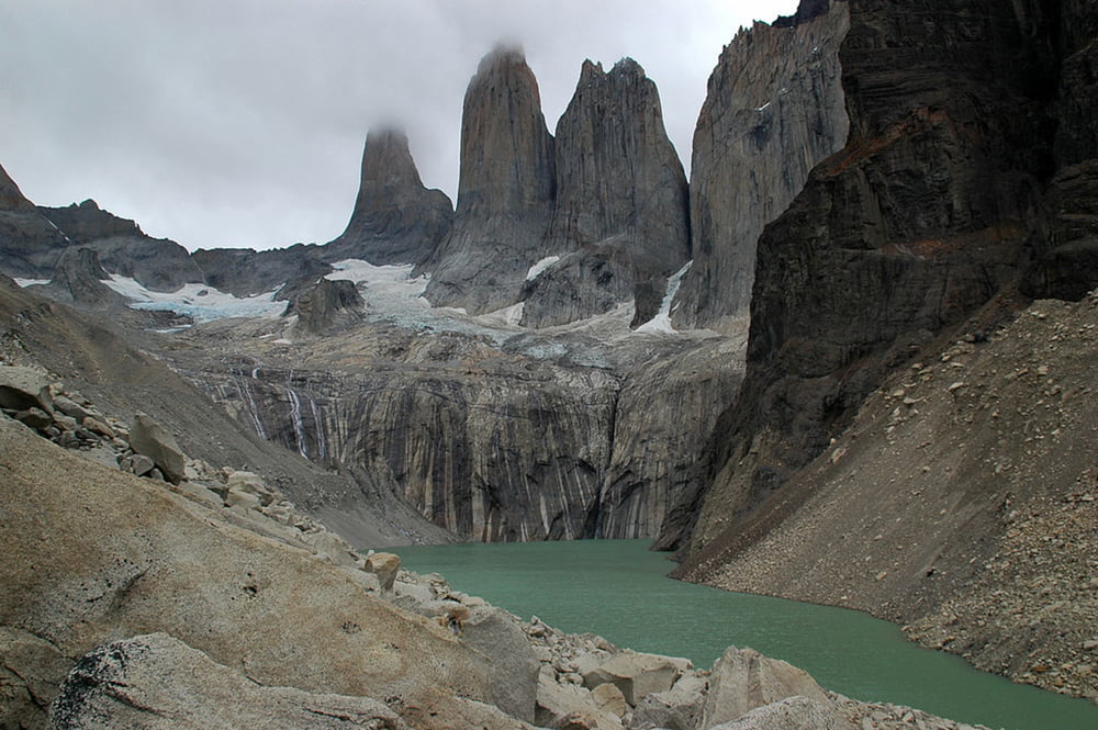
This was my favourite trek in South America, well maybe apart from the Cordillera Huayhuash in Peru anyway. Spectacular scenery, we had wonderful weather, and the refuges were a cut above anything else in South America. We did the whole thing through an agency as we were just on holiday in Chile but you don't need a guide so if you are already in SA and have all the equipment with you (ie: if you're backpacking) I think you could easily do it yourself.

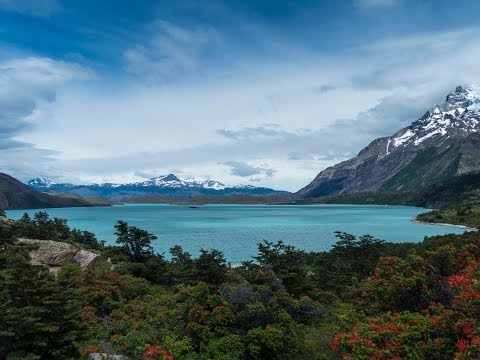
We did this W trek as a 5-day hike, but I think you can also do a complete loop aroudn the northern edge of the National Park if you have the time - I think 7 days?


Weitere Informationen unter

http://www.realworldholidays.co.uk/chile/

Tour Galerie

Tour Karte und Höhenprofil

  • Open Street Map
  • Google
Minimale Höhe 99999 m Maximale Höhe -99999 m Detailansicht

Mehr zum Tourautor

anna-gm
Mitglied seit 2015

Land: Vereinigtes Königreich

1 erstellte Touren
5
Private Nachricht senden

Kommentare

The tour starts at the Vertice Refugio and you then walk north along the shores of Lago Grey until you reach the Refugio Lago Grey where you stay tonight. From here you can head north another 1km to the foot of the Grey glacier before retracing your steps to the Refugio.

On Day 2 you trek back south to the Vertice Refugio and then head east to the north of Lake Skottsborg before cutting east across to the Rio Frances and the Campamento Italiano, where you stay tonight.

On Day 3 you follow the eastern bank of the Rio Frances north along the valley until you get to the Mirador at the northern end of the valley. From here you then head back down the valley to the campsite and then follow the shore of Lake Nordenskjold east until you get to the Los cuernos refugio. This is the longest day of the trek by far (around 10 hours) and is a real schlep but arguably the most spectacular of the trek as well.

On day 4 you have a long but level hike east from Los Cuernos until you reach the base of the Ascencio valley, just across from the Las Torres hotel. You follow the river north until you reach Lago Torres, where there are several campsites on the north shore.

On Day 5 all that's left to do is walk back down the valley to Las Torres, from where the bus will take you back to Puerto Natales and the ocean!


GPS-Tracks

Trackpunkte
  • GPX / Garmin Map Source (gpx) download
  • TCX / Garmin Training Center® (tcx) download
  • CRS / Garmin Training Center® (crs) download
  • Google Earth (kml) download
  • G7ToWin (g7t) download
  • TTQV (trk) download
  • Overlay (ovl) download
  • Fugawi (txt) download
  • Kompass (DAV) Track (tk) download
  • Tourenblatt (pdf) download
  • Originaldatei des Autors (gpx) download

Mehr zum Tourautor

anna-gm
Mitglied seit 2015

Land: Vereinigtes Königreich

1 erstellte Touren
5
Private Nachricht senden
Tour teilen
Zu meinen Favoriten hinzufügen
Von meinen Favoriten entfernen
Tags bearbeiten
Meine Bewertung
Bewerten
Tour: Torres del Paine "W" Circuit
Art: Bergtour
Länge: 71,4 km
Bewertet am:
Dauer:
Tag(e)
Stunde(n)
Minute(n)
Bewertung: Landschaft Spaßfaktor Kondition Technik