
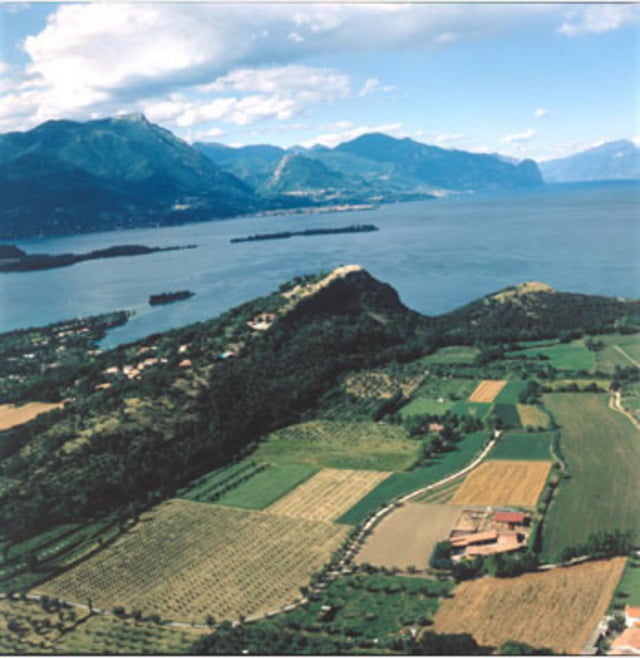

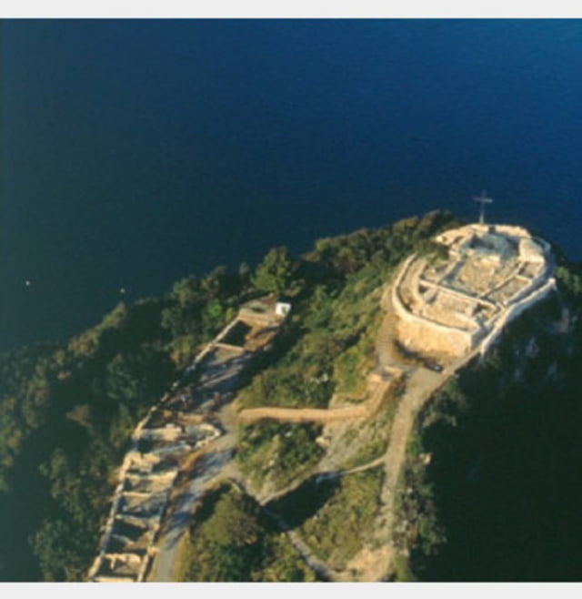
N° 3 Manerba del Garda.
Questo breve itinerario vuol dare una possibilità in più alle famiglie per poter visitare in maniera diversa il territorio di Manerba del Garda. Esso si sviluppa tra la rocca, Pieve, Manerba ed il porto di Dusano.
E’ un percorso di circa 10 km con un dislivello di appena 140 metri e sono queste caratteristiche che lo rendono accessibile alla maggior parte delle famiglie. Il percorso alterna strade con fondo asfaltato a strade con sfondo sterrato con alcuni passaggi su sentieri sterrati in riva al lago. Non mancano le varie soste a luoghi di interesse come la rocca di Manerba oppure il porto di Dusano, alle varie cantine del luogo e chiesette caratteristiche. La presenza di sentieri che portano a lago danno una maggiore opportunità nel periodo estivo per potersi rilassare su qualche spiaggia e godersi il panorama. Il percorso è comunque fattibile tutto l’anno.
No. 3 Manerba del Garda.
This short route means giving a more possibilities for families to be able to go in a different way the territory of Manerba del Garda. It develops between the fortress, Pieve, Manerba and the port of Dusano.
It 'a distance of about 10 km with an altitude difference of only 140 meters and it is these features that make it accessible to most families. The alternative route roads with asphalt, little dirt roads with some steps on dirts paths along the lake. There are stops at various places of interest such as the fortress of Manerba or the port of Dusano at various wineries and the local churches characteristics. The presence of paths leading to the lake give greater opportunities during the summer in order to relax on a beach and enjoy the view. The path is feasible throughout the year.
Sorry for the my english
Tour Galerie
Tour Karte und Höhenprofil
Minimale Höhe 66 m
Maximale Höhe 128 m
Mehr zum Tourautor
|
|
ugo-mtb |
Kommentare

zargoz
am 17.04.2009
Schöne tour für die ganze familie. Es hatte lediglich auf dem trail dem See entlang einige umgestürtzte Baume. Man kann jedoch gut auf andere trails ausweiwchen z.B. direkt auf der klippe am see(für Kinder jedoch etwas gefährlich da es gut 20m runtergeht). Das Gebiet am See ist auch für erwachsene ein tolles Bikerevier da sich einige trails dort verbergen.
GPS-Tracks
Trackpunkte-
GPX / Garmin Map Source (gpx) download
-
TCX / Garmin Training Center® (tcx) download
-
CRS / Garmin Training Center® (crs) download
-
Google Earth (kml) download
-
G7ToWin (g7t) download
-
TTQV (trk) download
-
Overlay (ovl) download
-
Fugawi (txt) download
-
Kompass (DAV) Track (tk) download
-
Tourenblatt (pdf) download
-
Originaldatei des Autors (gpx) download
Mehr zum Tourautor
|
|
ugo-mtb |
Zu meinen Favoriten hinzufügen
Von meinen Favoriten entfernen
Tags bearbeiten
Tour öffnen
Meine Bewertung
Bewerten