
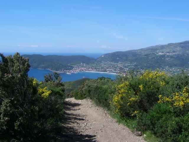

Tour from Lacona up to the Mt. Tambone and around the Mt. S. Martino down to Lacona again.
Down from Mt. Tambone to the the street (Lacona / Marina di Campo) and down to Locana are some good and difficult downhill trails (left from motor bike trail machines).
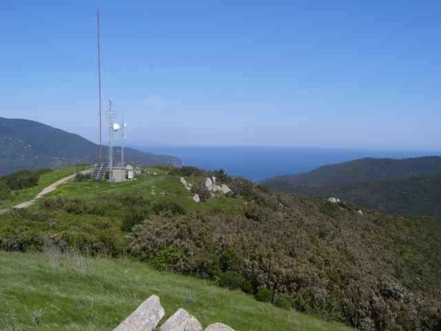
I did not ride over the Mt. S. Martino, but i marked the step into with a waypoint, if you do, send me the track to add.
There is another tour from Locana to the Mt. Tambone, going down to Mariana di Campo and Locana with variants (in up and down). The up from Locana is in this track 5minutes to hike (bad condition of way), in the other Tambone trail the up uses the street for 150m height.
Down from Mt. Tambone to the the street (Lacona / Marina di Campo) and down to Locana are some good and difficult downhill trails (left from motor bike trail machines).
I did not ride over the Mt. S. Martino, but i marked the step into with a waypoint, if you do, send me the track to add.
There is another tour from Locana to the Mt. Tambone, going down to Mariana di Campo and Locana with variants (in up and down). The up from Locana is in this track 5minutes to hike (bad condition of way), in the other Tambone trail the up uses the street for 150m height.
Weitere Informationen unter
http://www.gps-tour.info/tours/view.php?action=view&entity=list&limitstart=0&country=Italien&federal=ToskanaTour Galerie
Tour Karte und Höhenprofil
Minimale Höhe 12 m
Maximale Höhe 381 m
Mehr zum Tourautor
|
|
skyhopper |
Kommentare
Portoferrario, Locana, at the village end of Lacona in direction to Marina di Campo park the car (or come withe the othe Tambone tour up from Marina di Campo).
GPS-Tracks
Trackpunkte-
GPX / Garmin Map Source (gpx) download
-
TCX / Garmin Training Center® (tcx) download
-
CRS / Garmin Training Center® (crs) download
-
Google Earth (kml) download
-
G7ToWin (g7t) download
-
TTQV (trk) download
-
Overlay (ovl) download
-
Fugawi (txt) download
-
Kompass (DAV) Track (tk) download
-
Tourenblatt (pdf) download
-
Originaldatei des Autors (gpx) download
Mehr zum Tourautor
|
|
skyhopper |
Zu meinen Favoriten hinzufügen
Von meinen Favoriten entfernen
Tags bearbeiten
Tour öffnen
Meine Bewertung
Bewerten
Not suitable for biking
Gps accuracy is perfect, but leave your bike at home.
Uncycleable?
Uncycleable II