


N° 4 Villa di Salò – laghetti di Puegnago – Valtenesi – Polpenazze – Gavardo
Questo itinerario completamente in asfalto è pressoché praticabile per tutti i tipi di bikers e adatto alle famiglie.
Il percorso si sviluppa tra Salò, Polpenazze, Gavardo. La spettacolarità di questo percorso è sicuramente l’ambiente in cui esso è immerso. Passando attraverso borghi antichi, fattorie, maneggi, vigneti, laghetti incantati.
Come anticipato prima lo si può percorrere con qualsiasi tipo di bicicletta.
Il tratto più impegnativo è la salita che parte dalla frazione di Villa di Salò ed arriva nei pressi dei laghetti di Sovenigo, nelle colline moreniche del Garda e più precisamente nella Valtenesi.
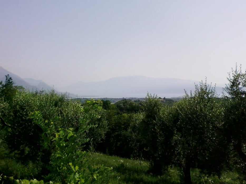
La particolarità di questi laghetti (PIC-1) è la loro posizione immersa nel verde dei boschi e coltivazioni di vigneti e uliveti (PIC-2).
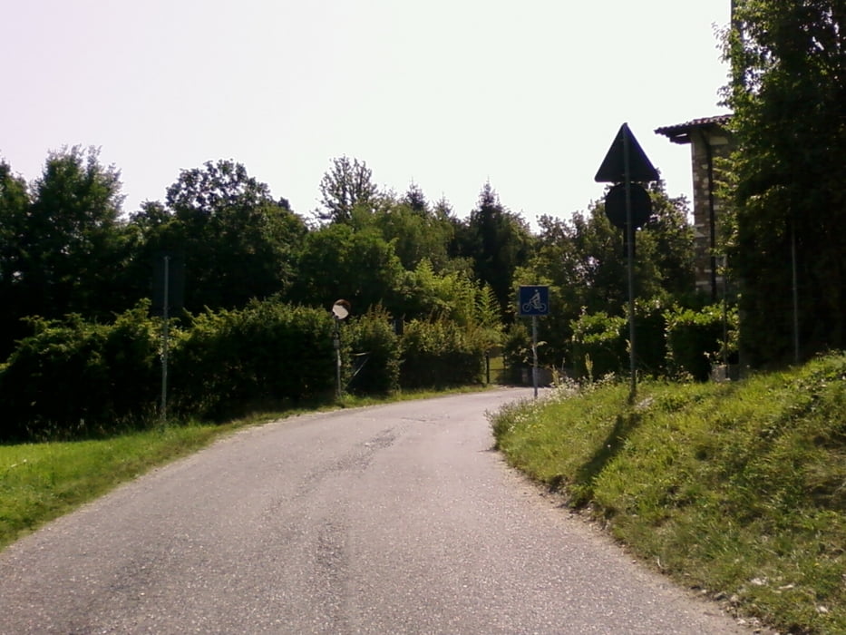
Passati i laghetti si prosegue con una svolta secca a dx (PIC-3) abbandonando la strada comunale per proseguire sulla ciclabile per direzione Lonato.
La strada sempre asfaltata ora passa per campi e maneggi (PIC-4) per poi arrivare nel paese di Polpenazze.
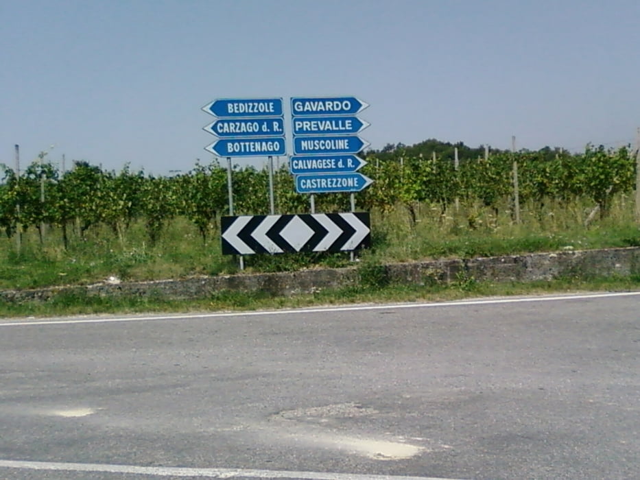
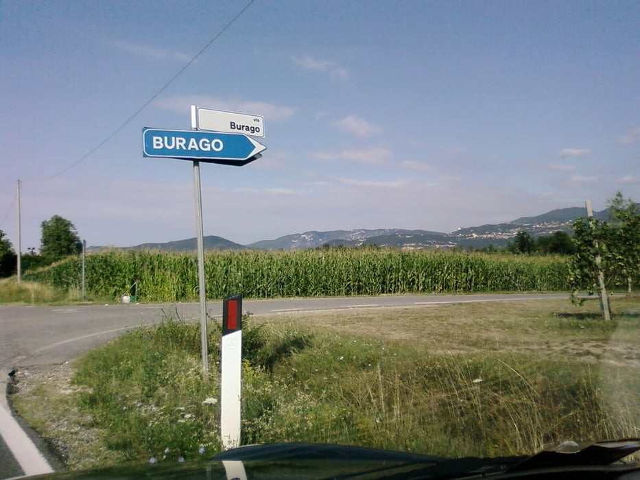
Di li si prosegue sempre con indicazioni per Calvagese della Riviera (PIC-5). Prima del paese di Calvagese, si svolta a dx per la frazione di Burago (PIC-7) per arrivare a Muscoline e poi scendere a Gavardo.
Di li si rientra sempre con alternanza di strade comunali e ciclabili a Salò.
Le molteplici strade e sentieri che lo circondano fanno di questo itinerario un prezioso punto di partenza per tantissime altre mete turistiche ed enogastronomiche.
Numerose possibilità di soste, tra cantine ed agriturismo, per poterci riposare e ristorarci.
Il percorso è per la maggior parte poco esposto al sole, perciò indicato anche nelle giornate estive.
Il percorso è comunque fattibile tutto l’anno in un senso o nell’altro.
N° 4 Villa di Salò – laghetti di Puegnago – Valtenesi – Polpenazze – Gavardo
This asphalt path is completely feasible for almost all types of bikers and suitable for families.
The course develops between Salò, Polpenazze, Gavardo. The spectacular nature of this path is the environment in which it is immersed. Passing through ancient villages, farms, stables, vineyards, enchanting lakes.
As first you can go with any type of bicycle.
The most demanding is the climb that starts from the village of Villa di Salò and arrives near the lakes Sovenigo in morainic hills of Lake Garda and more precisely in Valtenesi.
The peculiarity of these lakes (CIP-1) is their position deep in the green woods and cultivation of vineyards and olive trees (PIC-2).
After the lakes will continue with a dry turning right (PIC-3) abandoning the road to continue on the path to Lonato direction.
Always paved the road now passes for the fields and stables (PIC-4) and then arrive in the country of Polpenazze.
From there it continues with directions to the Riviera Calvagese (CIP-5). Before the country Calvagese, turn right for the fraction of Burago (PIC-7) to Muscoline and then declined to Gavardo.
Of them is always with alternation of roads and trails to Salò.
The many roads and trails that surround it makes this journey a valuable starting point for many other tourist attractions and food and wine.
Lots of stops between farm and winery, to be able to rest and eat.
The route is mostly just exposed to the sun, so also in summer days.
The path is feasible throughout the year in one direction or another.
Traslate by google.
Tour Galerie
Tour Karte und Höhenprofil
Minimale Höhe 178 m
Maximale Höhe 331 m
Mehr zum Tourautor
|
|
ugo-mtb |
Kommentare

da Salò seguire x direzione Villa di Salò
GPS-Tracks
Trackpunkte-
GPX / Garmin Map Source (gpx) download
-
TCX / Garmin Training Center® (tcx) download
-
CRS / Garmin Training Center® (crs) download
-
Google Earth (kml) download
-
G7ToWin (g7t) download
-
TTQV (trk) download
-
Overlay (ovl) download
-
Fugawi (txt) download
-
Kompass (DAV) Track (tk) download
-
Tourenblatt (pdf) download
-
Originaldatei des Autors (gpx) download
Mehr zum Tourautor
|
|
ugo-mtb |
Zu meinen Favoriten hinzufügen
Von meinen Favoriten entfernen
Tags bearbeiten
Tour öffnen
Meine Bewertung
Bewerten