Login

Login vergessen?

Cookies müssen akzeptiert werden!
Die Cookie-Funktion Ihres Browsers ist deaktiviert. Bitte aktivieren Sie die Funktion.

Noch kein Mitglied?

Jetzt Registrieren
Login

Nur für eingeloggte Benutzer möglich

Melde dich an, um diese Funktion nutzen zu können.

Login vergessen?

Cookies müssen akzeptiert werden!
Die Cookie-Funktion Ihres Browsers ist deaktiviert. Bitte aktivieren Sie die Funktion.

Noch kein Mitglied?

Jetzt Registrieren
Filter
Kategorien
Erweiterte Filter
  • Länge (km)
  • Höhenmeter
Filter speichern Filter zurücksetzen

TrackRank

QRCode

Technische Daten

Länge7,1 km Höhenmeter280 m Abstieg224 m Dauer03:17 h:m Datum28.08.2011
Bewertungen Autor Landschaft Spaßfaktor Kondition Technik

Statistik

343 Views Bewertungen 19 Downloads Durchschnitt
Bewerten
  • Tourenblatt
  • Anfahrt
  • Downloads

Date: July 29, 2011

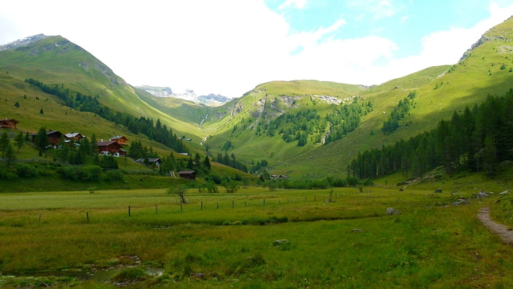
Start:1940 m (Lindlerkasa)
Finish: 1890 m (Lindlerkasa)

Highest point: 2033 m (Mohar)
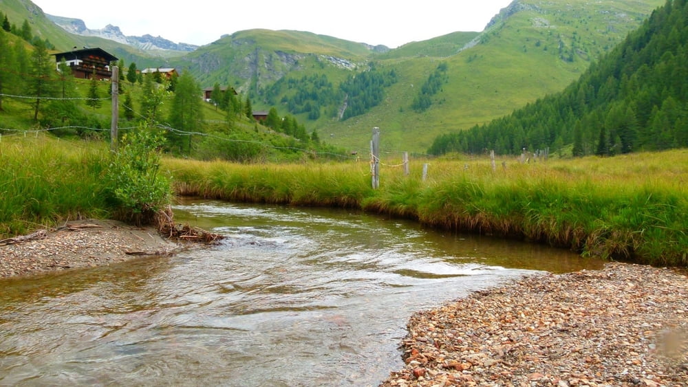
Lowest point: 1840 m (Astner Moos)

Total ascent: 350 m
Total descent: 350 m


**************************
Do not take anything, do not leave anything!
**************************
Please, do NOT leave trash behind. Paper tissues are also trash! Chocolate wrap as well. Bring a small trash bag with you and take your trash with yourself to the next trash can. It is not that heavy.
**************************


Weitere Informationen unter

https://picasaweb.google.com/beatahardi/2011072330AstentalNyaralas?authuser=0&feat=directlink

Tour Galerie

Tour Karte und Höhenprofil

  • Open Street Map
  • Google
Minimale Höhe 1841 m Maximale Höhe 2034 m Detailansicht

Mehr zum Tourautor

beepee
Mitglied seit 2009

Land: Ungarn

33 erstellte Touren
8.7
Private Nachricht senden

Kommentare

Places where you can eat and drink:
Sadnighaus
Alm where also their own cheese and milk products are sold - on the Almweg

Route:
1. Lindlerkasa or parking by Auernigalm
2. walk on the Astner Moos trail all the way around the moos
3. walk up to Sadnighaus
4. at Sadnighaus, follow the signs towards Glocknerblick. You can follow the normal street, or the red trail that means shortcuts to the curves of the street.
5. at the sign where Görlitzer Törl is straight, Glocknerblick is left, go to the RIGHT towards the Almweg
6. follow the Almweg all the way to an empty Alm, where sign shows Astental to the right
7. walk back to Astental.

Make sure to bring plenty of water!!!


**************************
Do not take anything, do not leave anything!
**************************
Please, do NOT leave trash behind. Paper tissues are also trash! Chocolate wrap as well. Bring a small trash bag with you and take your trash with yourself to the next trash can. It is not that heavy.
**************************


GPS-Tracks

Trackpunkte
  • GPX / Garmin Map Source (gpx) download
  • TCX / Garmin Training Center® (tcx) download
  • CRS / Garmin Training Center® (crs) download
  • Google Earth (kml) download
  • G7ToWin (g7t) download
  • TTQV (trk) download
  • Overlay (ovl) download
  • Fugawi (txt) download
  • Kompass (DAV) Track (tk) download
  • Tourenblatt (pdf) download
  • Originaldatei des Autors (gpx) download

Mehr zum Tourautor

beepee
Mitglied seit 2009

Land: Ungarn

33 erstellte Touren
8.7
Private Nachricht senden
Tour teilen
Zu meinen Favoriten hinzufügen
Von meinen Favoriten entfernen
Tags bearbeiten
Meine Bewertung
Bewerten
Tour: Lindlerkasa - Astner Moos - Almweg
Art: Bergtour
Länge: 7,1 km
Bewertet am:
Dauer:
Tag(e)
Stunde(n)
Minute(n)
Bewertung: Landschaft Spaßfaktor Kondition Technik