Login

Login vergessen?

Cookies müssen akzeptiert werden!
Die Cookie-Funktion Ihres Browsers ist deaktiviert. Bitte aktivieren Sie die Funktion.

Noch kein Mitglied?

Jetzt Registrieren
Login

Nur für eingeloggte Benutzer möglich

Melde dich an, um diese Funktion nutzen zu können.

Login vergessen?

Cookies müssen akzeptiert werden!
Die Cookie-Funktion Ihres Browsers ist deaktiviert. Bitte aktivieren Sie die Funktion.

Noch kein Mitglied?

Jetzt Registrieren
Filter
Kategorien
Erweiterte Filter
  • Länge (km)
  • Höhenmeter
Filter speichern Filter zurücksetzen

TrackRank

QRCode

Technische Daten

Länge7,1 km Höhenmeter864 m Abstieg18 m Dauer06:23 h:m Datum28.08.2011
Bewertungen Autor Landschaft Spaßfaktor Kondition Technik

Statistik

463 Views Bewertungen 29 Downloads Durchschnitt
Bewerten
  • Tourenblatt
  • Anfahrt
  • Downloads

Date: July 30, 2011

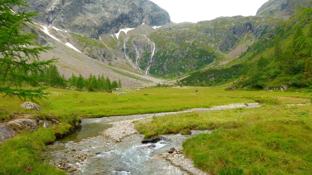
Start: 1640 m (Gradental parking area)
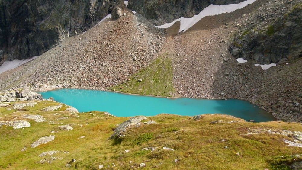
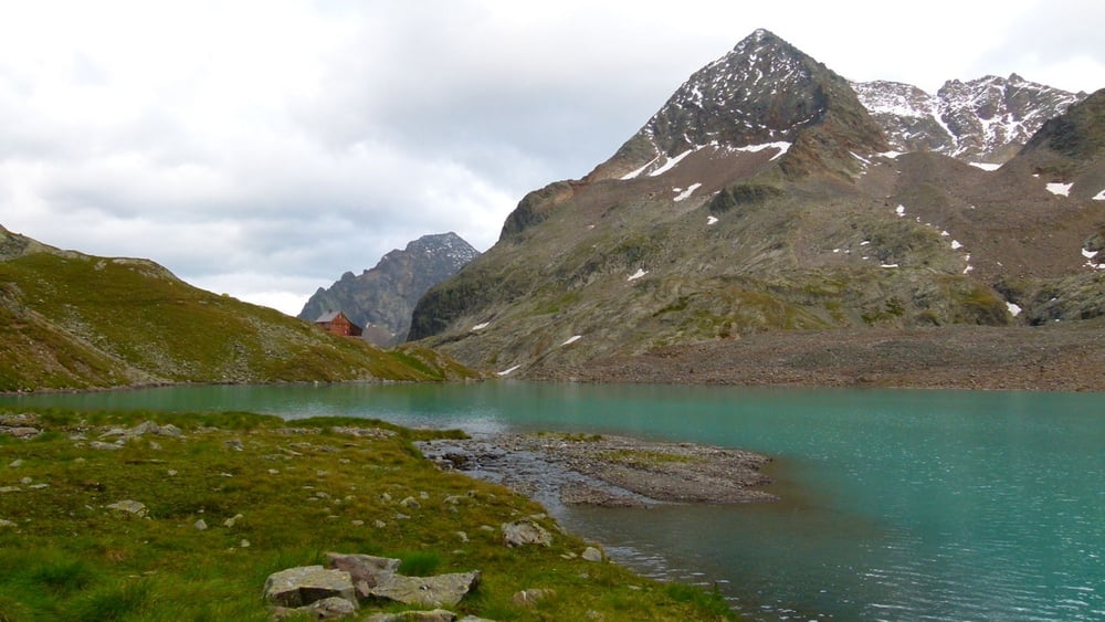
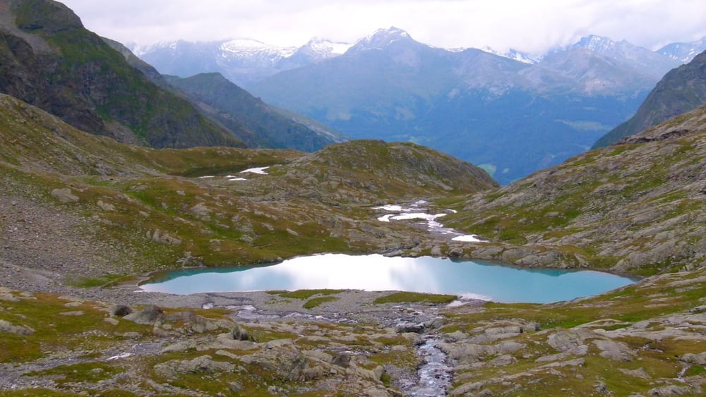
Finish: 2488 m (Adolf Nossberger Hütte)

Highest point: 2488 m (Adolf Nossberger Hütte)
Lowest point: 1640 m

Total ascent: 902 m
Total descent: 48 m

http://www.tauernalpin-touren.at/bergwandern-und-gipfelwandern/top-10-wandertipps/gradental.html

Our similar but shorter tour from 2009 (Gradental - Vordersee): /en/tracks/detail.48218.html
Our similar tour from 2010 (Gradental - A.Nossberger Hütte - Gradental): /en/tracks/detail.66080.html


**************************
Do not take anything, do not leave anything!
**************************
Please, do NOT leave trash behind. Paper tissues are also trash! Chocolate wrap as well. Bring a small trash bag with you and take your trash with yourself to the next trash can. It is not that heavy.
**************************


Weitere Informationen unter

https://picasaweb.google.com/beatahardi/2010073008013NaposHutteTura?authuser=0&feat=directlink

Tour Galerie

Tour Karte und Höhenprofil

  • Open Street Map
  • Google
Minimale Höhe 1624 m Maximale Höhe 2490 m Detailansicht

Mehr zum Tourautor

beepee
Mitglied seit 2009

Land: Ungarn

33 erstellte Touren
8.7
Private Nachricht senden

Kommentare

Places where you can eat and drink:
Adolf Nossberger Hütte

Route:
1. Gradental parking area
2. follow the dirt road next to the creek
3. as you reach Naturlehrweg Gradental sign, walk under it - into the forest
4. follow the marked trail in the forest, leading up
5. cross the creek, go through the gate, and soon you will reach Gradenmoos
6. in Gradenmoos, keep right, walk around the 'Moos' on its right side
7. after crossing the creek, soon you will find a trail marking, that shows the way towards Adolf Nossberger Hütte
8. on the way up, the longer trail via Vordersee is recommended (no.816)
9. after a quite steep walk (560 m ascent in 2 km) you will reach Vordersee
10. walk past Vordersee, then past Mittersee, and you will see the Hütte already
11. reach Adolf Nossberger Hütte that is built next to Gradensee

After a nice meal and some rest in the Hütte, walk around Gradensee! It will take about an hour if you walk slowly.

Make sure to bring plenty of water!!!


**************************
Do not take anything, do not leave anything!
**************************
Please, do NOT leave trash behind. Paper tissues are also trash! Chocolate wrap as well. Bring a small trash bag with you and take your trash with yourself to the next trash can. It is not that heavy.
**************************


GPS-Tracks

Trackpunkte
  • GPX / Garmin Map Source (gpx) download
  • TCX / Garmin Training Center® (tcx) download
  • CRS / Garmin Training Center® (crs) download
  • Google Earth (kml) download
  • G7ToWin (g7t) download
  • TTQV (trk) download
  • Overlay (ovl) download
  • Fugawi (txt) download
  • Kompass (DAV) Track (tk) download
  • Tourenblatt (pdf) download
  • Originaldatei des Autors (gpx) download

Mehr zum Tourautor

beepee
Mitglied seit 2009

Land: Ungarn

33 erstellte Touren
8.7
Private Nachricht senden
Tour teilen
Zu meinen Favoriten hinzufügen
Von meinen Favoriten entfernen
Tags bearbeiten
Meine Bewertung
Bewerten
Tour: Gradental - Winklerner Hütte hike part nr.1 (Gradental - Adolf Nossberger Hütte)
Art: Bergtour
Länge: 7,1 km
Bewertet am:
Dauer:
Tag(e)
Stunde(n)
Minute(n)
Bewertung: Landschaft Spaßfaktor Kondition Technik