
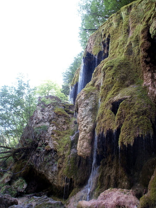

Kurze Rundwanderung im Ammertal zu den Schleierfällen in der Ammerschlucht. Der GPS-Track ist wegen Empfangsproblemen in der Ammerschlucht etwas ungenau; der Weg ist aber gut ausgeschildert (Weg "W6").
Trittsicherheit incl. gutem Schuhwerk unbedingt erforderlich! Wege beachten, da die Abbruchkanten anscheinend recht instabil sind. Das Betreten des Bereiches unmittelbar um den Wasserfall ist aus Naturschutzgründen nicht gestattet.
Further information at
http://www.panoramio.com/user/2786498/tags/Schleierf%C3%A4lleTour gallery


Tour map and elevation profile
Minimum height 779 m
Maximum height 877 m
More about the tour author

|
apismellifera |
Comments

B23 - Schwaigsee - Morgenbach - Kreut.
Die Runde kann an verschiedenen Stellen begonnen werden, ist gut ausgeschildert.
GPS tracks
Trackpoints-
GPX / Garmin Map Source (gpx) download
-
TCX / Garmin Training Center® (tcx) download
-
CRS / Garmin Training Center® (crs) download
-
Google Earth (kml) download
-
G7ToWin (g7t) download
-
TTQV (trk) download
-
Overlay (ovl) download
-
Fugawi (txt) download
-
Kompass (DAV) Track (tk) download
-
Track data sheet (pdf) download
-
Original file of the author (gpx) download
More about the tour author
|
|
apismellifera |
Add to my favorites
Remove from my favorites
Edit tags
Open track
My score
Rate