


Wir starten die Tour von der Pension und Gaststätte "Schrammsteinbaude" aus (preiswerte Unterkunft, 2,5km außerhalb vom Ortszentrum Bad Schandau siehe Link).
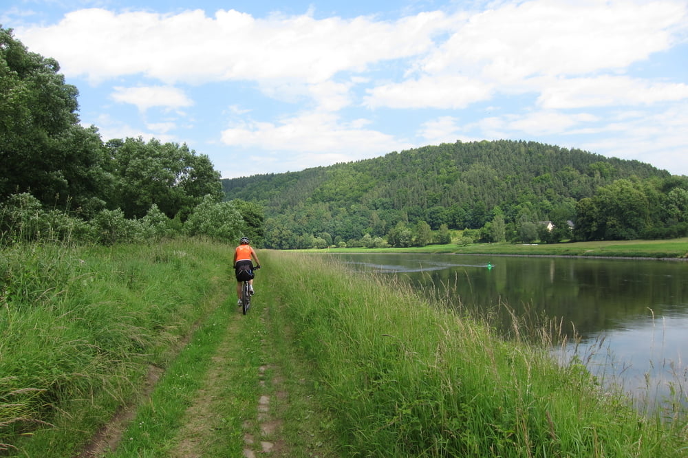
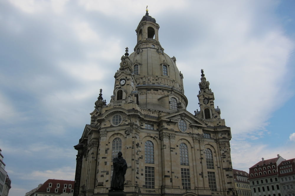
Von Bad Schandau bis Königstein ist die Tour MTB würdig (ist mit dem Trekkingbike auch fahrbar) . Danach geht es ganz normal auf dem Elbradweg nach Dresden. Dort besichtigen wir die Frauenkirche, Zwinger und Semperoper.
Für den Rückweg, gibt es drei Möglichkeiten: Schiff, Bahn oder wie wir mit dem Rad`l. Allerdings fahren wir den beschilderten Elbradweg nach Bad Schandau. Siehe Tour /de/touren/detail.103642.html
Further information at
http://www.schrammsteinbaude.de/index.php?option=com_content&view=article&id=2&Itemid=3Tour gallery


Tour map and elevation profile
Minimum height 111 m
Maximum height 206 m
More about the tour author
|
|
W-C |
Comments

Von Dresden kommend, durch Bad Schandau, Ortsende links ca. 1km den Berg hoch.
Gaststätte & Pension Schrammsteinbaude
Zahnsgrund 5
01814 Bad Schandau
Tel: 035022 42305
Gaststätte & Pension Schrammsteinbaude - Koordinaten für dein Navigationsgerät
N 50° 55. 036´
E 14° 11. 244´
GPS tracks
Trackpoints-
GPX / Garmin Map Source (gpx) download
-
TCX / Garmin Training Center® (tcx) download
-
CRS / Garmin Training Center® (crs) download
-
Google Earth (kml) download
-
G7ToWin (g7t) download
-
TTQV (trk) download
-
Overlay (ovl) download
-
Fugawi (txt) download
-
Kompass (DAV) Track (tk) download
-
Track data sheet (pdf) download
-
Original file of the author (gpx) download
More about the tour author
|
|
W-C |
Add to my favorites
Remove from my favorites
Edit tags
Open track
My score
Rate