

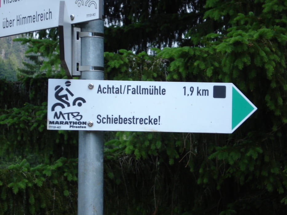
Diese Tour führt von der anderen Seite vom Achtal aus über die Schiebestrecke
vom Pfrontener Bike-Marathon ,
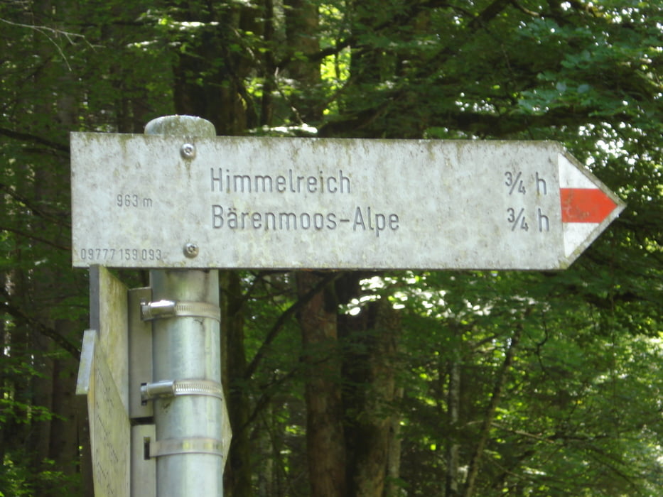
aber andersrum Bergaufwärts zur Bärenmoßalpe .
man muß das Bike ca. 20-25 min Hochtragen,das ist mit den Radschuhen nicht ganz ungefährlich man hat fast keinen halt.
Also gut überlegen wer es machen will !
Nach der steilen Abfahrt führt die Tour noch ein stück ins Vilstal und die Edelsberg-Traverse hoch
da kann jeder so weit hochfahren wie er will und kann.
Z.B zur Dinserhütte-Gundhütte Kappeler-Alm .
Tour gallery
Tour map and elevation profile
Minimum height 855 m
Maximum height 1208 m
More about the tour author
|
|
Appelmann |
Comments

GPS tracks
Trackpoints-
GPX / Garmin Map Source (gpx) download
-
TCX / Garmin Training Center® (tcx) download
-
CRS / Garmin Training Center® (crs) download
-
Google Earth (kml) download
-
G7ToWin (g7t) download
-
TTQV (trk) download
-
Overlay (ovl) download
-
Fugawi (txt) download
-
Kompass (DAV) Track (tk) download
-
Track data sheet (pdf) download
-
Original file of the author (gpx) download
More about the tour author
|
|
Appelmann |
Add to my favorites
Remove from my favorites
Edit tags
Open track
My score
Rate