

1-Etappe von Olbia nach Torpe.
Nebenstraßen und Wirtschaftswege
61 km 1100 Hm
2.Etappe von Torpe nach Cala Gonone
westlich am Monte Albo über Lula nach Cala Gonone,
Nebenstraßen und Wirtschaftswege
87 km 1800 Hm
3. Etappe von Cala Gonone nach Villa Grande Strisaili (einsam durchs Supramonte)
erst zur Cala Luna (200 Hm abwärts Schiebestück), von der Bucht haben wir 900 Hm hoch geschoben, war zu steil zum fahren. Vielleicht besser über einen „Wanderweg“ im Bachbett ca. 9km 200 Hm zu einen kleinen Sträßchen und von dort zur SS125 zu gelangen.
Von Talana nach Villa Grande aufgegebene Straße auf einer Höhe.
Nebenstraßen, Wirtschaftswege, Wanderwege
75 km 2250 Hm
4. Etappe von Villa Grande nach Seulo (auf Hirtenwegen durchs Gennargentu)
am Stausee Fumendosa entlang, auf einen kleinen Asphaltweg hoch zu einer abgelegenen Nuraghe, auf Hirtenwegen (bergauf teilw. schieben) zur einer Passstraße, auf Asphalt über Gadoni nach Seulo.
Nebenstraßen, Wirtschaftswege, Wanderwege
83 km 2000 Hm
5. Etappe von Seulo nach Mogoro
in Isili Nuraghe „Is Paras“ sehenswert, auf Basalthochebene Giara di Gesturi im Frühjahr viele kleine Seen.
Nebenstraßen, Wirtschaftswege, Wanderwege
82 km 1300 Hm
6. Etappe von Mogoro nach Fluminimaggiore
an die Westküste (Sanddünen und ehm. Bergbaugebiet)
Nebenstraßen, Wirtschaftswege, Wanderwege
75 km 1200 Hm
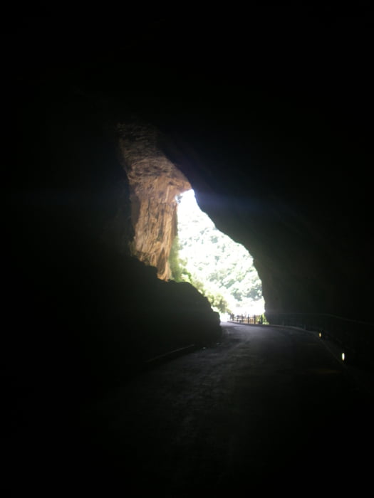
7. Etappe Fluminimaggiore nach Cagliari
mit den MTB durch eine Tropfsteinhöhle
Straße, Wirtschaftswege
75 km 1000 Hm
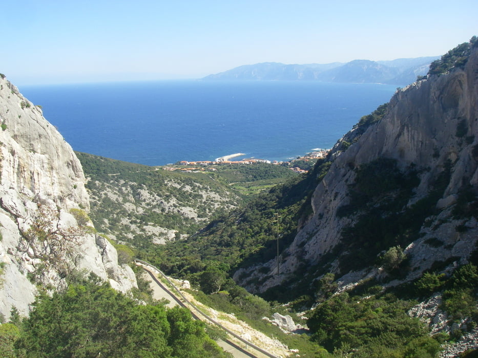
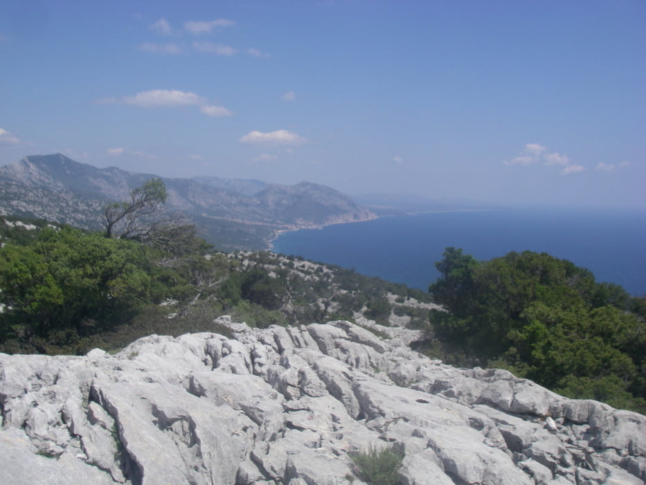
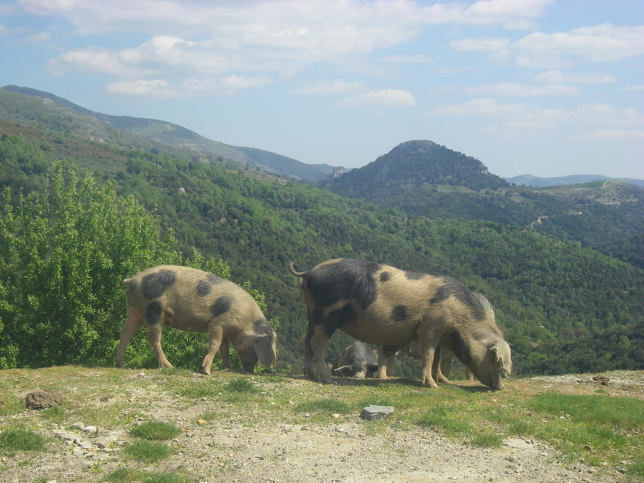
Tour gallery
Tour map and elevation profile
Minimum height 3 m
Maximum height 1218 m
More about the tour author
|
|
radrige |
Comments
Gute Flugverbindungen nach Olbia und Cagliari
GPS tracks
Trackpoints-
GPX / Garmin Map Source (gpx) download
-
TCX / Garmin Training Center® (tcx) download
-
CRS / Garmin Training Center® (crs) download
-
Google Earth (kml) download
-
G7ToWin (g7t) download
-
TTQV (trk) download
-
Overlay (ovl) download
-
Fugawi (txt) download
-
Kompass (DAV) Track (tk) download
-
Track data sheet (pdf) download
-
Original file of the author (gpx) download
More about the tour author
|
|
radrige |
Add to my favorites
Remove from my favorites
Edit tags
Open track
My score
Rate
Transsardinien
ich plane auch einen Sardinien-cross.
Wie habt ihr die Räder transportiert im Flieger ? Bikekoffer?
Ist die Tour vergleichbar mit einem AlpenX?