
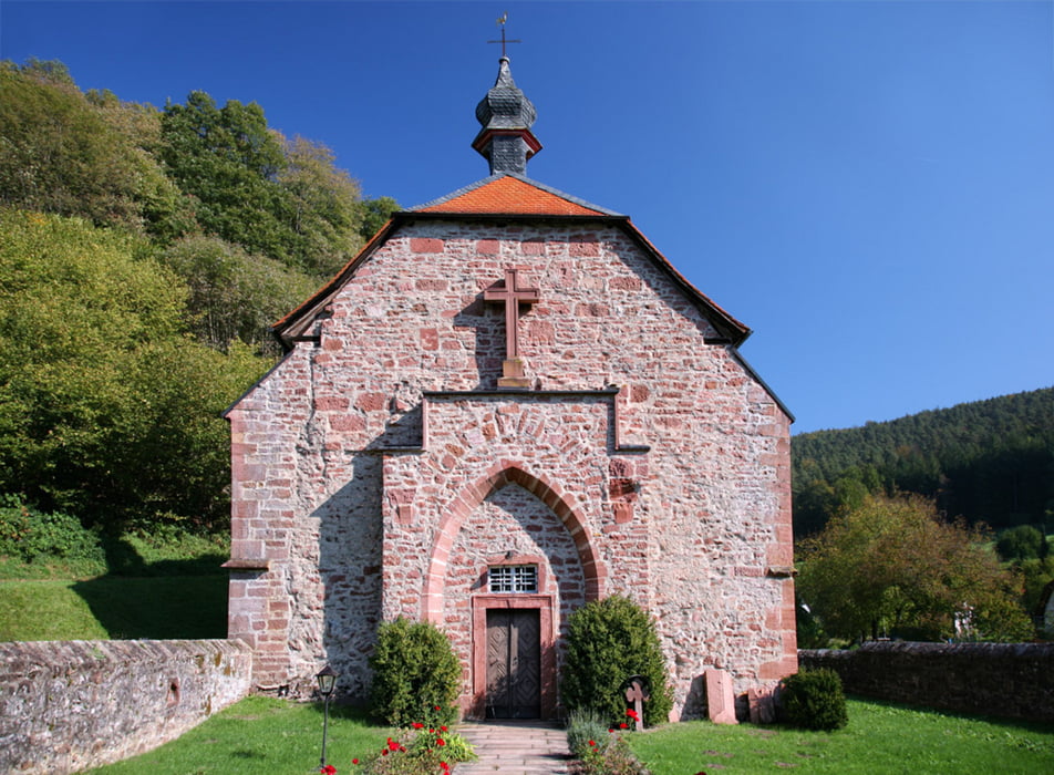

Am Main in Miltenberg am Thai Palace startet die Tour in Richtung Amorbach, dort biegt man ab in Richtung Schöllenbach, weiter geht es Richtung Hesseneck, danach folgt eine der schönsten Abfahrten auf kleiner Strasse durch den Wald, um dann wieder auf die Siegfriedstrasse abzubiegen. Wieder geht es hoch und dann wieder in rasanter Abfahrt nach Hetzbach, dann Beerfelden, dort auf die Strasse am Galgen vorbei über Olfen und Airlenbach, immer schön hoch und runter bis Waldmichelbach. Von dort geht es dann mal wieder hoch nach Abtsteinach, um dort ins Gorxheimertal abzubiegen. Die anspruchsvolle Abfahrt dort runter, dann wieder hoch nach Oberflockenbach, um dann die letzte Abfahrt über Heiligkreuz zu fahren. Dann noch flach über Heddesheim durch das Rheintal nach Mannheim Mitte.
Further information at
http://www.thaipalace.de/Tour gallery

Tour map and elevation profile
Minimum height 95 m
Maximum height 515 m
More about the tour author
|
|
baan-samko |
Comments

GPS tracks
Trackpoints-
GPX / Garmin Map Source (gpx) download
-
TCX / Garmin Training Center® (tcx) download
-
CRS / Garmin Training Center® (crs) download
-
Google Earth (kml) download
-
G7ToWin (g7t) download
-
TTQV (trk) download
-
Overlay (ovl) download
-
Fugawi (txt) download
-
Kompass (DAV) Track (tk) download
-
Track data sheet (pdf) download
-
Original file of the author (gpx) download
More about the tour author
|
|
baan-samko |
Add to my favorites
Remove from my favorites
Edit tags
Open track
My score
Rate