
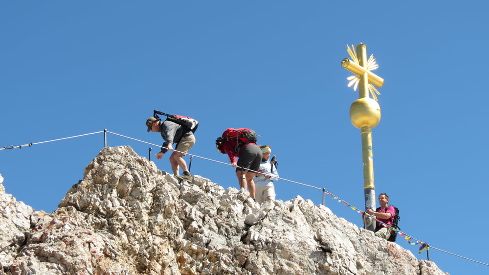

Der Höllental-Klettersteig ist unserer Meinung nach der schönste und abwechslungsreichste Weg auf Deutschlands höchsten Berg.
Gestartet sind wir zu der sehr langen Tour früh morgens gegen 6:00 Uhr am Campingplatz in Grainau. Zunächst geht es durch den Ort Richtung Hammersbach, wo der Wanderweg ins Höllental beginnt. Von hier aus haben wir nach ca. 1/2 Stunde den Eingang in die Höllentalklamm erreicht. Die Kasse war diesmal schon besetzt, so dass wir nicht wie vor neun Jahren kostenlos durch die Klamm durften.
Tour gallery

Tour map and elevation profile
Minimum height 724 m
Maximum height 2960 m
More about the tour author
|
|
biauwe |
Comments

GPS tracks
Trackpoints-
GPX / Garmin Map Source (gpx) download
-
TCX / Garmin Training Center® (tcx) download
-
CRS / Garmin Training Center® (crs) download
-
Google Earth (kml) download
-
G7ToWin (g7t) download
-
TTQV (trk) download
-
Overlay (ovl) download
-
Fugawi (txt) download
-
Kompass (DAV) Track (tk) download
-
Track data sheet (pdf) download
-
Original file of the author (gpx) download
More about the tour author
|
|
biauwe |
Add to my favorites
Remove from my favorites
Edit tags
Open track
My score
Rate