


Entweder Aufstieg von Donnersbachwald zur Mörsbachhütte oder Auffahrt mit der Seilbahn Riesneralm und Abfahrt zuerst auf der Piste und dann nach Norden zum Startpunkt des Track.
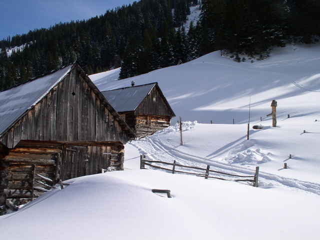
Vom Bärneck geniesst man an schönen Tagen einen herrlichen Rundblick. Den Tourenabschluß bietet die Mörsbachhütte des Grazer Alpenvereins. Von dort existiert eine markierte Schiabfahrt bis zur Talstation der Riesneralm oder eine Rodelbahn direkt ins Tal.
Vom Bärneck geniesst man an schönen Tagen einen herrlichen Rundblick. Den Tourenabschluß bietet die Mörsbachhütte des Grazer Alpenvereins. Von dort existiert eine markierte Schiabfahrt bis zur Talstation der Riesneralm oder eine Rodelbahn direkt ins Tal.
Further information at
http://derstandard.at/?url=/?id=1392800%26_range=1Tour gallery
Tour map and elevation profile
Minimum height 595 m
Maximum height 2080 m
More about the tour author
|
|
gsimon |
Comments

Ins Ennstal bis Trautenfels, dann nach Donnersbachwald
GPS tracks
Trackpoints-
GPX / Garmin Map Source (gpx) download
-
TCX / Garmin Training Center® (tcx) download
-
CRS / Garmin Training Center® (crs) download
-
Google Earth (kml) download
-
G7ToWin (g7t) download
-
TTQV (trk) download
-
Overlay (ovl) download
-
Fugawi (txt) download
-
Kompass (DAV) Track (tk) download
-
Track data sheet (pdf) download
-
Original file of the author (gpx) download
More about the tour author
|
|
gsimon |
Add to my favorites
Remove from my favorites
Edit tags
Open track
My score
Rate