


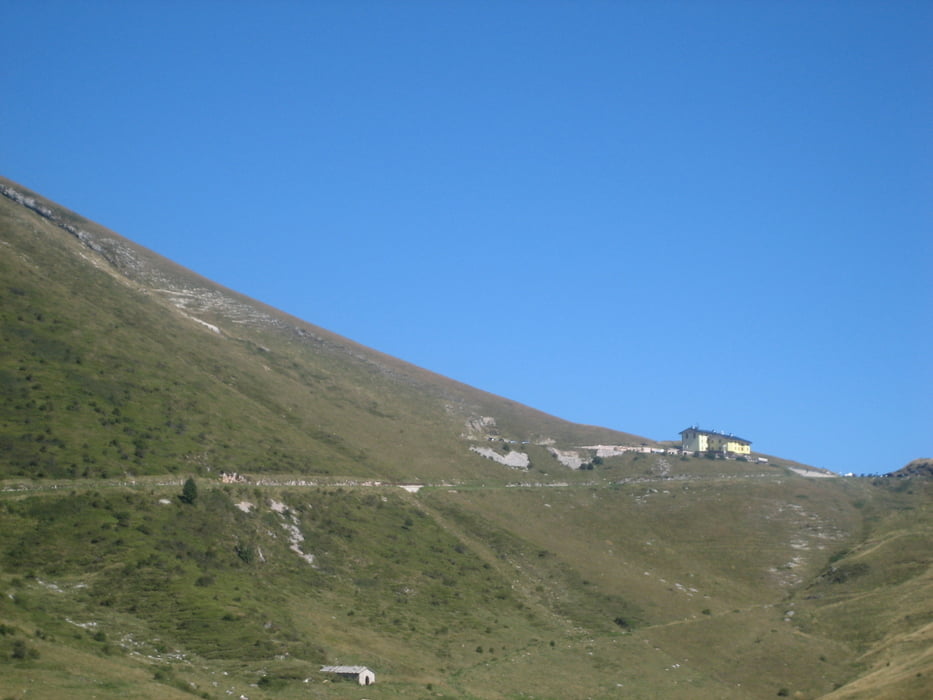
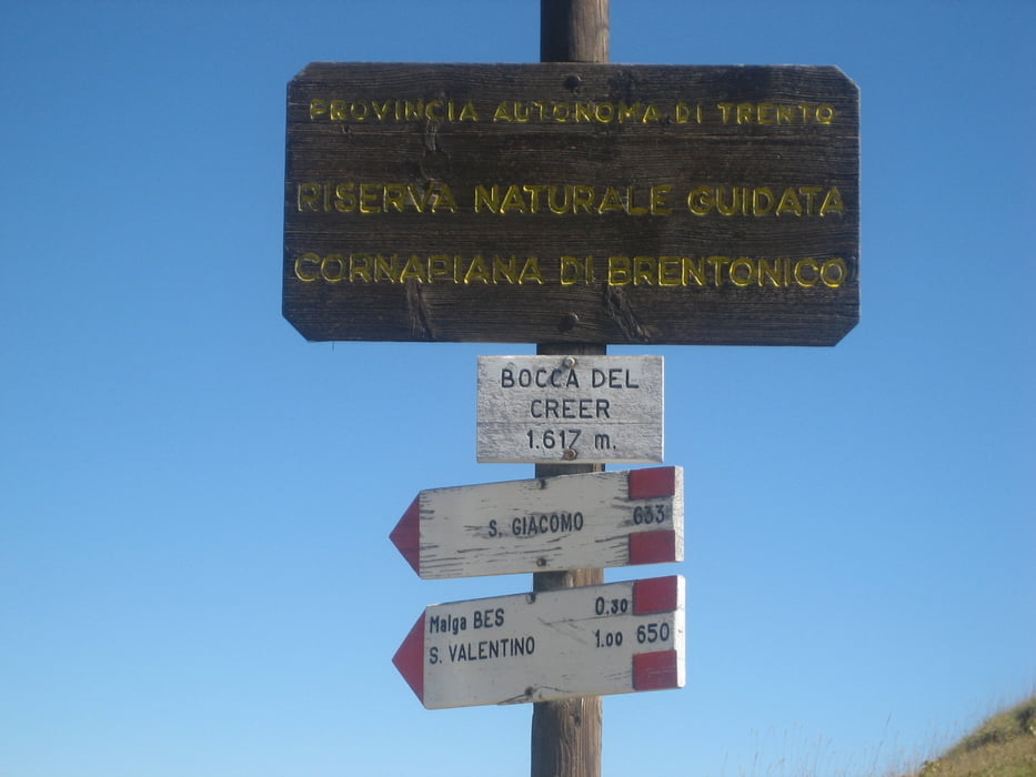
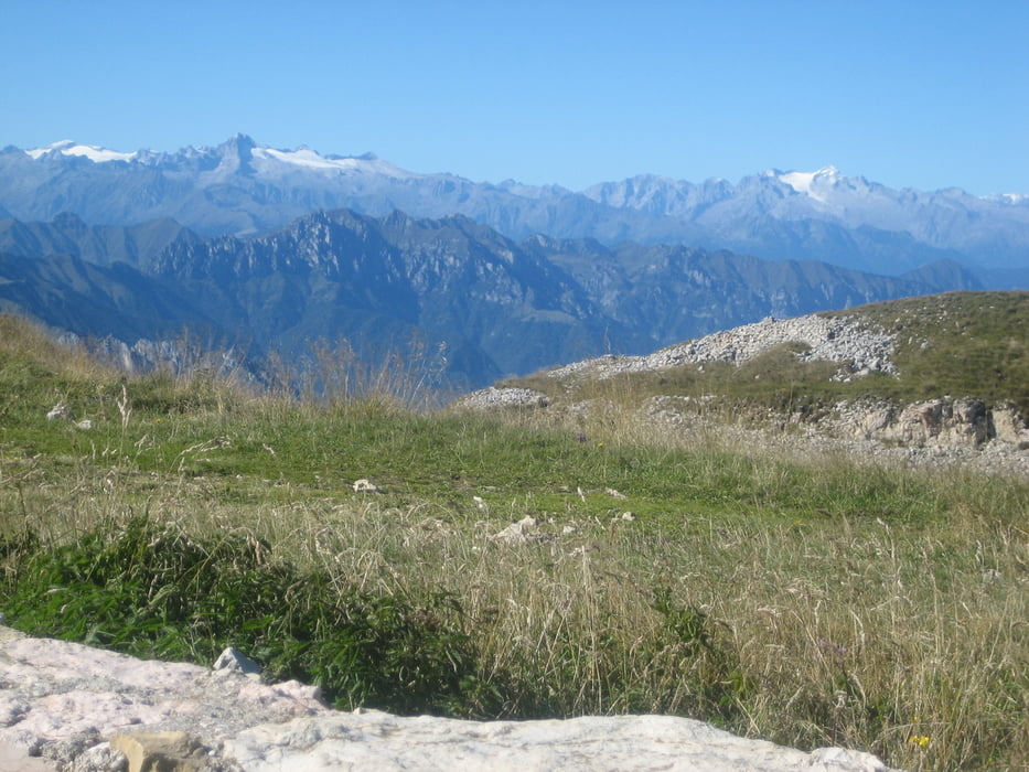
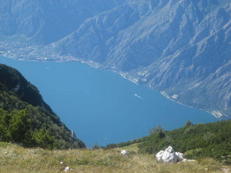
Konditionell anspruchsvolle Tour vom Süden des Sees bis weit in den Norden zum "Monte Altissimo del Nago". Auffahrt meist auf Asphalt, aber im Mittelteil auch Schotter und steile Betonpiste bis zum Rifugio Graziano. (Aufpassen auf Murmeltiere, die auch auf der Strasse unterwegs sind oder zumindest gleich daneben spielen) .Hier könnte man direkt ins Etschtal abfahren, oder wie ich, noch 400 hm hoch zum Altissimo, (teils schieben wegen grobem Schotter, Abfahrt aber gut möglich). Oben überwältigendes Panorama zu den Brenta-Dolomiten mit Geltschern, Tiefblicke zum Lago. Zurück zum "Graziano" dann ins Etschtal nach Avio auf serpentinenreicher Teerstrasse durch wunderbare Felseinschnitte. Leider ziemlich öde Rückfahrt im Tal entlang der Etsch zum Ausgangspunkt.
Further information at
http://helwa.deTour gallery
Tour map and elevation profile
Minimum height 15 m
Maximum height 1999 m
More about the tour author

|
helwa |
Comments

Vom Campingplatz in Lazise über Nebenstrassen und Radwege bis nach Caprino, hier beginnt die Bergstrecke.
GPS tracks
Trackpoints-
GPX / Garmin Map Source (gpx) download
-
TCX / Garmin Training Center® (tcx) download
-
CRS / Garmin Training Center® (crs) download
-
Google Earth (kml) download
-
G7ToWin (g7t) download
-
TTQV (trk) download
-
Overlay (ovl) download
-
Fugawi (txt) download
-
Kompass (DAV) Track (tk) download
-
Track data sheet (pdf) download
-
Original file of the author (gpx) download
More about the tour author
|
|
helwa |
Add to my favorites
Remove from my favorites
Edit tags
Open track
My score
Rate