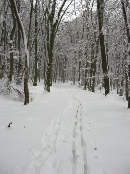
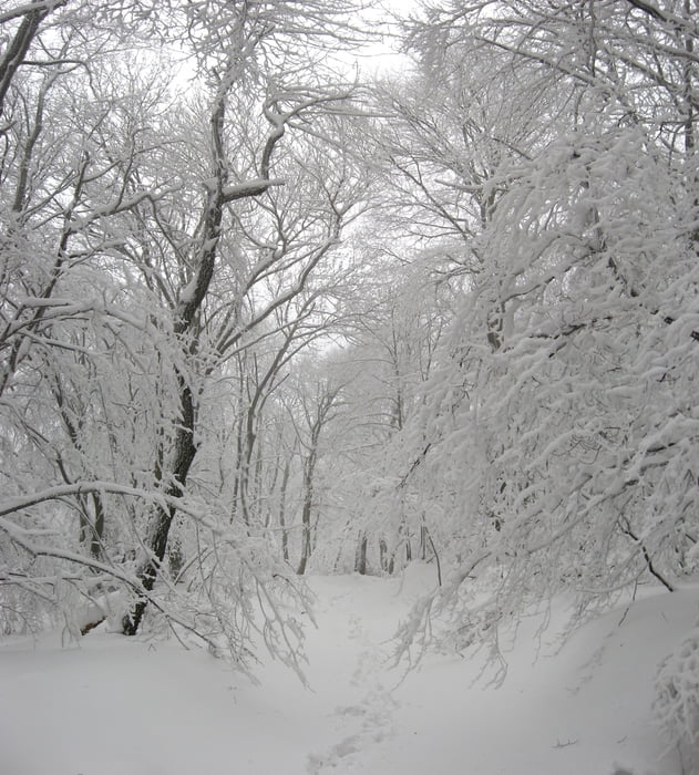
Login

Forgotten password?

Cookies have to be accepted!
Your browser's cookie functionality is disabled. Please enable this functionality.

Not a member yet?

Register now
Login

Available for registred users only

Log in to use this feature.

Forgotten password?

Cookies have to be accepted!
Your browser's cookie functionality is disabled. Please enable this functionality.

Not a member yet?

Register now
Filter
Categories
Advanced filters
  • Distance (km)
  • Height
Save filters Reset filter

TrackRank

QRCode

Technical data

Distance14,2 km Height296 m Way down343 m Duration01:37 h:m Date20.01.2013
Scores Author Landscape Fun factor Fitness Technique

Statistics

171 Views Scores 2 Downloads Average
Rate
  • Track data sheet
  • Directions
  • Downloads

20.1.2013

Dnes som si dal skôr rovinu. Ak nepočítam výstup ku základni na Kobyle v štýle skialpu. :-D Sneh sa lepil - bol odmäk. No vo vyjazdených stopách to nevadilo, len keď som sa pechoril mimo ne. Les bol nádherný.

Tour gallery

Tour map and elevation profile

  • Open Street Map
  • Google
Minimum height 365 m Maximum height 608 m Detailed view

More about the tour author

tmax
Member since 2007

Send private message

Comments

BA-Dlhé Diely

GPS tracks

Trackpoints
  • GPX / Garmin Map Source (gpx) download
  • TCX / Garmin Training Center® (tcx) download
  • CRS / Garmin Training Center® (crs) download
  • Google Earth (kml) download
  • G7ToWin (g7t) download
  • TTQV (trk) download
  • Overlay (ovl) download
  • Fugawi (txt) download
  • Kompass (DAV) Track (tk) download
  • Track data sheet (pdf) download
  • Original file of the author (gpx) download

More about the tour author

tmax
Member since 2007

Send private message
Share track
Add to my favorites
Remove from my favorites
Edit tags
My score
Rate
Track: 20130120_Bežky na Kobyle
Type: Cross-country skiing
Distance: 14,2 km
Evaluated on:
Duration:
Day(s)
Hour(s)
Minute(s)
Score: Landscape Fun factor Fitness Technique