Login

Forgotten password?

Cookies have to be accepted!
Your browser's cookie functionality is disabled. Please enable this functionality.

Not a member yet?

Register now
Login

Available for registred users only

Log in to use this feature.

Forgotten password?

Cookies have to be accepted!
Your browser's cookie functionality is disabled. Please enable this functionality.

Not a member yet?

Register now
Filter
Categories
Advanced filters
  • Distance (km)
  • Height
Save filters Reset filter

TrackRank

QRCode

Technical data

Distance10,8 km Height1240 m Way down1731 m Duration07:00 h:m Date26.01.2013
Scores Author Landscape Fun factor Fitness Technique

Statistics

474 Views Scores 74 Downloads Average
Rate
  • Track data sheet
  • Directions
  • Downloads
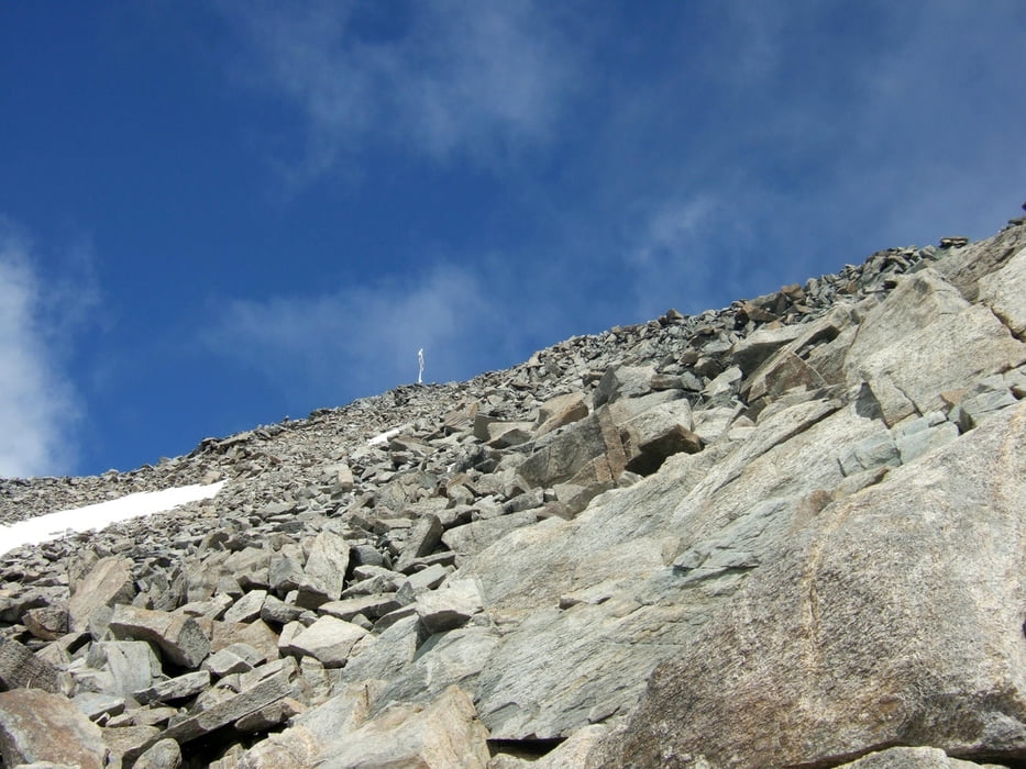
Von der Bergstation des Kanzel-Sesselliftes in südlicher Richtung in den Rosimboden und bis kurz unter den Rosimferner ansteigen. Achtung: nicht zu dicht bis unter den Gletscher gehen. Links neben diesem bis zum Rosimjoch und über den SO-Grat zum Gipfel.

Tour gallery

Tour map and elevation profile

  • Open Street Map
  • Google
Minimum height 1908 m Maximum height 3602 m Detailed view

More about the tour author

Ingo-Dessau
Member since 2013

Send private message

Comments

Aus dem Vinschgau über die Stilfser-Joch-Straße bis nach Gomagoi fahren, dann in das Suldental einbiegen. Der Parkplatz befindet sich direkt am Lift.


GPS tracks

Trackpoints
  • GPX / Garmin Map Source (gpx) download
  • TCX / Garmin Training Center® (tcx) download
  • CRS / Garmin Training Center® (crs) download
  • Google Earth (kml) download
  • G7ToWin (g7t) download
  • TTQV (trk) download
  • Overlay (ovl) download
  • Fugawi (txt) download
  • Kompass (DAV) Track (tk) download
  • Track data sheet (pdf) download
  • Original file of the author (gpx) download

More about the tour author

Ingo-Dessau
Member since 2013

Send private message
Share track
Add to my favorites
Remove from my favorites
Edit tags
My score
Rate
Track: Vertainspitze SO-Grat
Type: Mountain hiking
Distance: 10,8 km
Evaluated on:
Duration:
Day(s)
Hour(s)
Minute(s)
Score: Landscape Fun factor Fitness Technique