Login

Forgot your login?

Cookies have to be accepted!
Your browser's cookie functionality is disabled. Please enable this functionality.

Not a member yet?

Register now
Login

Available for registred users only

Log in to use this feature.

Forgot your login?

Cookies have to be accepted!
Your browser's cookie functionality is disabled. Please enable this functionality.

Not a member yet?

Register now
Filter
Categories
Advanced filters
  • Distance (km)
  • Height
Save filters Reset filter

TrackRank

QRCode

Technical data

Distance10,7 km Height342 m Way down323 m Duration03:00 h:m Date13.02.2013
Scores Author Landscape Fun factor Fitness Technique

Statistics

1059 Views Scores 113 Downloads Average
Rate
  • Track data sheet
  • Directions
  • Downloads

Start und Ziel: Arure

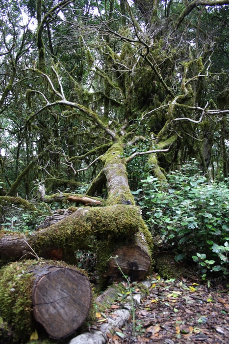
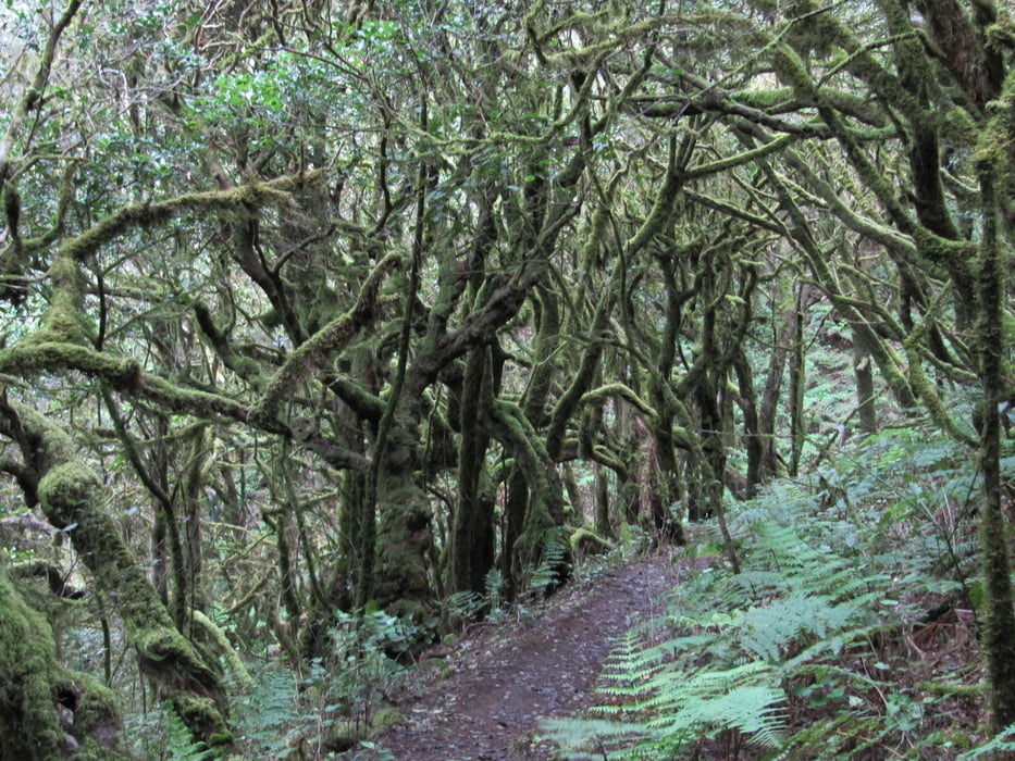
leichte Wanderung durch den Nebelurwald der Insel

von der Hauptsraße in Arure an der Kapelle Ermita Virgen de la Salud vorbei und rechts haltend auf den Weg

vorbei an einem kleinen Stausee dem PR LG 11 folgend durch den Urwald


Tour gallery

Tour map and elevation profile

  • Open Street Map
  • Google
Minimum height 790 m Maximum height 1093 m Detailed view

More about the tour author

schwaran
Member since 2012

Send private message

Comments

Rother Wanderführer „La Gomera“ Wanderung 21


GPS tracks

Trackpoints
  • GPX / Garmin Map Source (gpx) download
  • TCX / Garmin Training Center® (tcx) download
  • CRS / Garmin Training Center® (crs) download
  • Google Earth (kml) download
  • G7ToWin (g7t) download
  • TTQV (trk) download
  • Overlay (ovl) download
  • Fugawi (txt) download
  • Kompass (DAV) Track (tk) download
  • Track data sheet (pdf) download
  • Original file of the author (gpx) download

More about the tour author

schwaran
Member since 2012

Send private message
Share track
Add to my favorites
Remove from my favorites
Edit tags
My score
Rate
Track: Von Arure zum Raso de la Bruma
Type: Hiking
Distance: 10,7 km
Evaluated on:
Duration:
Day(s)
Hour(s)
Minute(s)
Score: Landscape Fun factor Fitness Technique