


Variante von Tour 8409.
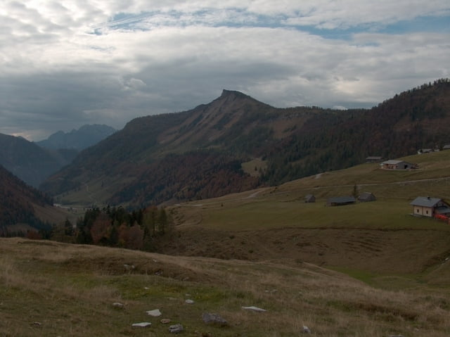
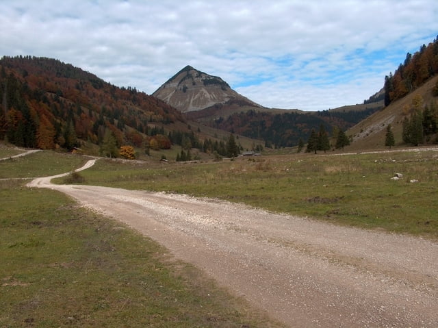
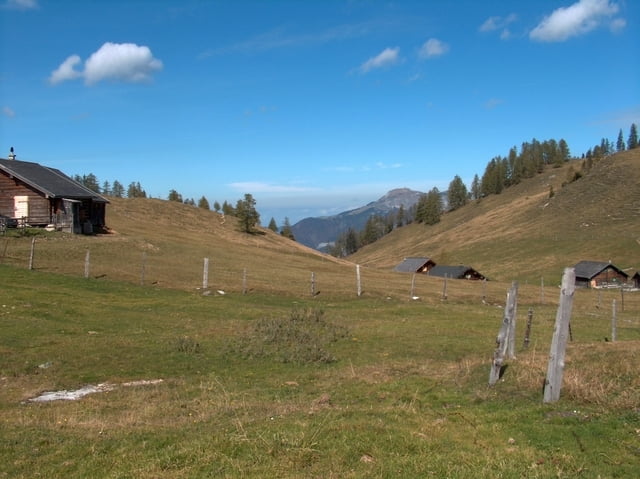
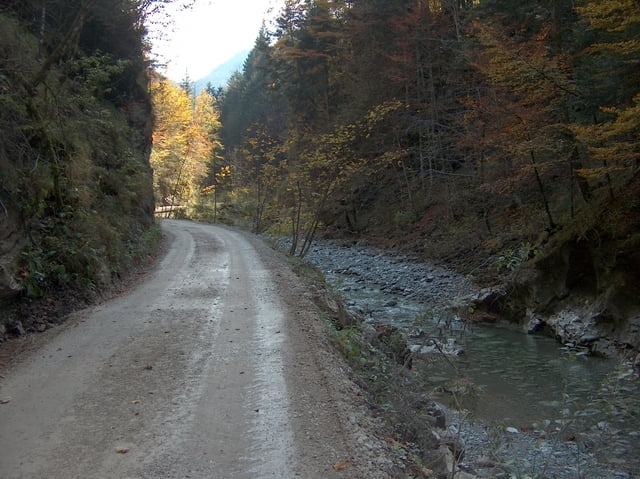
Start ist in Faistenau, Ortsteil Tiefenbrunnau. Von dort über die Schafbachalm Ri. Hintersee, danach hoch zur Genner-Alm. Nach Abfahrt mündet man an eine schmale Asphaltstraße hinauf zur Postalm. Abfahrt nach Strobl, weiter nach Abersee, von dort ins Zinkenbachtal und weiter zur Königsbachalm. Von hier gehts zurück zur Schafbachalm und zum Ausgangspunkt der Tour.
Landschaftlich schöne, konditionell anstrengende Runde, die allerdings durch zahlreiche Bike-Verbots-Schilder getrübt wird.
Als Biker ist man hier offentsichtlich nicht willkommen.
Further information at
http://www.teutatesonline.netTour gallery
Tour map and elevation profile
Minimum height 547 m
Maximum height 1372 m
More about the tour author

|
Comments

Die Autobahn Salzburg-Wien an der Abfahrt Thalgau verlassen.
Man hält sich Ri. Hof, nach Ortsdurchfahrt rechts Ri. Hintersee. In Faistenau biegt man links ab Ri. Tiefenbrunnau. Man folgt der Straße bis zum Ende, wo man links auf einem Kiesplatz parken kann. Hier startet die Tour.
Man hält sich Ri. Hof, nach Ortsdurchfahrt rechts Ri. Hintersee. In Faistenau biegt man links ab Ri. Tiefenbrunnau. Man folgt der Straße bis zum Ende, wo man links auf einem Kiesplatz parken kann. Hier startet die Tour.
GPS tracks
Trackpoints-
GPX / Garmin Map Source (gpx) download
-
TCX / Garmin Training Center® (tcx) download
-
CRS / Garmin Training Center® (crs) download
-
Google Earth (kml) download
-
G7ToWin (g7t) download
-
TTQV (trk) download
-
Overlay (ovl) download
-
Fugawi (txt) download
-
Kompass (DAV) Track (tk) download
-
Track data sheet (pdf) download
-
Original file of the author (gpx) download
More about the tour author
|
|
Add to my favorites
Remove from my favorites
Edit tags
Open track
My score
Rate