


Eine Genießertour:
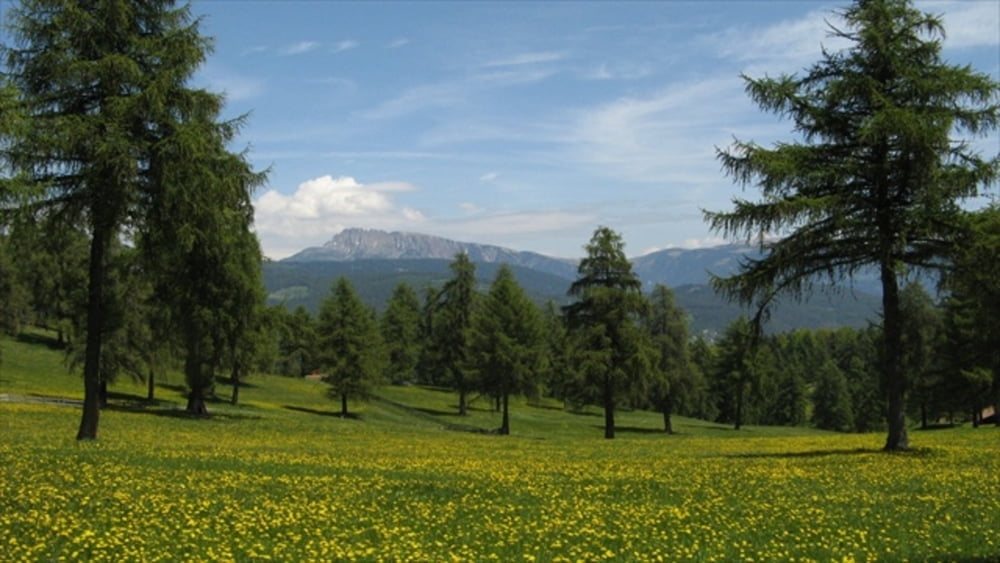
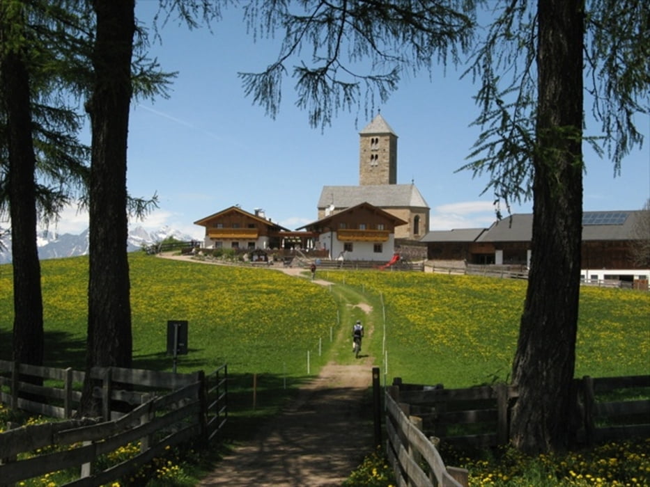
Mit der Bergbahn von Bozen nach Jesenien. (Man kann auch hochradeln dann hat man ca. 500hm mehr). Von dort aus immer auf der Höhe entlang an lichten Wiesen mit Lärchen. Dort gibt es auch eine schöne Einkehrmöglichkeit bei St. Jakob. Bis hier waren es breite Forstwege oder kleine Straßen. Ab jetzt geht es über Wanderwege forbei am Stoarnerne Mandel nach Hafling.
Von hier aus die Straße in rasender Abfahrt nach Meran. Und schließlich auf dem Radweg zurück nach Bozen.
Rückmeldungen und Votings sind sehr erwünscht.
Tour gallery
Tour map and elevation profile
Minimum height 251 m
Maximum height 1943 m
More about the tour author
|
|
Cycling666 |
Comments

Wir sind in Andrian gestartet in der nähe von Bozen, wo wir eine Ferienwohnung hatten. Andrian ist ein netter kleiner Ort in den Obst/Weinbergen. Anfahrt mit dem Auto. Von Bozen ca. 10min entfernt.
GPS tracks
Trackpoints-
GPX / Garmin Map Source (gpx) download
-
TCX / Garmin Training Center® (tcx) download
-
CRS / Garmin Training Center® (crs) download
-
Google Earth (kml) download
-
G7ToWin (g7t) download
-
TTQV (trk) download
-
Overlay (ovl) download
-
Fugawi (txt) download
-
Kompass (DAV) Track (tk) download
-
Track data sheet (pdf) download
-
Original file of the author (gpx) download
More about the tour author
|
|
Cycling666 |
Add to my favorites
Remove from my favorites
Edit tags
Open track
My score
Rate