Login

Forgot your login?

Cookies have to be accepted!
Your browser's cookie functionality is disabled. Please enable this functionality.

Not a member yet?

Register now
Login

Available for registred users only

Log in to use this feature.

Forgot your login?

Cookies have to be accepted!
Your browser's cookie functionality is disabled. Please enable this functionality.

Not a member yet?

Register now
Filter
Categories
Advanced filters
  • Distance (km)
  • Height
Save filters Reset filter

TrackRank

QRCode

Technical data

Distance17,6 km Height167 m Way down421 m Duration04:00 h:m Date05.04.2013
Scores Author Landscape Fun factor Fitness Technique

Statistics

233 Views Scores 5 Downloads Average
Rate
  • Track data sheet
  • Directions
  • Downloads
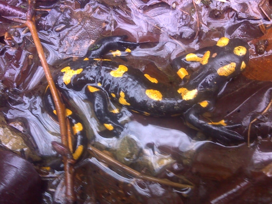
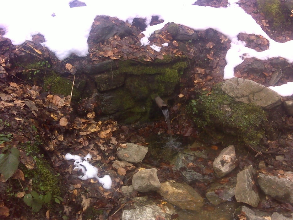
 Hermesről indulva egy darabig a határ mellett haladtam,majd a nagy-zuhatag völgyén leereszkedve a Hideg-víz forrás után fel a terv-út irányába Ágfalván át,majd Sopronba gyalogoltam.

Tour gallery

Tour map and elevation profile

  • Open Street Map
  • Google
Minimum height 221 m Maximum height 541 m Detailed view

More about the tour author

frontera74
Member since 2011

Send private message

Comments

 Hermesre busszal Brennbergig,vagy összekötve más túrűval gyalog.

GPS tracks

Trackpoints
  • GPX / Garmin Map Source (gpx) download
  • TCX / Garmin Training Center® (tcx) download
  • CRS / Garmin Training Center® (crs) download
  • Google Earth (kml) download
  • G7ToWin (g7t) download
  • TTQV (trk) download
  • Overlay (ovl) download
  • Fugawi (txt) download
  • Kompass (DAV) Track (tk) download
  • Track data sheet (pdf) download
  • Original file of the author (gpx) download

More about the tour author

frontera74
Member since 2011

Send private message
Share track
Add to my favorites
Remove from my favorites
Edit tags
My score
Rate
Track: Hermes-Hidegvíz-Sopron
Type: Hiking
Distance: 17,6 km
Evaluated on:
Duration:
Day(s)
Hour(s)
Minute(s)
Score: Landscape Fun factor Fitness Technique